Acquired August 10, 2010, and almost exactly one year earlier, August 11, 2009, these false-color images show dramatic changes caused by torrential rains in the summer of 2010.
Published Aug 10, 2010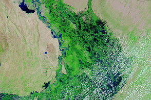
Acquired September 21, 2011, and September 22, 2009, these false-color images compare conditions in southern Pakistan, which suffered severe flooding in 2011.
Published Sep 21, 2011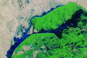
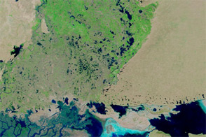
Acquired September 21, 2012, and September 1, 2012, these images compare conditions in farmed fields west of the Indus River in Pakistan. Floods struck the region in September 2012.
Published Sep 22, 2012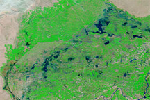
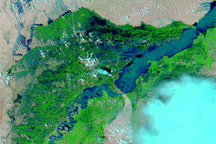
Acquired on February 21, 2011, and February 23, 2010, these false-color images show water levels along the Indus River before and after the monsoon floods that struck Pakistan in 2010.
Published Feb 25, 2011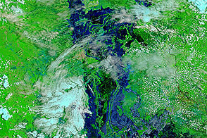
Acquired August 24, 2011, and August 26, 2010, these false-color images compare conditions in Cambodia. Flooding occurred along the Mekong River, Tônlé Sab, and around Phnum Penh in 2011.
Published Aug 29, 2011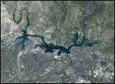
Patches of flood water remain in Pakistan’s Sindh Province, months after floods struck the region.
Published Jan 26, 2012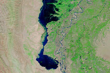
Images from September 3, October 2, and November 1, 2010, show the development and slow draining of a massive floodwater lake west of the Indus River.
Published Nov 3, 2010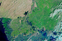
These false-color images show parts of Pakistan affected by the 2010 monsoon floods. The image from November 201, shows the area after flooding. The image from November 2009 shows conditions one year before.
Published Nov 15, 2010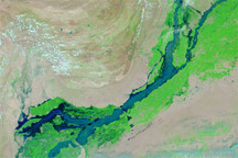
Acquired August 22, 2010, and July 31, 2010, these false-color images show the shift of floodwaters toward southern Pakistan.
Published Aug 23, 2010alert message
