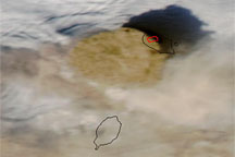
A true-color image from June 13, 2004, shows a high-profile ash plume from Sarychev Peak casting a large shadow to the north.
Published Jun 13, 2009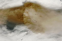
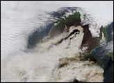
This true-color image of the plume from Sarychev Peak on June 14, 2009, shows intense volcanic ash concentrations west of the volcano, and ash spreading both east and west of the summit.
Published Jun 14, 2009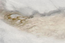
True-color images of the Central Kuril Islands show ash plumes from Sarychev Peak hovering over a blanket of clouds in early June 2009, and a clear-sky view of the same region acquired a month earlier.
Published Jun 12, 2009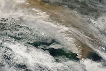
This true-color MODIS image shows ash plumes from Sarychev Peak blowing across the Sea of Okhotsk and the island of Sakhalin.
Published Jun 16, 2009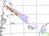
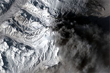
In contrast to the explosive eruptions of the previous week, ash emissions from Mount Redoubt became more frequent but confined to lower altitudes on March 30, 2009. The commercial satellite GeoEye-1 captured a high-resolution view of the volcano the same day.
Published Apr 1, 2009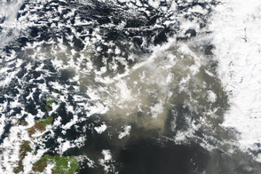
Ash from Grímsvötn spread over the North Sea on May 24, 2011, canceling several hundred flights in Scotland and Scandinavia.
Published May 24, 2011
Days after a large-scale eruption from Chile's Chaiten Volcano on February 19, 2009, volcanic ash lingered on the Patagonian landscape.
Published Feb 25, 2009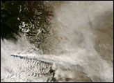
alert message
