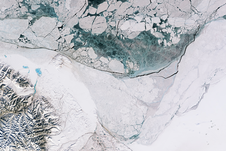
Springtime sunlight and warmth advanced the melting of sea ice to produce some beautiful patterns and textures in the Beaufort Sea.
Published Apr 30, 2018
The satellite measures more than just polar ice; it also makes detailed elevation measurements over the planet’s tropical and temperate latitudes.
Published Jan 29, 2019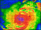
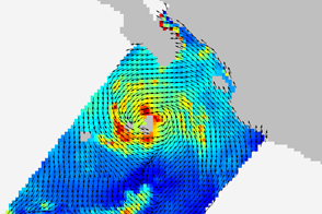
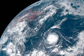
Barely two weeks after its launch and two days after its installation, the ISS-Rapid Scatterometer observed the wind field around a tropical storm.
Published Oct 8, 2014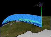
Orbiting the Earth at nearly 17,000 miles per hour, NASA's Ice, Cloud and land Elevation Satellite (ICESat) is collecting spectacular new three-dimensional measurements of the Earth's surface and atmosphere.
Published Dec 10, 2003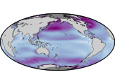
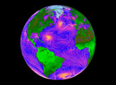
Wind energy has the potential to provide 10 to 15 percent of the world’s future energy, according to Paul Dimotakis, chief technologist at NASA’s Jet Propulsion Laboratory.
Published Jul 16, 2008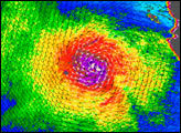
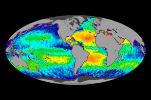
One year after its launch, the Aquarius instrument is giving ocean sciences its first global view of sea surface salinity.
Published Jun 12, 2012
New elevation measurements will give researchers an unprecedented understanding of the thickness of sea ice, which will be used to help improve climate modeling and forecasts.
Published Dec 18, 2018
The storm has central Taiwan in its sights.
Published Aug 8, 2015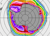
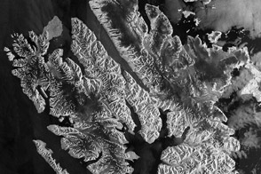
The European Space Agency’s flagship Earth-observing satellite captured this image of Spitsbergen in early September 2011.
Published Mar 3, 2012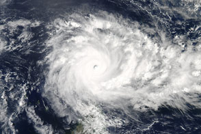
The category 5 storm became the most intense on record for the Indian Ocean.
Published Apr 20, 2016
alert message
