On March 1, 2002, the European Space Agency (ESA) launched Envisat, which the agency has called the “largest Earth-observation satellite ever built.” Envisat was built to operate for five years, so its tenth anniversary this week is a pleasant surprise for its engineers and for Earth scientists.
Envisat carries ten optical and radar sensors designed to monitor Earth’s land cover, ocean color, ozone layer, pollutant plumes, land and sea temperatures, and surface topography. It’s largest instrument is the Advanced Synthetic Aperture Radar (ASAR), which is capable of sensing the planet surface through clouds and darkness. That ability has enabled scientists to monitor Earth’s poles, which are subject to months-long winter nights and frequent storms.
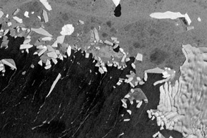
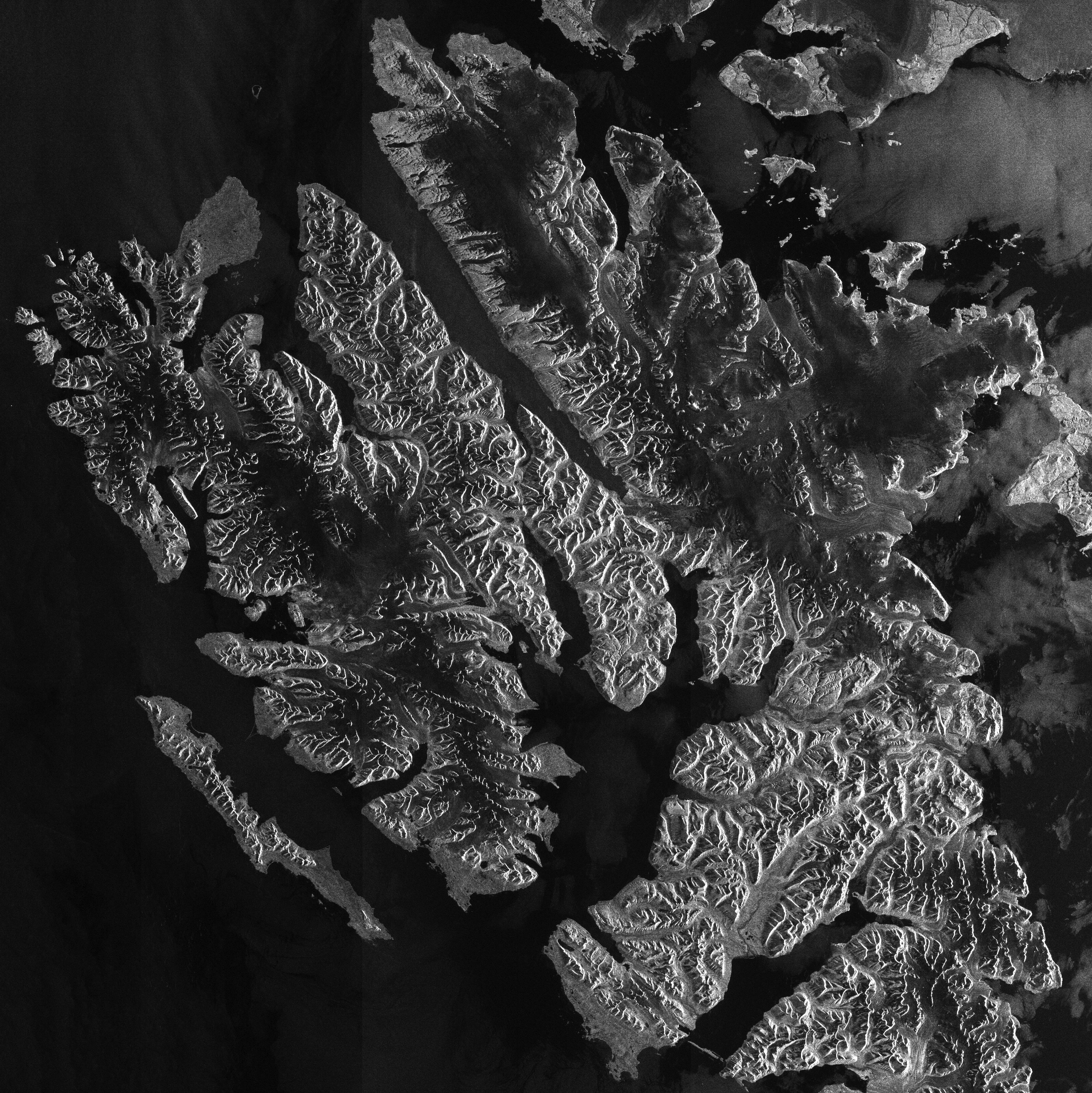
ASAR acquired this image of Spitsbergen—Norway’s largest island—on September 6, 2011. The gray scale image shows Spitsbergen’s rugged landscape of high peaks and sprawling glaciers. North of the island is the Arctic Ocean, and the Greenland Sea lies to the west.
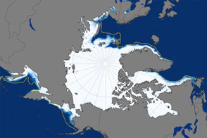
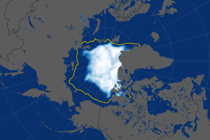
ASAR’s ability to observe polar regions has served the science community well. As the last decade has witnessed record low Arctic sea ice extents—in 2002, 2005, and 2007, according to the U.S. National Snow and Ice Data Center—the ability to monitor sea ice has become especially important. Envisat observed another very low sea ice extent in September 2011.
ESA hopes the satellite will keep functioning until 2013, when its next generation of satellites (known as the Sentinels) become fully operational. ESA leaders noted in a release: “High engineering and scientific skills keep the mission going—Envisat owes its decade of success to over ten years of teamwork.”
Image © 2011 by the European Space Agency. Caption by Michon Scott.
alert message