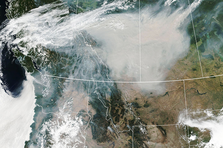
Winds carried thick plumes of smoke and pollution across the United States and Canada.
Published Aug 16, 2018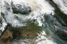
Plumes of smoke from forest fires in British Columbia stretch across much of Canada in this true-color image from August 19, 2010.
Published Aug 20, 2010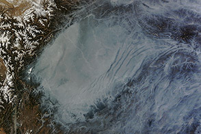
The Sichuan Basin’s bowl-shaped topography helps trap air pollution.
Published Jan 26, 2014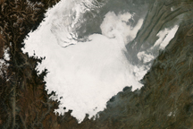
A temperature inversion most likely created this stunning view of low clouds hugging the contours of the Sichuan Basin in Central China in early December 2008.
Published Dec 27, 2008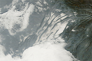
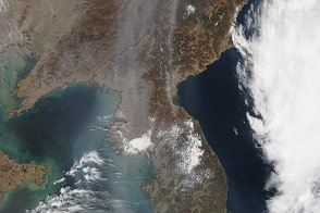
Haze, clouds, and fog mingled in China’s Sichuan Basin on December 24, 2014.
Published Dec 26, 2014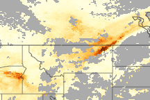
Smoke from fires in southwestern Oregon drifted over much of Oregon in this true color image from late September 2009. The associated aerosol image reveals that the smoke reached as far east as eastern Montana and central Canada, illustrating that pollution travels long distances.
Published Oct 21, 2009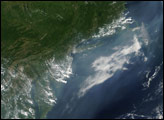
White-gray haze covers the Ganges Plain of northern India in this true-color image from December 2, 2009.
Published Dec 2, 2009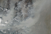
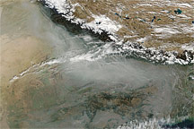
Thick, gray-brown haze conforms to the contours of the North China Plain in this photo-like image from October 28, 2009.
Published Oct 30, 2009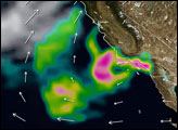

An unusual amount of smoke from wildfires has spread across hundreds of miles.
Published Aug 20, 2020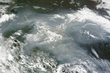
A thick, gray-brown cloud of smoke stretches across hundreds of kilometers over Canada’s Northwest Territories, Alberta, and Saskatchewan in this image from June 26, 2010.
Published Jun 28, 2010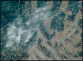
A collaborative field study seeks to advance NASA’s ability to monitor air quality from space.
Published Mar 2, 2016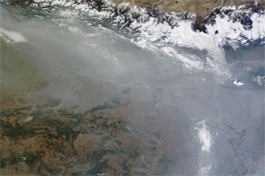
Acquired in early December 2011, this natural-color image shows haze along the southern slopes of the Himalaya, continuing a weeks-long pattern.
Published Dec 5, 2011alert message
