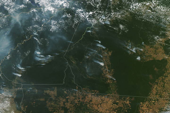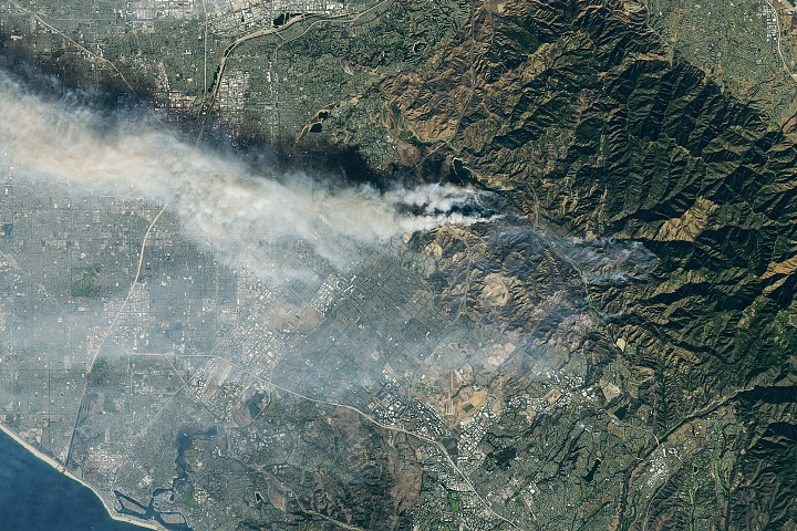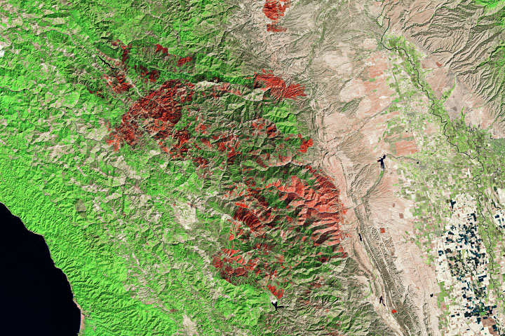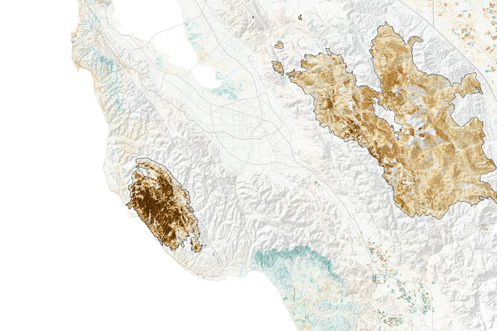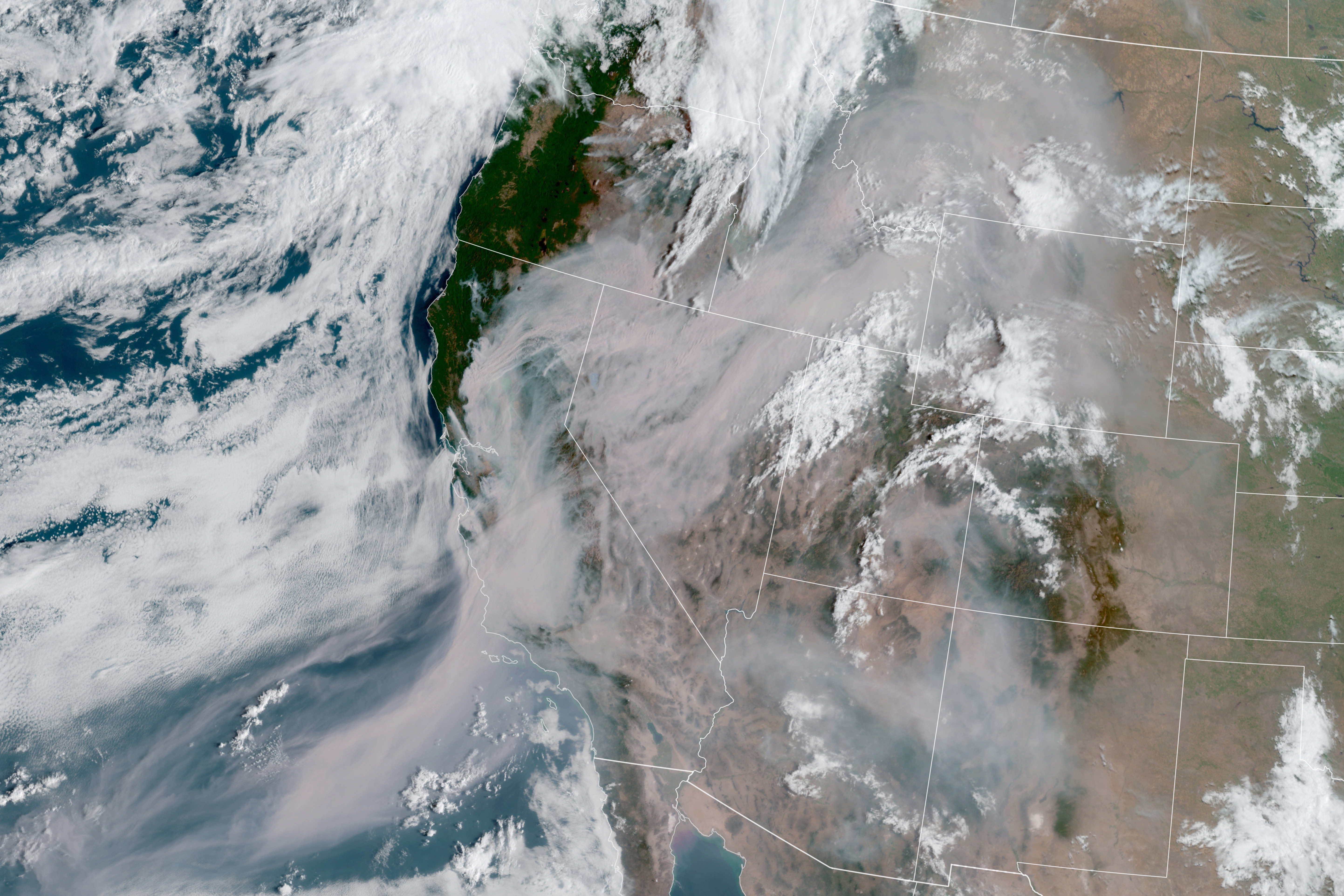
After more than 10,000 lightning strikes in 72 hours, hundreds of wildfires erupted across California, particularly in the northern part of the state. The fires, which have been exacerbated by a historic heatwave, have burned more than 300,000 acres (1,200 square kilometers) in the state since August 16, 2020. Smoke has spread across large swaths of the western United States and the Pacific Ocean.
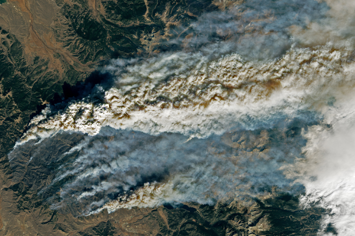
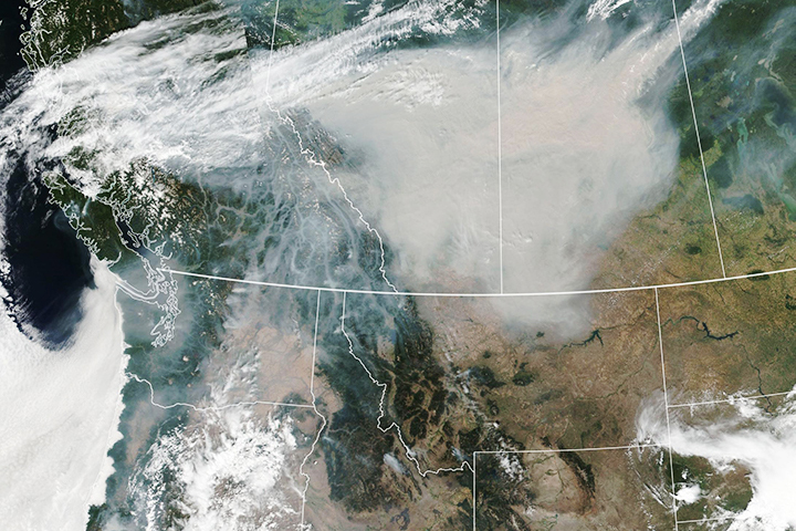
In the morning of August 20, 2020 in California, the Geostationary Operational Environmental Satellite 17 (GOES-17) captured a natural-color image of the smoke (above). GOES-17 is operated by the National Oceanic and Atmospheric Administration (NOAA); NASA helps develop and launch the GOES series of satellites.
Wildfire smoke is dangerous because it carries tiny, harmful particles into the air. Known as aerosols, these solid and liquid particles can degrade air quality and cause breathing and lung problems, particularly for people with asthma. Long-term exposure to air pollution can also contribute to heart disease and cancer.
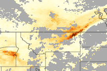
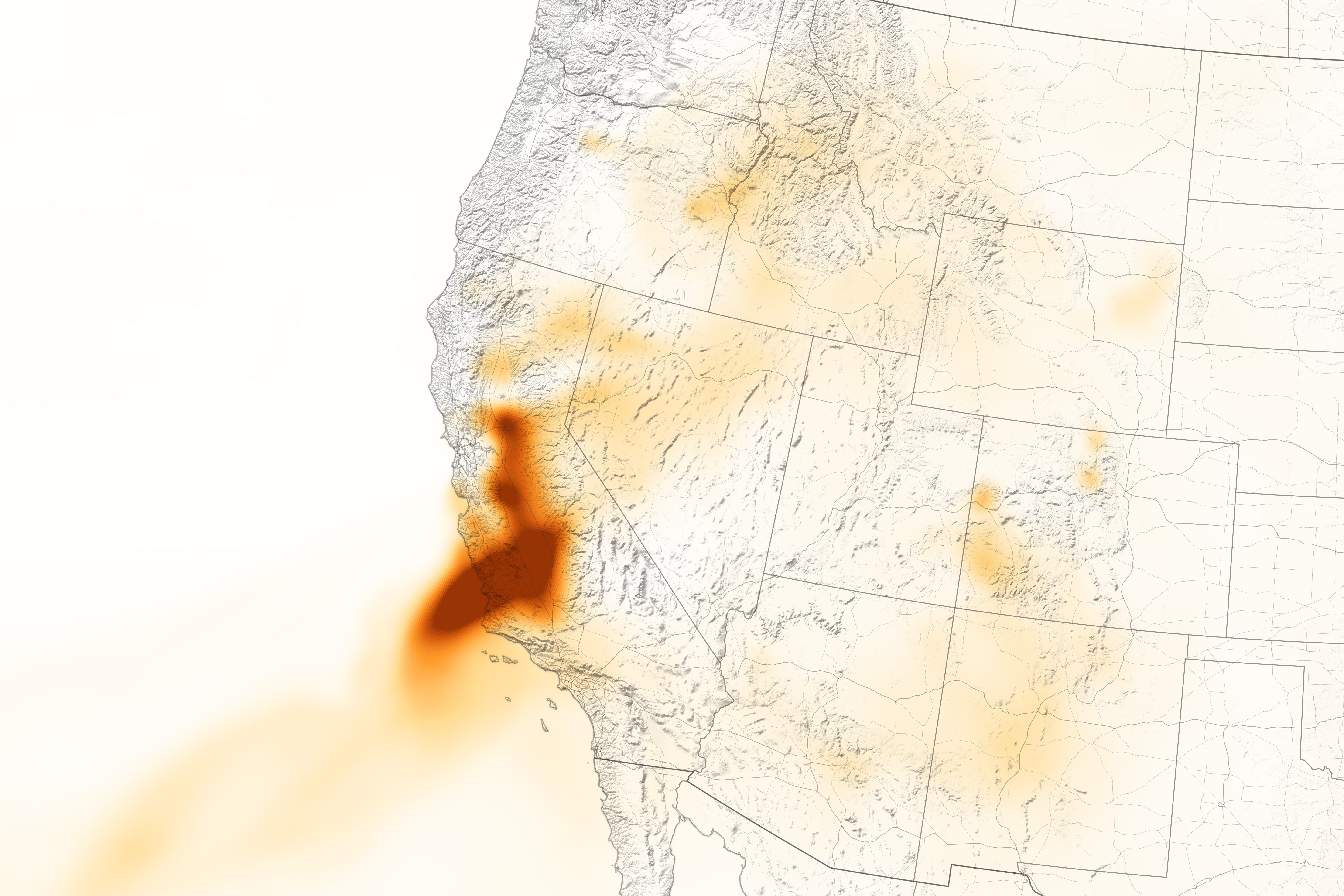
The map below shows the concentration of black carbon particulates—commonly called soot—at 12:30 a.m. on August 20. Black carbon can harm humans and other animals by entering the lungs and bloodstream; it also plays a role in global warming. The black carbon data come from the GEOS forward processing (GEOS-FP) model, which assimilates data from satellite, aircraft, and ground-based observing systems. In this case, GEOS-FP assimilated fire and aerosol observations with meteorological data on air temperature, moisture, and winds to project the behavior and extent of the plume.
On August 19, air quality monitors reported unhealthy levels of pollution across California as the smoke tinged skies with red haze. In fact, atmospheric testing showed Northern California had the worst air quality in the world on that day. Unhealthy air was also reported in Southern California and the Sacramento and Napa Valleys.
“This amount of smoke is extremely unusual,” said Michael Garay, an air quality researcher at NASA’s Jet Propulsion Laboratory. “The amount of smoke is due to both the large number of individual fires, as well as large ‘fire complexes,’ which are extremely large fires.”
As of August 20, the largest fire in the state was the SCU Lightning Complex near San Jose. It had burned more than 137,000 acres across five counties since igniting on August 18. The second-largest fire is the LNU Lightning Complex near Sacramento, which had burned more than 130,000 acres since August 17.
How long the smoke stays in the air will depend a lot on the weather, Garay said. Excessive heat warnings are in effect for several parts of the state through August 21. The National Weather Service issued forecasted poor air quality in California’s Central Valley until the fires are extinguished.
NASA Earth Observatory images by Lauren Dauphin, using GOES 17 imagery courtesy of NOAA and the National Environmental Satellite, Data, and Information Service (NESDIS) and GEOS-5 data from the Global Modeling and Assimilation Office at NASA GSFC. Story by Kasha Patel.
alert message