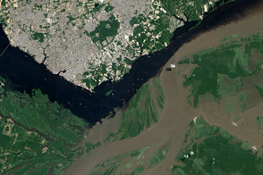
The confluence of the Rio Negro and Rio Solimões in Brazil is famous for unusual mixing patterns.
Published Sep 7, 2012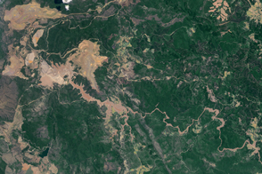
Brazilian villages and rivers are inundated with mud after mining dams burst.
Published Nov 14, 2015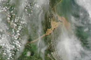
A plume of muddy sediment appears along the coast of southeastern Brazil in early January 2012, following days of heavy rains.
Published Jan 6, 2012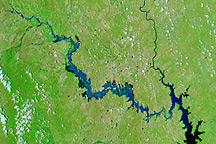
Acquired July 11, 2010, and June 21, 2010, these false-color images show northeastern Mexico before and after flooding along the Rio Salado.
Published Jul 15, 2010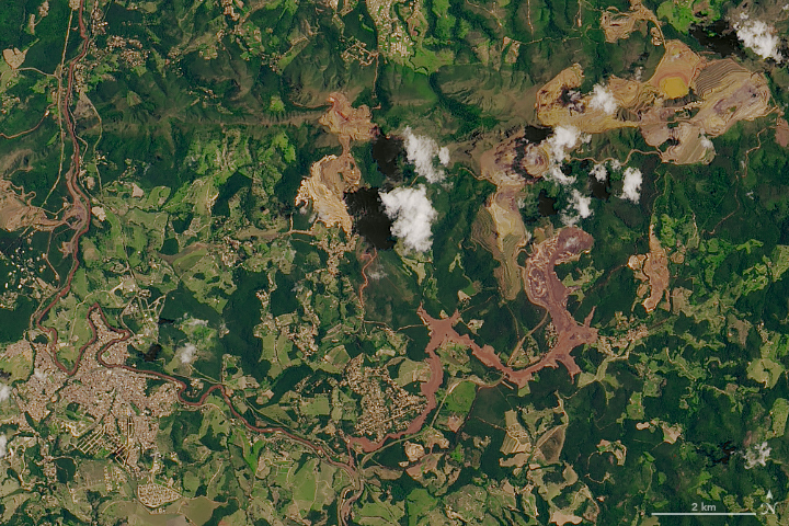
A torrent of waste sludge from an iron mine has devastated a small town in Minas Gerais.
Published Feb 1, 2019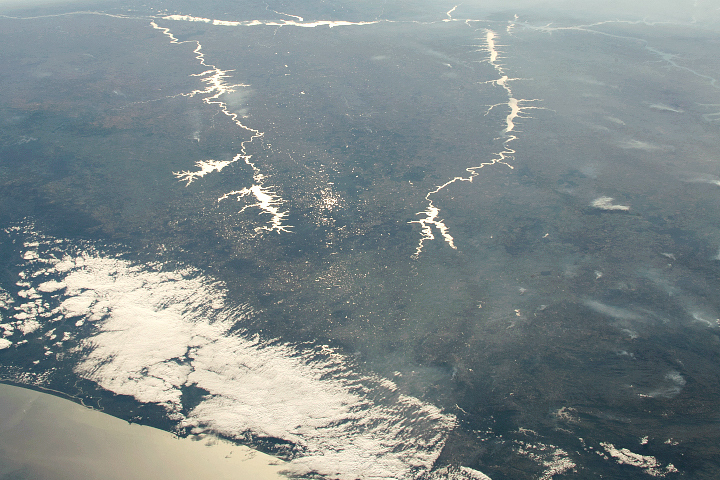
Sunlight highlights details around Rio Paraná, Rio Tiete, and Rio Paranapanema.
Published Dec 22, 2019
Acquired on December 1, and October 28, 2009, these false-color images show flood waters inundating land around two lagoons: Lagoa dos Patos and Lagoa Mirim.
Published Dec 4, 2009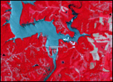
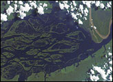
The wide, multi-island zone in the Rio Negro (Black River) shown in this astronaut photograph from September 2, 2006, is one of two, long “archipelagoes” upstream of the city of Manaus (not shown) in central Amazonia. Sixty kilometers of the total 120-kilemeter length of this archipelago appear in this image.
Published Dec 4, 2006
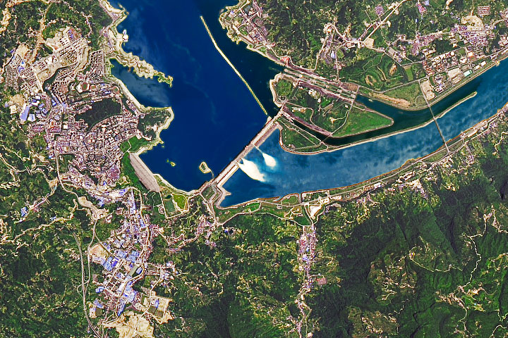
As water levels rise from excessive monsoon rainfall, dam operators discharge water through spillway gates.
Published Jul 24, 2020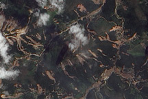
The Advanced Land Imager on EO-1 captured these true-color images of the hills north and west of Teresópolis, Brazil, where mudslides devastated the mountainous region in January 2011.
Published Feb 5, 2011