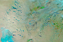
Acquired January 14, 2011, and December 29, 2010, these false-color images show changes to Australia’s interior caused by heavy rains.
Published Jan 14, 2011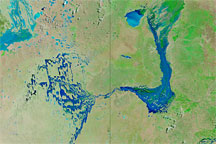
Acquired March 26, 2010 (top), and March 14, 2010 (bottom), these false-color images track the movement of floodwaters in Australia’s Channel Country.
Published Mar 29, 2010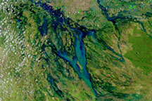
Acquired on January 4, 2010, and December 22, 2009, these false-color images show the difference heavy rains can make on usually dry land. The image from January 2010 shows a newly created water body in New South Wales.
Published Jan 4, 2010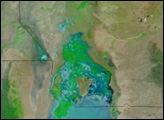
Acquired on December 31, 2010, and December 28, 2009, these images show part of Queensland, Australia, before and after flooding affected the state in late December 2010.
Published Dec 31, 2010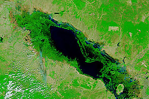
High waters remained in Thailand and Cambodia in January 2012, months after flooding struck the region.
Published Jan 9, 2012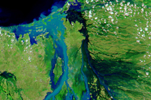
The Flinders River in northern Queensland, Australia, spread over more than 100 kilometers on February 18, 2009, when this image was taken.
Published Feb 21, 2009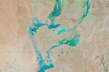
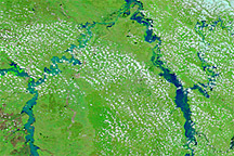
Water flowed through Australia’s Channel Country on February 18, 2009, as seasonal rivers and wetlands filled in response to seasonal rains in Australia's north.
Published Feb 18, 2009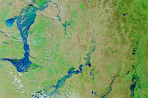
These false-color images of southwestern Queensland on March 14, 2010 (top), February 17, 2010 (middle), and March 16, 2009 (bottom), reveal the extent of recent, severe flooding.
Published Mar 16, 2010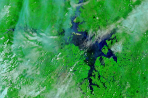
Acquired June 23, 2011, and May 26, 2011, these false-color images show changes in Dongting and Poyang Lakes, comparing drought to flood conditions.
Published Jun 23, 2011