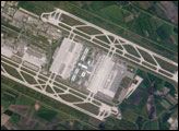
The Franz Josef Strauss, or Munich, International Airport served 29 million passengers in 2005, making it Germany’s second-busiest airport, after Frankfurt. This astronaut photograph, taken from the International Space Station, shows enough detail to distinguish individual airplanes on the terminal apron, and the dark gray-blue rooftop of Terminal 2.
Published Oct 9, 2006
The largest airport in Texas, Dallas-Fort Worth International (DFW) is also the fourth largest in the world, and it occupies more surface area than the entire island of Manhattan in New York. This astronaut photograph captures the entire airport and portions of the surrounding Dallas-Fort Worth metropolitan area.
Published Jul 3, 2006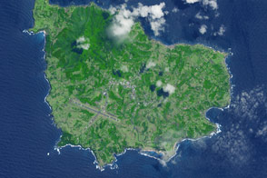
A 35-square-kilometer island rises from the Pacific Ocean about 1,400 kilometers from the Australian mainland.
Published May 23, 2015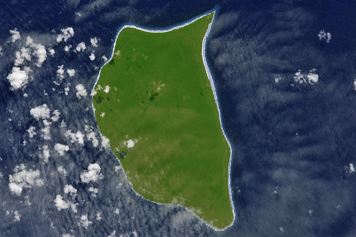
For hundreds of years, Henderson Island has seen little human activity. Nonetheless, it has human fingerprints all over its beaches.
Published Jul 23, 2017
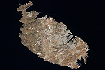
Acquired August 12, 2009, this true-color image shows the Mediterranean island of Malta, the largest island in the Republic of Malta archipelago.
Published Dec 13, 2009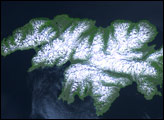
Attu Island is so far west, it’s actually in the Eastern Hemisphere. It is the westernmost of Alaska’s Aleutian Islands, even farther west than the Hawaiian Islands.
Published Jul 5, 2006
On September 25, 2002, astronauts aboard the International Space Station viewed Easter Island, one of the most remote locations on Earth. Easter Island is more than 2000 miles from the closest populations on Tahiti and Chile—even more remote than astronauts orbiting at 210 nautical miles above the Earth. Archaeologists believe the island was discovered and colonized by Polynesians at about 400 AD. Subsequently, a unique culture developed. The human population grew to levels that could not be sustained by the island. A civil war resulted, and the island’s deforestation and ecosystem collapse was nearly complete.
Published Oct 6, 2002
The most interesting geology lies just offshore and below the water line of this Northwest Australian island.
Published Aug 3, 2015
Rivers and bays were loaded with sediment and mud following the damaging storm.
Published Sep 5, 2018
The ghostly white shapes northeast and immediately southwest of Wrangel Island are sea ice. Over the course of the satellite record, Arctic sea ice has advanced and retreated past Wrangel Island many times. From 1979 to 2000, the sea ice edge at the end of summer generally fell somewhere in the vicinity of Wrangel Island, but this is not the first summer when the sea ice edge has retreated well north of the island.
Published Aug 29, 2008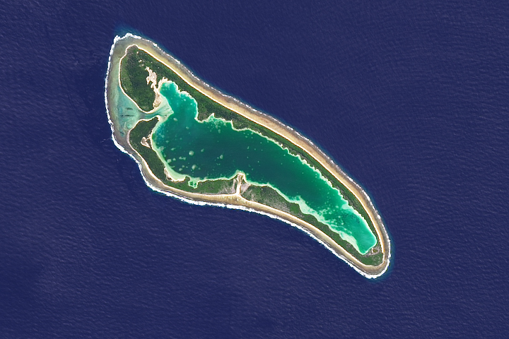
It is one of the most famous patches of coral outside of the Great Barrier Reef.
Published Mar 26, 2018
This image provides a good bird’s-eye view of the center of the city, including famous colonial and independence locations extending from Boston Common to the North End.
Published Nov 17, 2003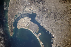
Astronauts flying on the International Space Station took this photograph of California’s southernmost coastal city.
Published Mar 16, 2015
Deception Island is one of the only places in the world where ships can sail directly into the center of an active volcano.
Published Jan 18, 2020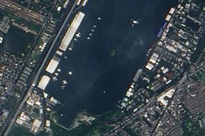
This view of airplanes stranded on a flooded airport tarmac highlights the seriousness of the flood disaster unfolding in Bangkok, Thailand.
Published Nov 2, 2011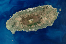
Cheju Island is an oval-shaped volcanic landmass off the southern tip of the Korean Peninsula. The island’s dominant feature is Halla Mountain, a volcano that has been dormant since the early eleventh century.
Published Nov 16, 2008