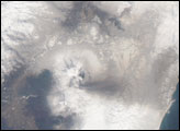
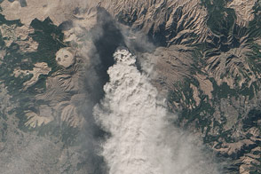
NASA satellites detected ash from Mount Kelut nearly 20 kilometers (12 miles) in the atmosphere within two hours of the explosive February 13 eruption.
Published Feb 15, 2014
It was the largest eruption of the 20th century, but you've probably never heard of it.
Published Jun 9, 2012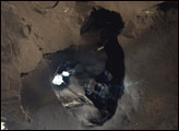
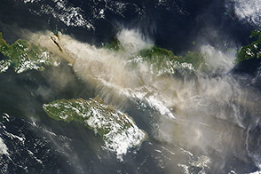
An explosive volcanic eruption in Indonesia has proved a hazard to air travelers.
Published Jun 3, 2014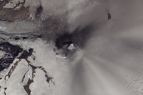
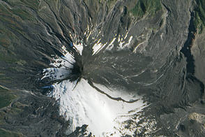
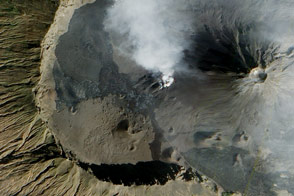
Satellite images captured the ongoing, low-level eruption of one of the Alaskan Peninsula’s largest volcanoes.
Published Aug 3, 2013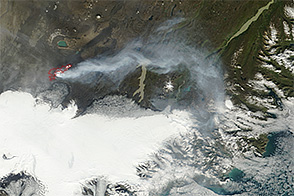
On September 5, 2014, two new fissures opened up near Vatnajökull ice cap in the ongoing eruption at Iceland’s Bárdarbunga volcano.
Published Sep 5, 2014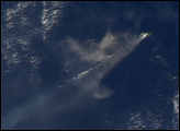
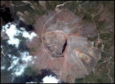
Volcanic material ejected from one of Chile’s most active volcanoes now masks the snow and glaciers on the mountain’s eastern flank.
Published Mar 12, 2015
In January 2020, the volcano in the Philippines spewed lava and emitted hazardous amounts of volcanic ash fall and gases.
Published Jan 13, 2020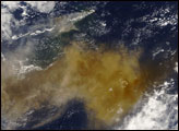
Landsat 8 observed a thick plume of ash from the Japanese volcano on January 13, 2015.
Published Jan 18, 2015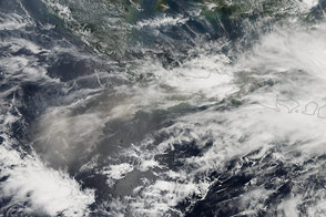
A major eruption occurred at Indonesia’s Kelud volcano on February 13, 2014.
Published Feb 14, 2014
Hundreds of people were forced to flee their homes as lava headed for settlements within Fogo’s caldera.
Published Dec 30, 2014