NASA satellites and sensors constantly take the pulse of our planet, measuring how Earth changes by the day, season, year, and decade. Researchers and resource managers analyze those measurements and apply them on local and regional scales to better manage things like our food and water supplies, health, safety, land use, and ecosystems. NASA data is also used by other government agencies to help with responses to natural disasters and emergencies around the country and the world.
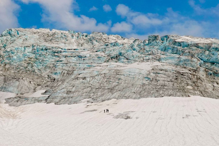
Scientists use satellites in orbit and boots on the ice to monitor glacial changes on the flanks of Mount Baker and elsewhere in Washington state.
Published Sep 19, 2024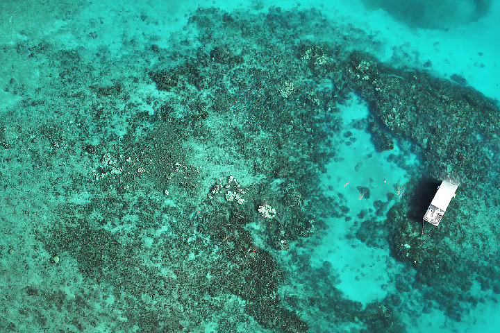
After a brutally hot summer in 2023 that caused widespread bleaching and coral death, summer 2024 was more favorable for the state’s vulnerable reefs.
Published Sep 17, 2024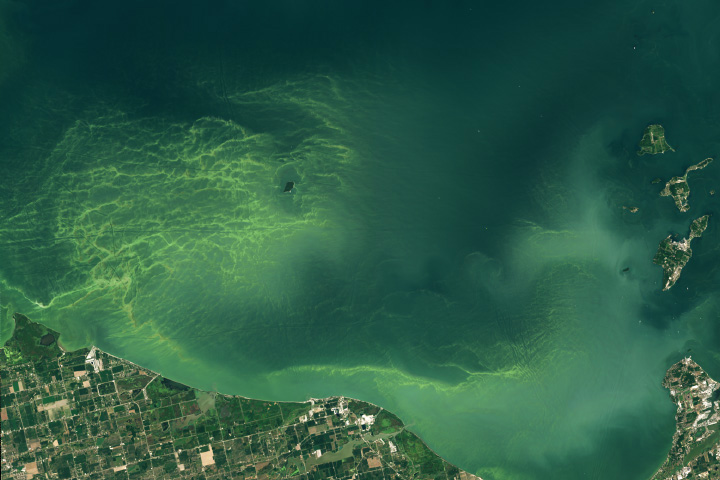
Algal communities flourish in Lake Erie’s western basin each summer. Scientists are looking to new NASA technology to better track them from space.
Published Sep 5, 2024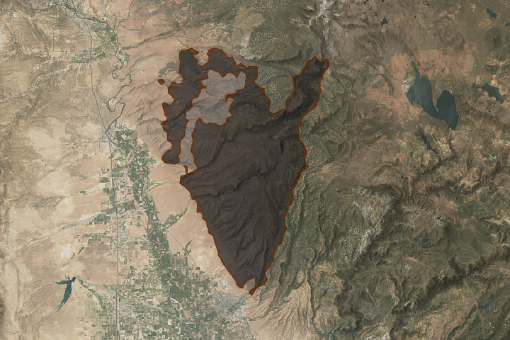
An array of satellite sensors observed the long-duration, episodic spread of the state’s historic fire.
Published Aug 31, 2024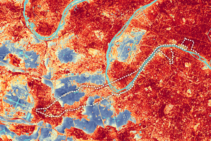
The city’s urban heat island could add to the challenge for Olympic marathoners.
Published Aug 10, 2024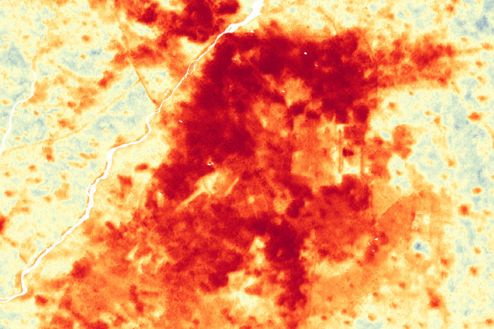
Greening projects in Lahore could help cool the city as climate change and rapid urbanization intensifies the urban heat island effect.
Published Jul 16, 2024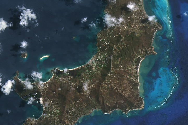
The Category 4 hurricane caused widespread damage to infrastructure and vegetation on the Grenadine island.
Published Jul 9, 2024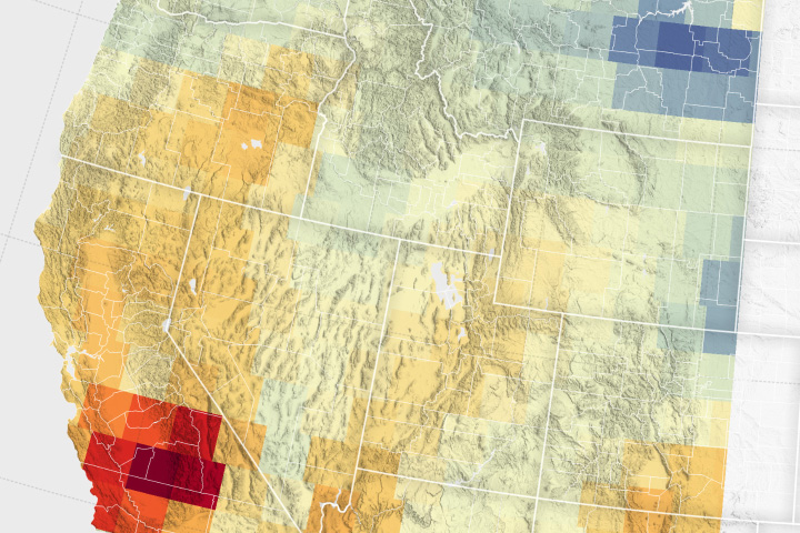
Record snowfall has not been enough to offset groundwater losses amid long-term drying and a heightened demand for the resource.
Published Jun 25, 2024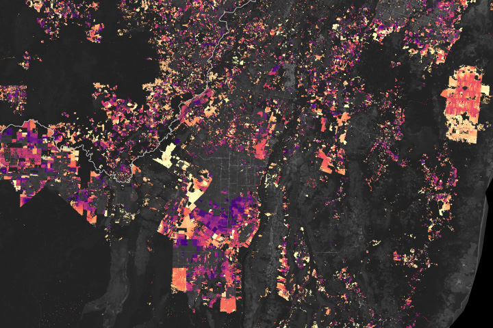
Decades of satellite data paint a picture of how forests in this Central American country are changing.
Published Jun 19, 2024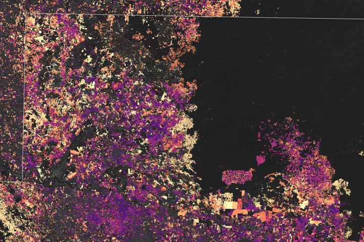
The largest tropical rainforest in Mesoamerica is shrinking as pastures and croplands spread across Guatemala, Belize, and Mexico.
Published Jun 18, 2024
Strong winds and ample fuel helped spread flames over 14,000 acres of grassland in San Joaquin County.
Published Jun 5, 2024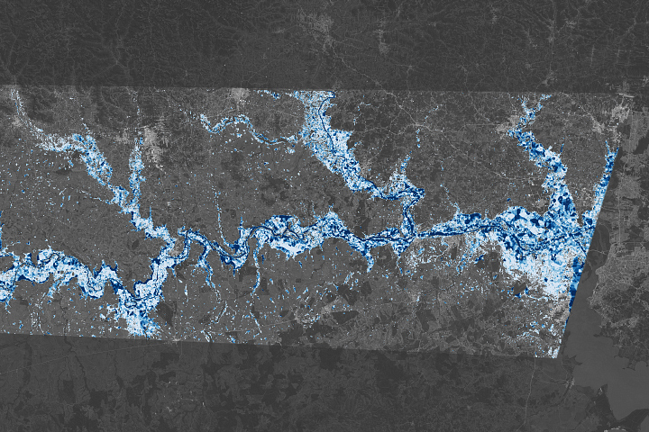
This map reveals the depth of floodwater that covered Rio Grande do Sul in May 2024.
Published May 31, 2024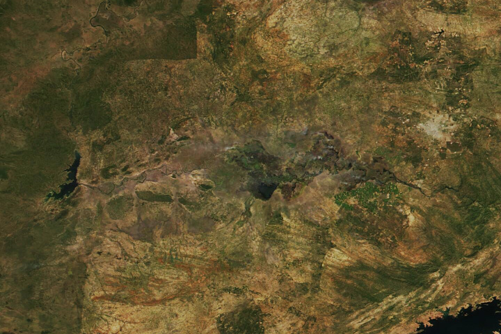
Severe drought in Zambia jeopardizes electricity supplies and food security for millions of people.
Published Apr 30, 2024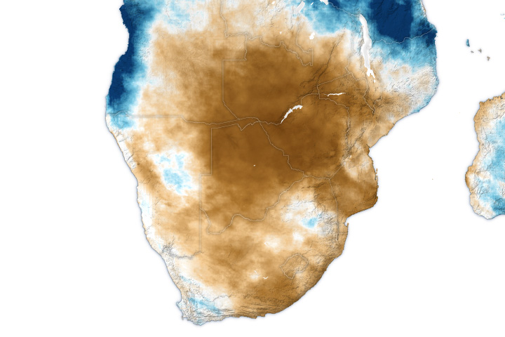
One of the driest growing seasons in decades has decimated crops and left millions hungry.
Published Apr 22, 2024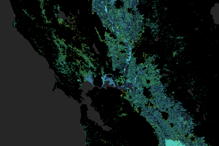
A moisture measurement tool known as OpenET is improving the way farmers, ranchers, and water resource managers steward one of Earth’s most precious resources.
Published Feb 2, 2024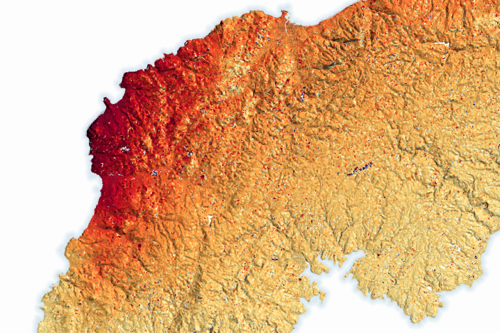
Some parts of the peninsula rose up to 4 meters (13 feet), shifting the position of coastlines and leaving some ports dry.
Published Jan 23, 2024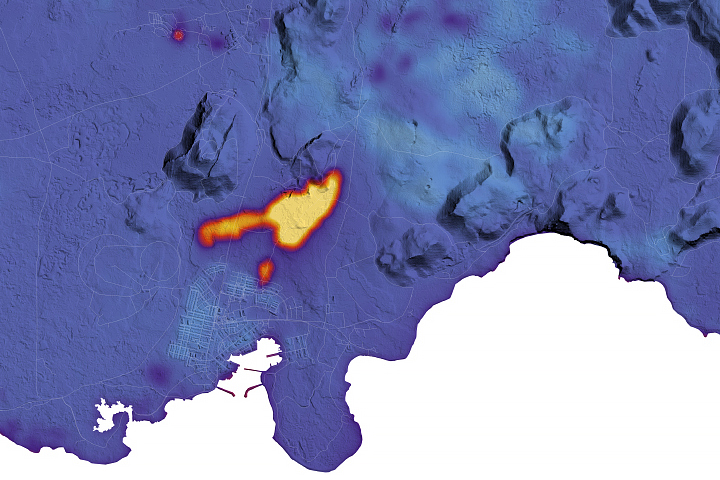
The latest round of eruptions on the Reykjanes peninsula destroyed homes in the town of Grindavík.
Published Jan 19, 2024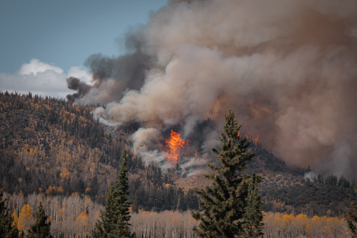
A high-intensity prescribed burn in south-central Utah will help restore the region’s aspen trees. It could also improve the lives of people managing, fighting, and living with fire.
Published Dec 14, 2023
Heavy rainfall in the Horn of Africa submerged entire towns in floodwater.
Published Nov 21, 2023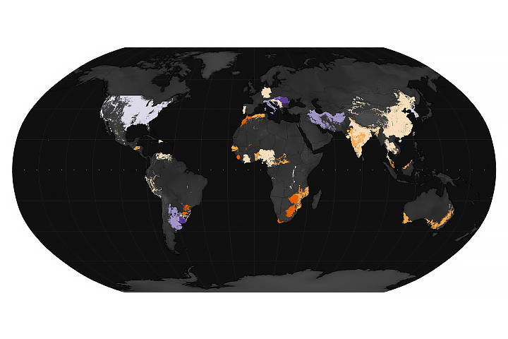
Shifting rainfall patterns are projected to leave millions of people without consistent access to food in late 2023 and early 2024.
Published Oct 30, 2023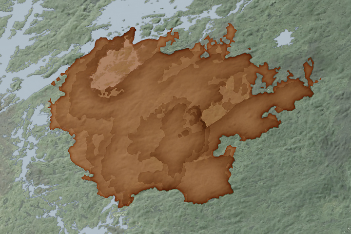
A new system that draws upon active fire data from satellites is making it easier for scientists to track the spread of wildland fires in near real-time.
Published Oct 25, 2023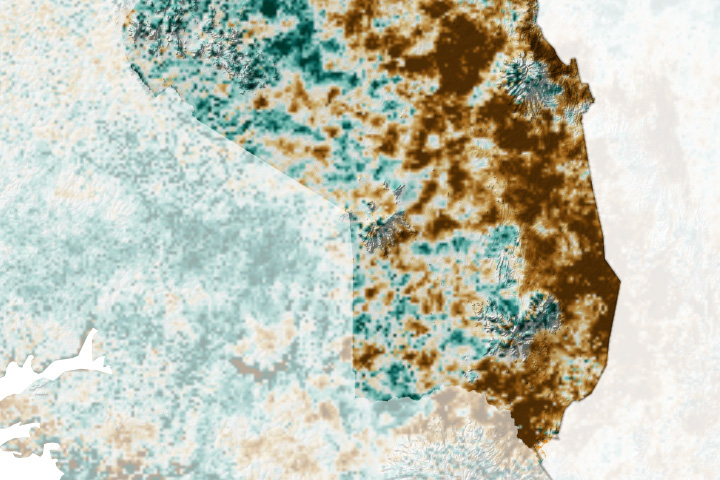
Poor harvests stemming from a prolonged dry spell have exacerbated food insecurity in northeastern Uganda.
Published Oct 23, 2023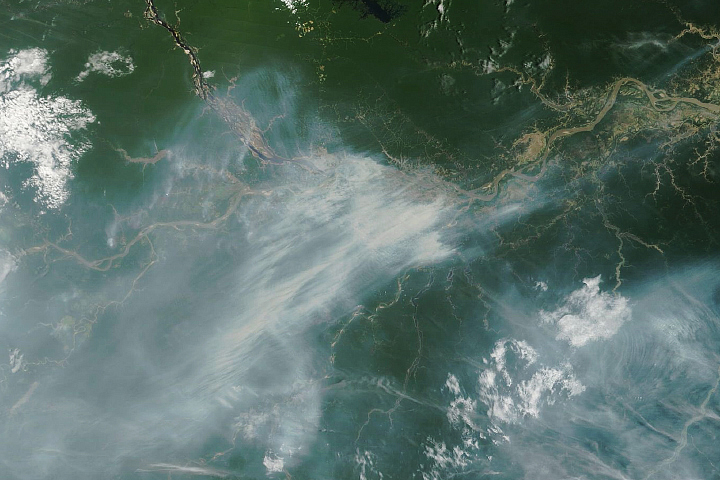
With an El Niño brewing in the Pacific, uncontrolled fires are burning beneath the canopy in some parts of the rainforest.
Published Oct 19, 2023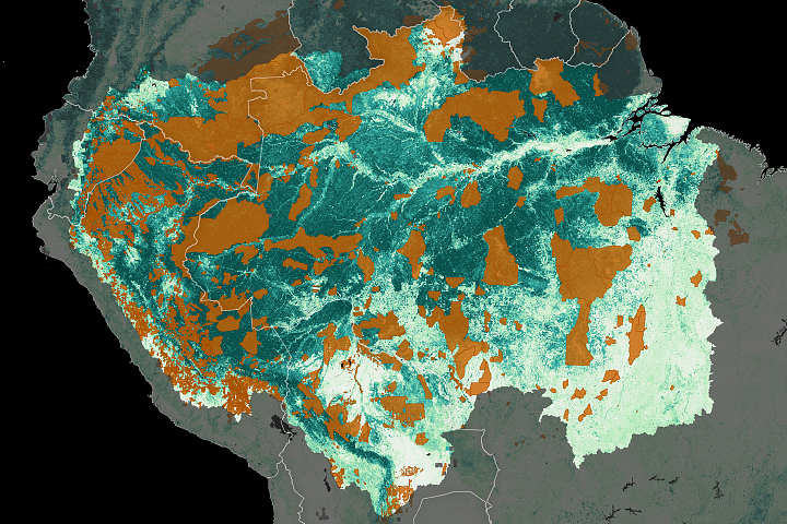
Indigenous people are protecting carbon-rich forests in South America, and satellites are helping.
Published Oct 9, 2023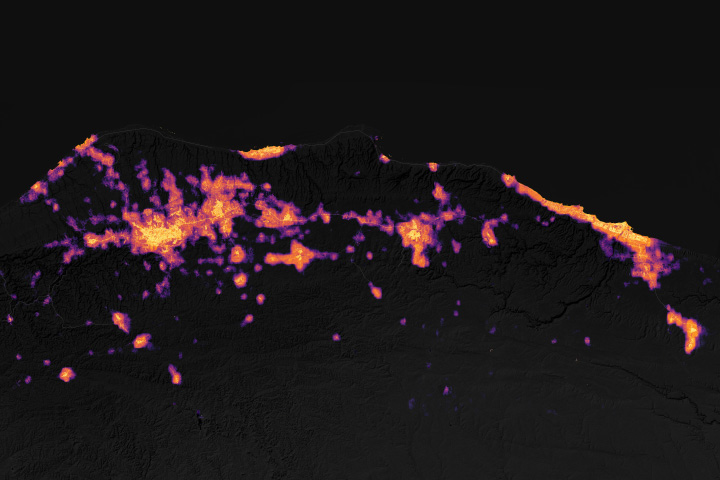
Cities and towns darkened after a cyclone unleashed torrential flooding along the country’s coast.
Published Sep 25, 2023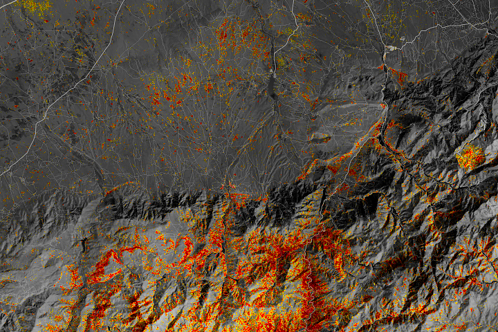
Communities in the High Atlas Mountains were among the hardest hit after a magnitude 6.8 earthquake caused widespread damage.
Published Sep 20, 2023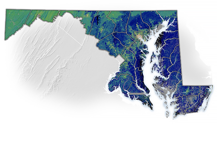
Using remote sensing, researchers have developed a method to guide the state of Maryland’s tree-planting efforts.
Published Sep 7, 2023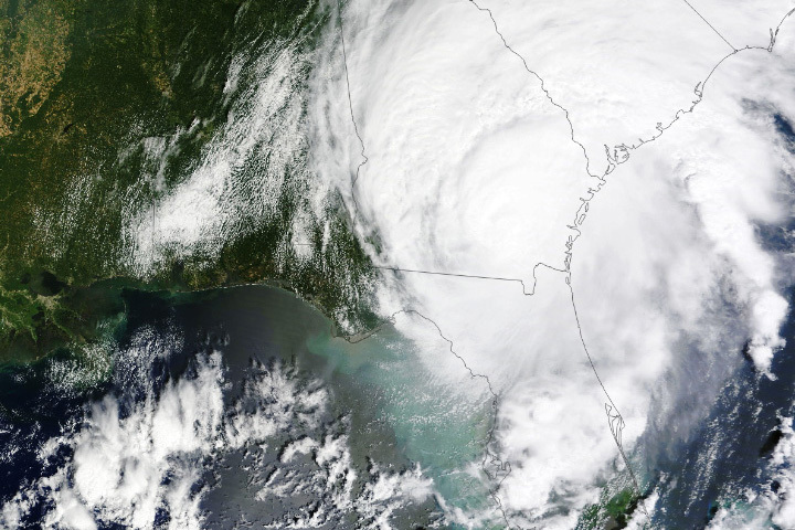
The hurricane rapidly intensified over the Gulf of Mexico, weakening only slightly before making landfall over Florida.
Published Aug 30, 2023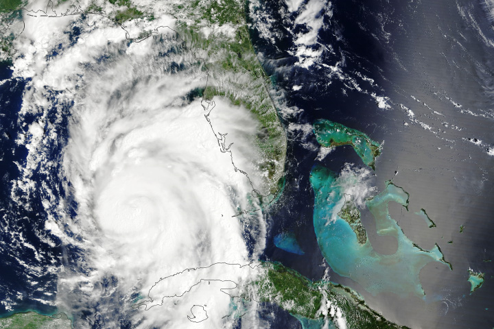
Fueled by unusually warm waters, the hurricane is forecast to rapidly intensify before barreling into Florida.
Published Aug 29, 2023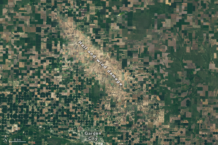
A new database details two decades of damage swaths left after winds and hail pulverize crops and vegetation.
Published Aug 23, 2023