NASA satellites and sensors constantly take the pulse of our planet, measuring how Earth changes by the day, season, year, and decade. Researchers and resource managers analyze those measurements and apply them on local and regional scales to better manage things like our food and water supplies, health, safety, land use, and ecosystems. NASA data is also used by other government agencies to help with responses to natural disasters and emergencies around the country and the world.
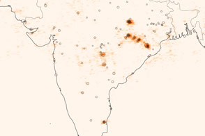
A new analysis of data from the Aura satellite shows greater concentrations of this atmospheric pollutant.
Published Dec 20, 2013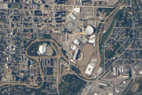
A camera system on the International Space Station observed the high water and muddy aftermath in southern Alberta, Canada.
Published Jun 29, 2013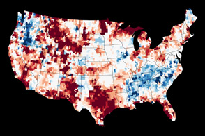
At the surface, moisture is more abundant than in 2012. But time will tell if it seeps down to restore aquifers parched by drought.
Published Jun 18, 2013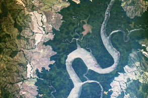
ISERV Pathfinder camera system may eventually provide needed Earth observations to developing countries.
Published Mar 3, 2013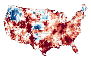
The GRACE satellites can detect the movement and depletion of water supplies at and below Earth’s surface.
Published Sep 20, 2012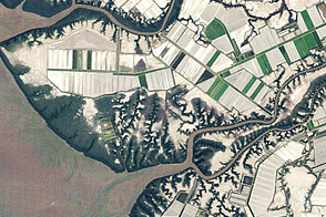
Aquaculture along the coast of the Gulf of Fonseca shows the delicate balance between coastal development and conservation.
Published Jun 15, 2012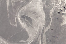
On June 26, 2010, oil was visible in the waters surrounding Horn and Petit Bois Islands following the Deepwater Horizon spill.
Published Jun 29, 2010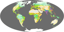
This global map shows Earth’s anthropogenic biomes—ecological patterns caused or influenced by human activity.
Published Oct 2, 2009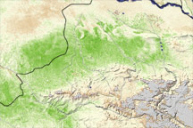
A vegetation index image shows areas of above-average crop growth in northern Afghanistan, following beneficial rains in March and April 2009.
Published Jun 12, 2009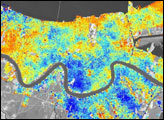
In the three-year period prior to Hurricane Katrina, the city subsided 8 millimeters per year relative to global mean sea level.
Published Jun 3, 2006