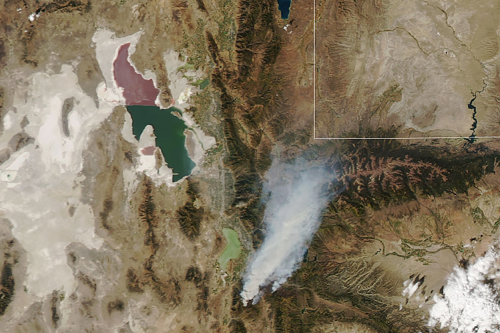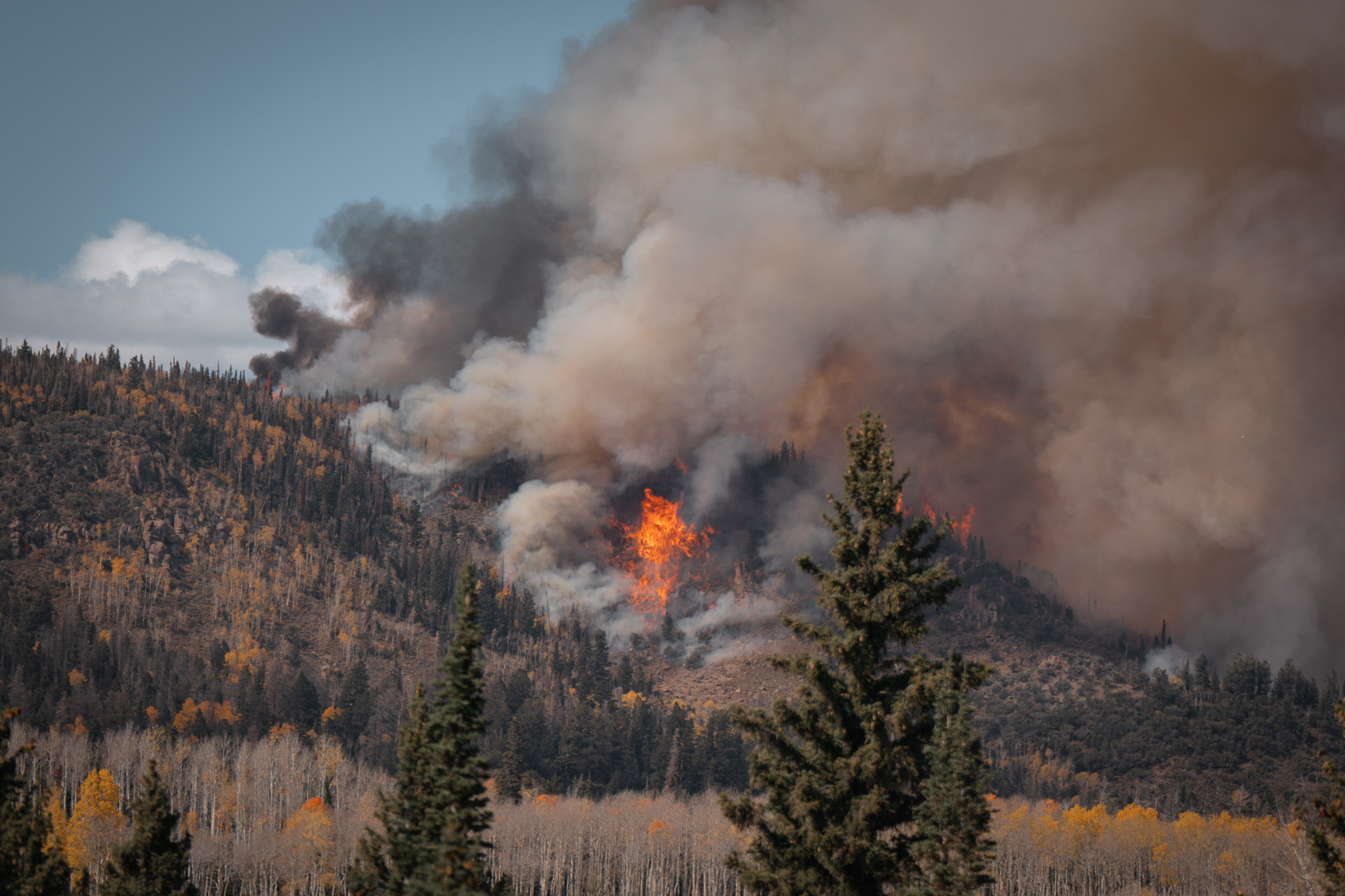
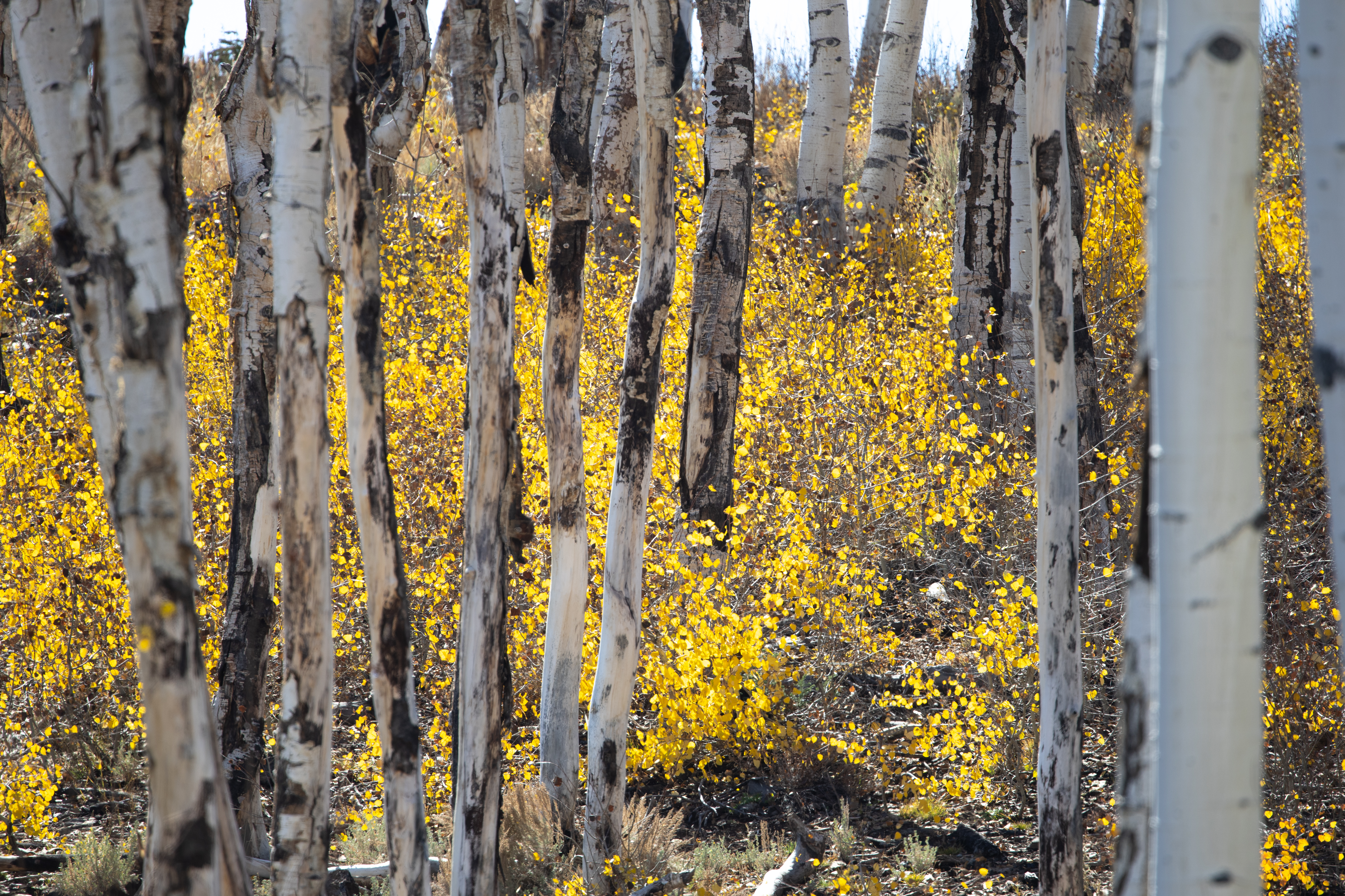
At the start of October 2023, green conifers and golden aspen covered the slopes of Monroe Mountain in Utah’s Fishlake National Forest. Then, starting on October 9, these forests turned black as fire worked its way across the mountain. Flames and smoke were visible for miles.
Unlike wildfires sparked by lightning or accidentally by people, this fire was ignited deliberately with a fire-dripping device suspended from a helicopter. The burn (pictured above), managed by the Richfield Ranger District, aimed to reintroduce fire to the Monroe Mountain region. Fire promotes aspen regeneration and reduces accumulated brush and dead vegetation that could fuel a larger uncontrolled fire.
The managed, or “prescribed” burn also provided an opportunity for researchers to closely examine a high-intensity fire. Dozens of scientists from the Forest Service and other organizations and universities collected data from the ground and from the sky as part of FASMEE, the Fire and Smoke Model Evaluation Experiment. Scientists with NASA’s FireSense project participated, too, collecting data that could ultimately aid wildland fire managers in the future.
“Participating in the prescribed burn offered NASA an opportunity to test technologies and demonstrate their effectiveness in supporting wildland fire management across the life cycle of a fire,” said Michael Falkowski, program manager for the Applied Sciences Wildland Fire program at NASA Headquarters and lead of FireSense.
According to the Monroe Mountain Aspen Ecosystem Restoration Project led by the Forest Service, the number of aspens on this landscape has declined by 70 percent in the past 200 years due to overbrowsing and a lack of fire. Beyond losing a scenic icon of autumn, the decline has implications for the plants and animals supported by the aspen ecosystem, such as elk and mule deer.
In the past, this part of south-central Utah would burn about every 18 years, according to Linda Chappell, a fire ecologist (retired) with the Forest Service. But a history of fire prevention and suppression has allowed conifers to encroach on stands of shade-intolerant aspen. Efforts to cut down the conifers has not been enough. Aspens need fire.
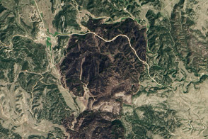
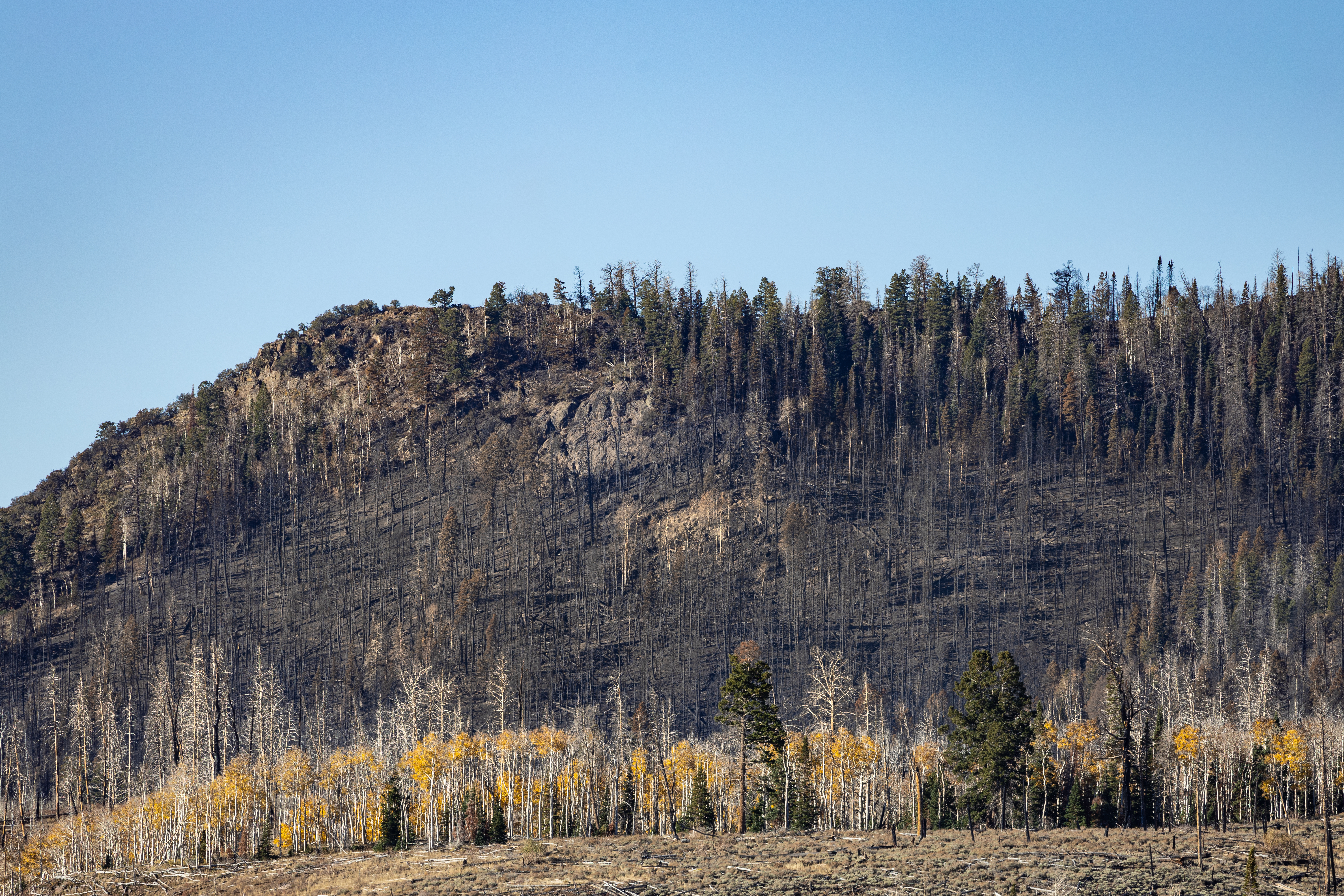
The photo below (top) shows the South Monroe burn on October 18 after the prescribed burn had mostly run its course. Puffs of smoke (not visible) occasionally rose from the still-smoldering hillside that day. In all, fire managers successfully burned about 1,400 acres (5.7 square kilometers) of forest. It remains to be seen if new aspen shoots will emerge from the blackened ground.
Prescribed burns do not replicate the 18-year cycle exactly. Fire managers have to consider things like fuel moisture, proximity to people and private land, and the amount of resources and time invested in each burn. But they have an increasing array of tools, data, and expertise to help them identify the best weather windows for conducting safe and effective burns, the places that would benefit the most from managed fire, and the best ways to minimize fire’s impact on people.
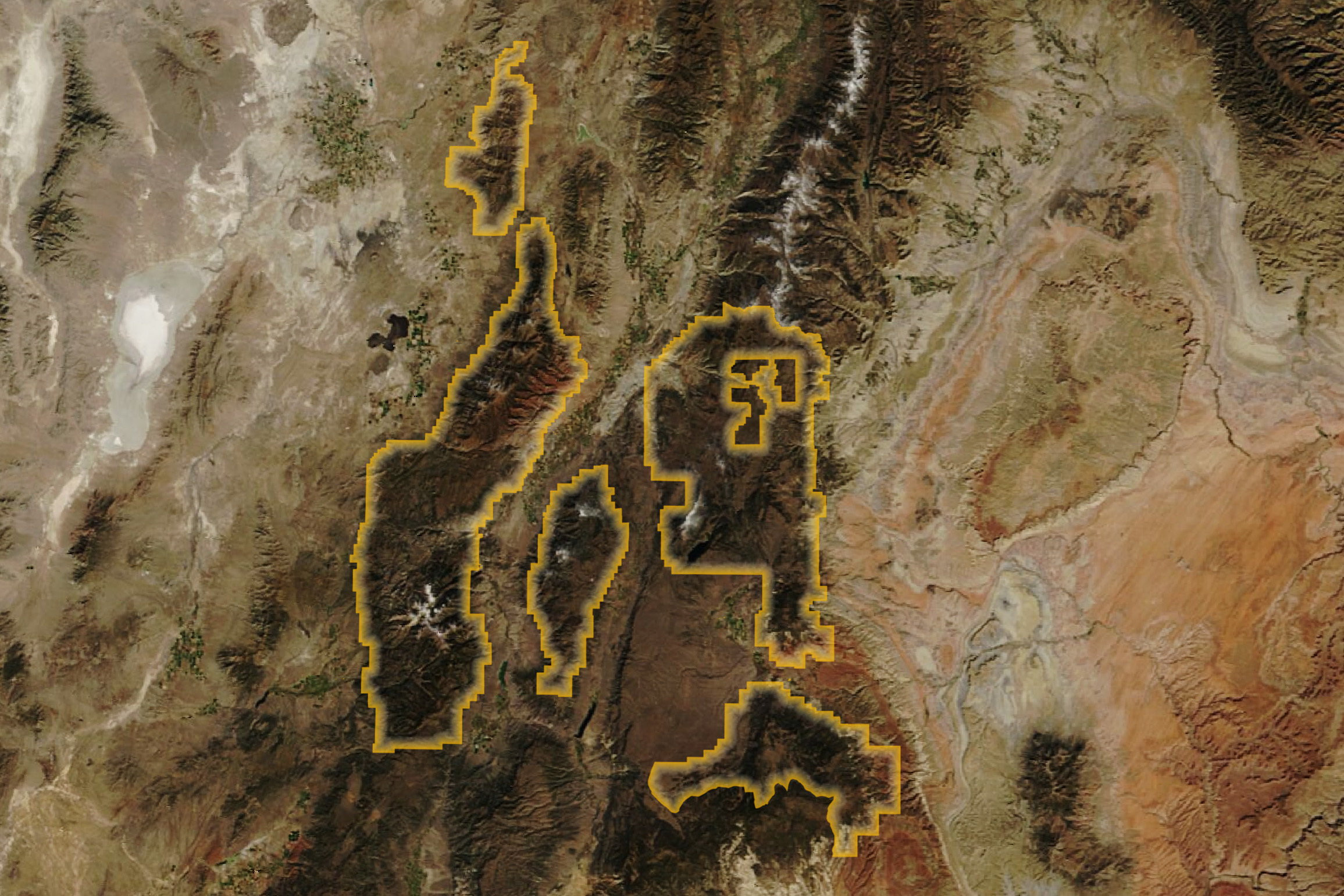
Aiding that effort is FASMEE, the multi-agency experiment led by the USDA Forest Service Pacific Northwest Research Station. The burn on Monroe Mountain in October 2023 was the fourth FASMEE-affiliated burn in Fishlake National Forest since 2019, among others across the U.S. West and Southeast.
Beyond the benefits for aspen recovery, the Monroe Mountain burn is informing over a dozen research projects. Some of them are ecological studies, such as an investigation to find out how bats respond to fire, led by Boise State University, and an assessment of post-fire aspen regeneration, led by the Tall Timbers Research Institute. Other projects will improve the models that inform firefighting strategies, smoke forecasts, and carbon and climate research.
“This is the perfect natural laboratory for fire,” said Jacquelyn Shuman, a forest ecologist at NASA’s Ames Research Center, and project scientist for NASA’s FireSense project.
High-intensity prescribed burns, like the one on Monroe Mountain, closely resemble wildland fires. But because the fires are planned, scientists can measure the landscape before the burn, as well as during and after. They can probe the soil’s moisture content, set up air sampling devices, and map the forest’s fuel load and calculate fuel consumption.
They balance all these tasks while staying flexible to just-right burn conditions; that is, a period of dry, not-too-windy weather, followed by a period of snow or rain that ensures the fire will die out.
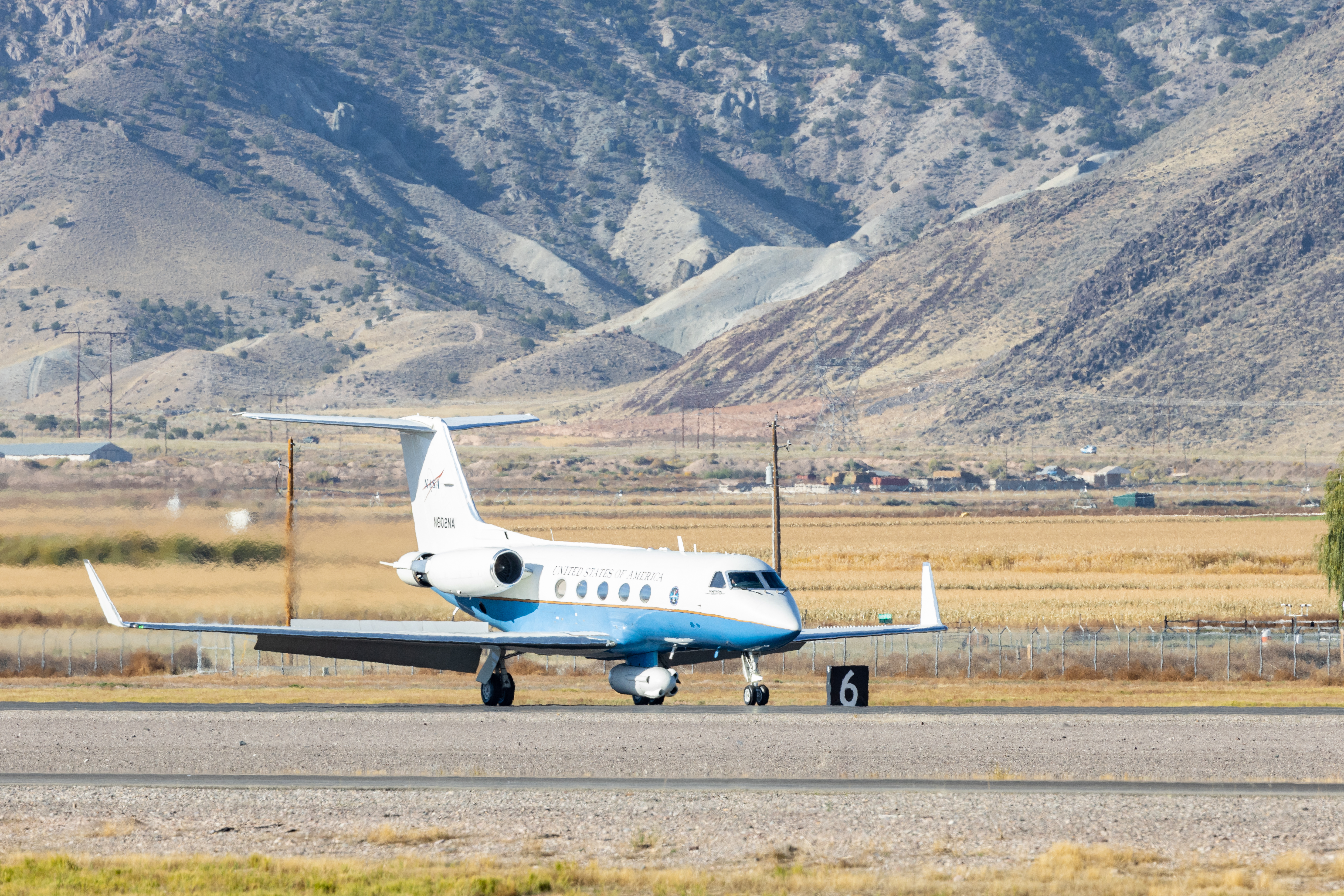
Three NASA aircraft arrived in Richfield for the burn. Their participation in FASMEE was a first for FireSense, a NASA project that includes field campaigns to evaluate and improve science resources delivered to operational fire agencies. One of the aircraft, NASA’s Gulfstream III, is pictured above at the Richfield Municipal Airport on October 17, 2023.
“The airborne perspective will allow FASMEE researchers to better understand fire behavior and smoke production, and hopefully someday support increasing the use of beneficial prescribed fire to mitigate fire risk, restore degraded ecosystems, and protect human communities from catastrophic fire,” Falkowski said.
Airborne data collected before, during, and after the burn on Monroe Mountain will help characterize the entire life cycle of the fire, covering a larger area than is possible from ground-based instruments alone. Data from the radar and optical instruments aboard the aircraft will be used to map the forest’s composition and the moisture in its soils and fuels. Researchers can also track how the fire grew, whether it was flaming or smoldering, and the concentration of smoke particles it lofted into the air.
“Like an angler might use a depth finder to help them decide where to fish, fire managers can use airborne data to help make decisions about a fire,” Shuman said. She noted that these data are a tool, supplementing fire managers’ knowledge of the landscape with additional insights from above. “The ultimate goal of FireSense is to improve the experience for fire managers and to mitigate the risk for firefighters and communities.”
Photo (top) by Grace Weikert/NASA GSFC. All other photos by Milan Loiacono/NASA ARC. Satellite image by Wanmei Liang/NASA Earth Observatory, using MODIS data from NASA EOSDIS LANCE and GIBS/Worldview. Story by Kathryn Hansen.