The Earth Observatory has published its last Image of the Day on this website. Please join us on our new home at science.nasa.gov/earth/earth-observatory.
NASA satellites and sensors constantly take the pulse of our planet, measuring how Earth changes by the day, season, year, and decade. Researchers and resource managers analyze those measurements and apply them on local and regional scales to better manage things like our food and water supplies, health, safety, land use, and ecosystems. NASA data is also used by other government agencies to help with responses to natural disasters and emergencies around the country and the world.
A satellite-based analysis indicates that nearly 27 million tons of wheat were harvested from the country’s farms this year, but Ukraine won’t reap all of the benefits.
Published Dec 2, 2022Image of the Day Land Unique Imagery Human Presence Remote Sensing
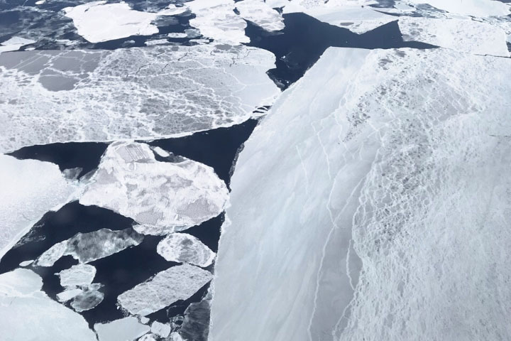
New evidence shows that a sufficient amount of daylight penetrates the ice to sustain blooms of floating, plant-like organisms.
Published Nov 29, 2022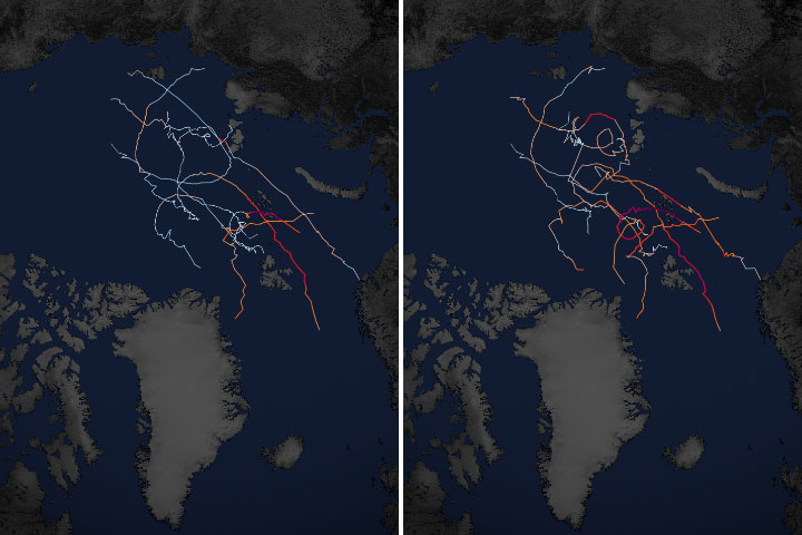
Scientists project that sea ice loss and rapidly warming temperatures will cause storms in the far north to intensify by the end of this century.
Published Nov 16, 2022Image of the Day Atmosphere Water Snow and Ice Remote Sensing
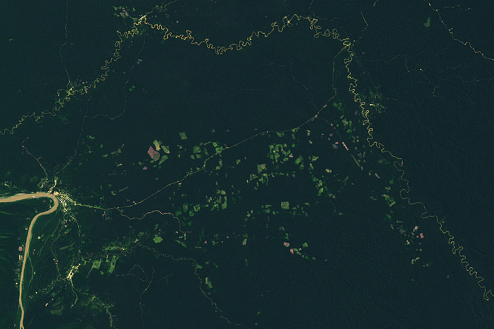
A remote oil and logging road first established in eastern Peru in the 1980s has become a hub for forest clearing.
Published Oct 25, 2022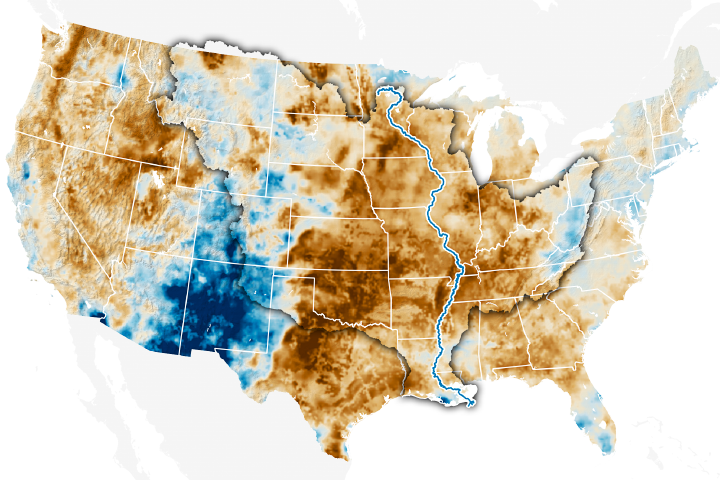
Low water levels are making it difficult to ship goods down the river and allowing a wedge of saltwater to move upstream.
Published Oct 21, 2022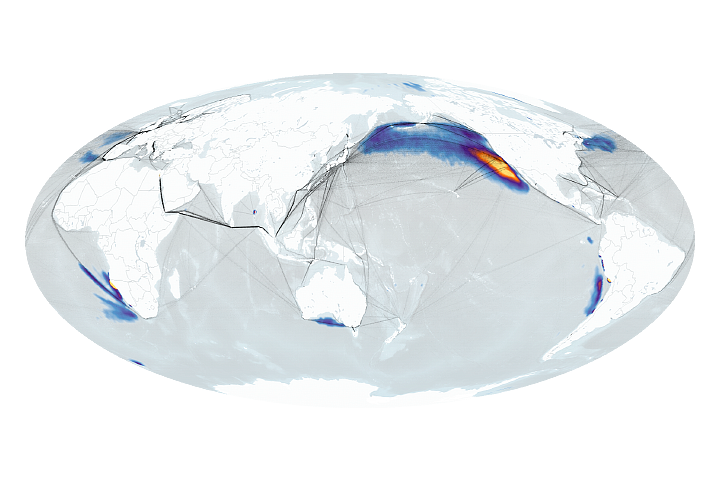
A global standard limiting sulfur in ship fuel reduced artificial “ship track” clouds to record-low levels in 2020. Pandemic-related disruptions played a secondary role.
Published Oct 19, 2022Image of the Day Atmosphere Water Human Presence Remote Sensing
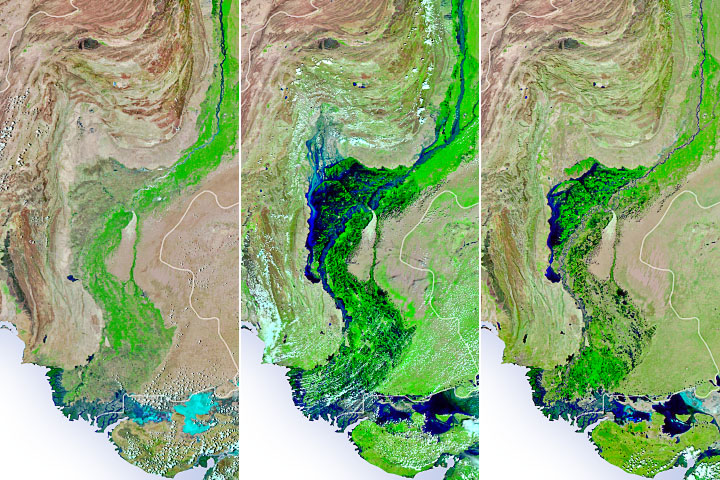
Water has begun to recede, but large swaths of farmland remain waterlogged as food shortages loom and waterborne diseases spread.
Published Oct 13, 2022Image of the Day Atmosphere Land Water Floods Human Presence Remote Sensing
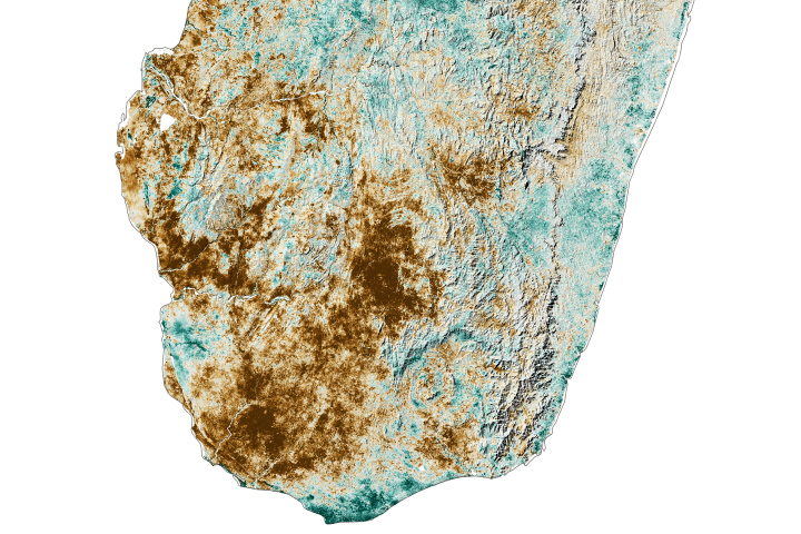
Persistent drought in southern Madagascar is fueling food shortages in the arid region.
Published Oct 11, 2022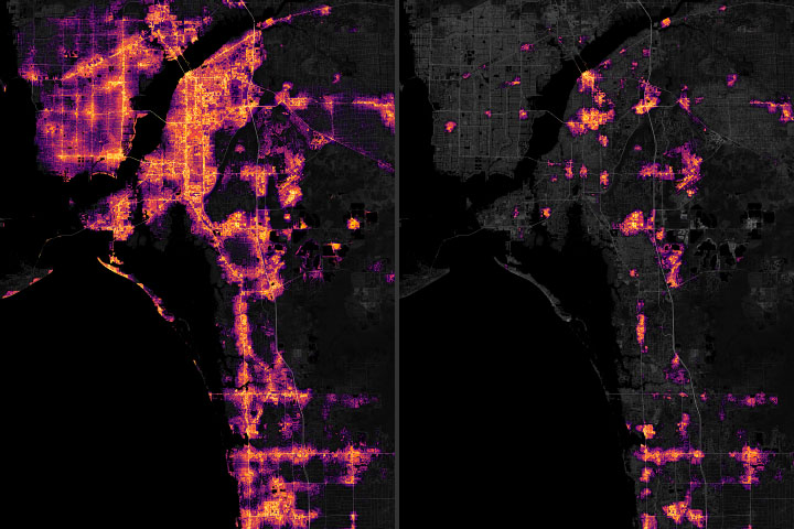
Several cities on the west coast of Florida lost much of their electric power for days after the storm.
Published Oct 3, 2022Image of the Day Land Severe Storms Human Presence Remote Sensing
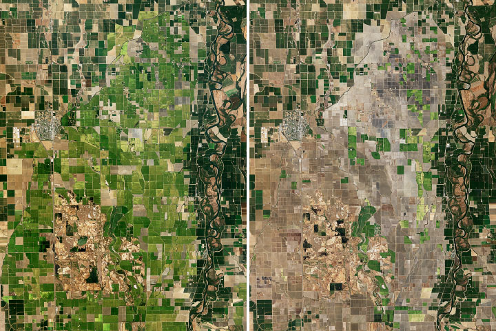
The ongoing drought has cut rice acreage in the Sacramento Valley in half.
Published Oct 3, 2022Image of the Day Heat Land Water Human Presence Remote Sensing
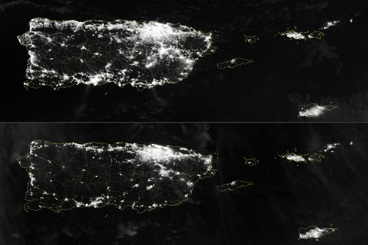
Four days after Hurricane Fiona made landfall on the island, citizens were coping with widespread power losses.
Published Sep 22, 2022Image of the Day Atmosphere Land Severe Storms Human Presence Remote Sensing
A significant disparity in tree cover across urban neighborhoods leads to differences in temperatures and health outcomes.
Published Sep 19, 2022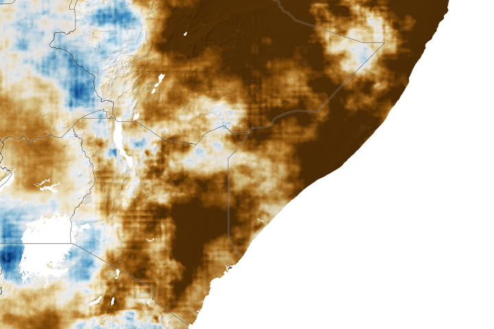
The Horn of Africa is facing drought and crop failures after four inadequate rainy seasons.
Published Aug 16, 2022Image of the Day Land Floods Severe Storms Human Presence Landslides
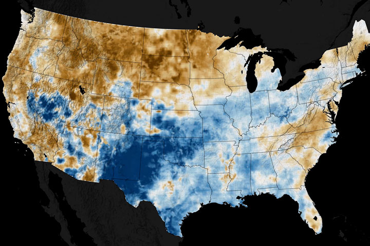
From soaked to dry, the variable state of U.S. soils has implications for farmers and crop production.
Published Jul 29, 2022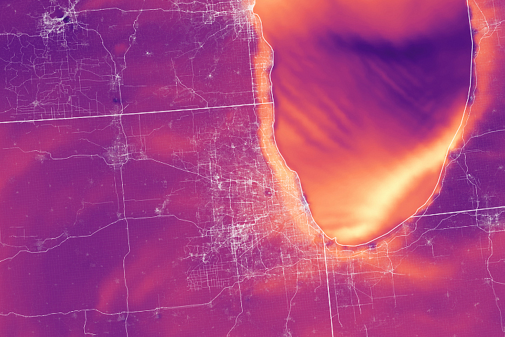
Scientists and regulators are using satellite data and custom models from NASA to help monitor ozone pollution.
Published Jul 28, 2022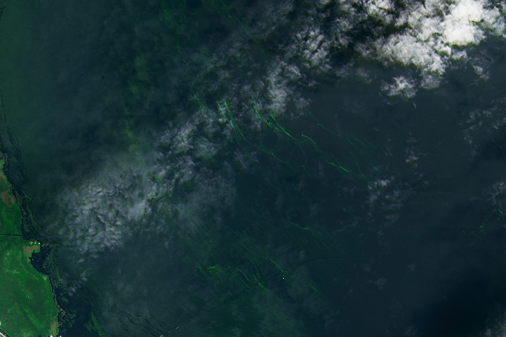
Nearly half of the lake was covered with blue-green algae in early July 2022.
Published Jul 15, 2022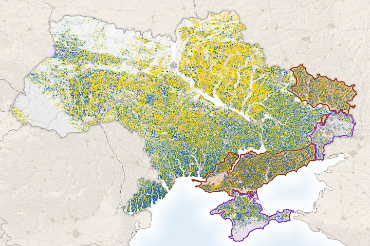
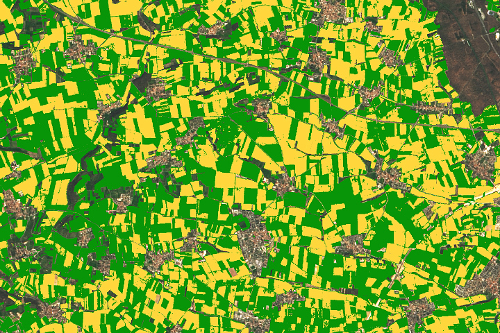
NASA Harvest researchers are using satellite observations and economic data to track how the Russia-Ukraine conflict is disrupting the global food system.
Published Jun 29, 2022Image of the Day Land Unique Imagery Human Presence Remote Sensing
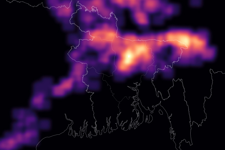
Researchers with SERVIR created a web-based tool that integrates NASA satellite data with observations from the Bangladesh Meteorological Department.
Published Jun 21, 2022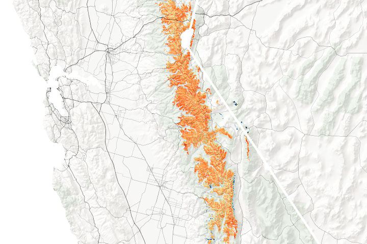
The California mountain range alternated between extreme precipitation and none at all this winter.
Published May 6, 2022Image of the Day Heat Land Drought Fires Snow and Ice Remote Sensing
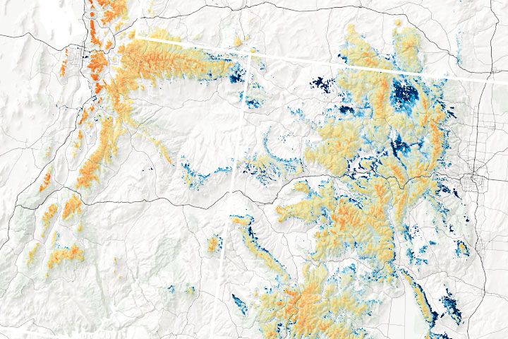
In the midst of a megadrought, scientists are working to improve snowpack measurements used to forecast water supplies.
Published May 5, 2022Image of the Day Heat Land Drought Fires Snow and Ice Remote Sensing
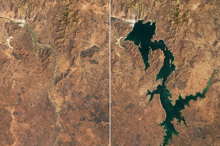
Remote sensing could help experts monitor Nile hydrology as a new reservoir is filled.
Published Apr 20, 2022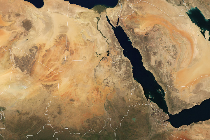
The Grand Ethiopian Renaissance Dam will boost electricity production and development in Ethiopia, but could have less desirable consequences for other users of Nile River water.
Published Apr 19, 2022
A new satellite-derived dataset links concentrations of fine particulate matter in air pollution with health outcomes in cities around the world.
Published Mar 15, 2022Image of the Day Atmosphere Life Human Presence Remote Sensing
A new satellite-derived global dataset links concentrations of nitrogen dioxide with cases of pediatric asthma in urban areas around the world.
Published Mar 14, 2022Image of the Day Atmosphere Life Human Presence Remote Sensing
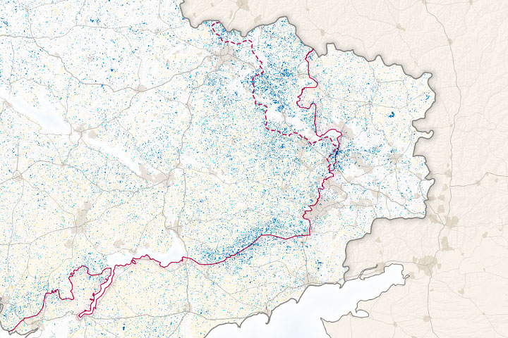
An instrument designed to measure tree height can also distinguish corn from other crops.
Published Mar 7, 2022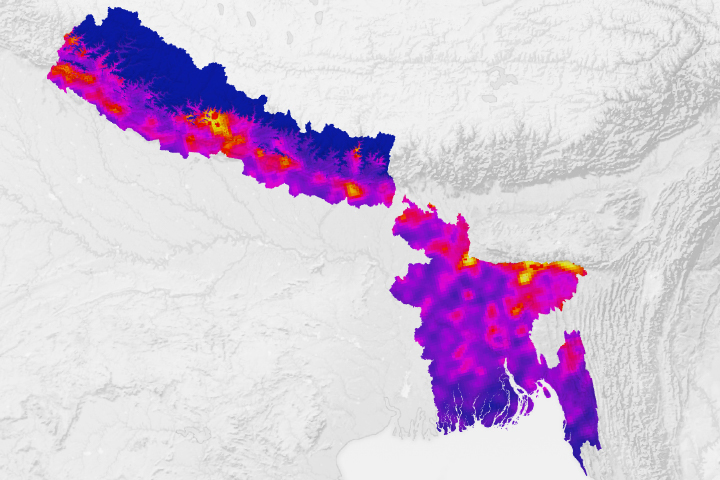
With lightning killing hundreds of people in Bangladesh and Nepal each year, researchers think space-based observations could help reduce risks.
Published Feb 11, 2022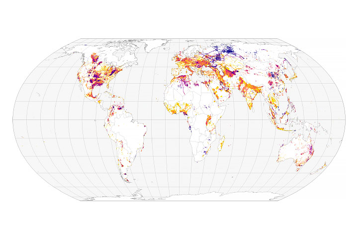
Scientists track the sources of 97 million metric tons of methane emissions.
Published Jan 25, 2022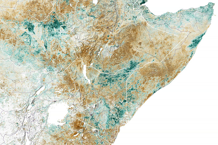
More than 20 million people in Somalia, Kenya, and Ethiopia now face some of the worst food security risks in 35 years.
Published Jan 7, 2022Image of the Day Heat Land Water Human Presence Remote Sensing
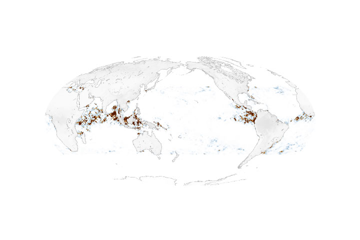
Researchers used satellite data to detect and track masses of plastic floating in the ocean.
Published Dec 3, 2021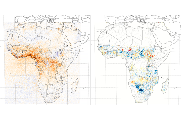
Scientists used satellites to parse where and how agriculture is changing atmospheric concentrations of the chemical.
Published Nov 17, 2021Image of the Day Atmosphere Land Human Presence Remote Sensing
