In August 2021, a wedding in northwestern Bangladesh took a tragic turn when lightning struck and killed 17 guests along the Padma River during a downpour. Though such mass casualty incidents are rare, fatal lightning strikes in Bangladesh and nearby Nepal are not.
Hundreds of people lose their lives to lightning in these two countries each year, and hundreds more are injured. Due to sharp increases in lightning deaths and injuries in Bangladesh and Nepal in recent years compared to the past few decades, the problem is getting more attention from both scientists and government officials. As awareness of lightning dangers grow, satellite observations and ground-based lightning networks are playing key roles in sizing up the extent of the problem and helping people formulate strategies to minimize the risks.
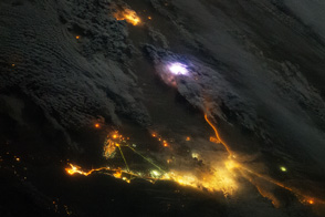
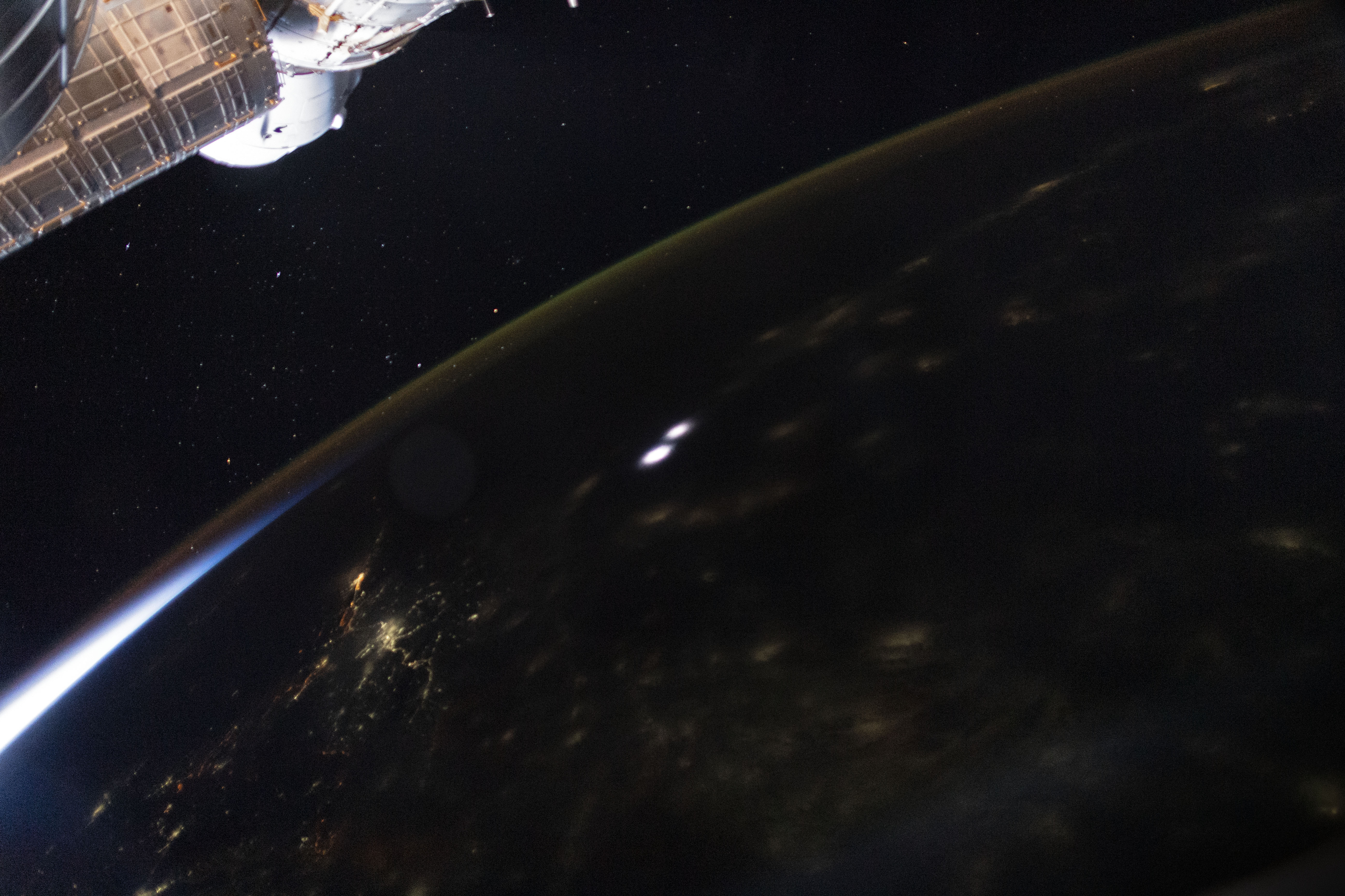
The number of reported lightning deaths and injuries in Bangladesh has increased from dozens of deaths per year in the 1990s to more than 300 per year now. Trends are more difficult to determine in Nepal due to a lack of long-term data, but one recent study estimated about 100 people are killed by lightning there each year. For comparison, lightning kills about 17 people per year in the United States, a country with more than 10 times as many people as Nepal. The photograph below, taken by an astronaut on the International Space Station, shows lightning flashing over Nepal in 2021.
Lightning experts cite a variety of reasons for the apparent increases in deadly strikes, including population growth, better reporting, and increasing storminess due to climate change. Though the cause is not clear, the timing is quite clear.
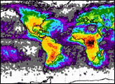
“The frequency of lightning is highest in Bangladesh during the pre-monsoon period from mid-April to June,” said Ashraf Dewan, a remote sensing scientist at Curtin University. Using observations from NASA’s Lightning Imaging Sensor (LIS), he found that 69 percent of the lightning strikes in Bangladesh occur during the period before the heaviest seasonal rains set in. And lightning flashes were particularly common in the morning. The LIS instrument flew on NASA’s Tropical Rainfall Measuring Mission (TRMM) satellite from 1997 to 2015, and a duplicate sensor has operated on the International Space Station since 2017.
“Bangladesh has more lightning from sunrise to midday than anywhere else in the world,” added Ron Holle, a meteorologist with the National Lightning Safety Council. “Unfortunately, that is when people are farming in huge numbers across the country.” Holle and Dewan worked together on a study of ground-based lightning data from the Global Lightning Detection Network that documented a large number of lightning deaths among Bangladeshi farmworkers.
Dewan and other colleagues have been analyzing decades of satellite observations from LIS as well as data from ground-based lightning networks to map lightning patterns in Bangladesh. Other researchers have done similar mapping for Nepal.
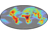
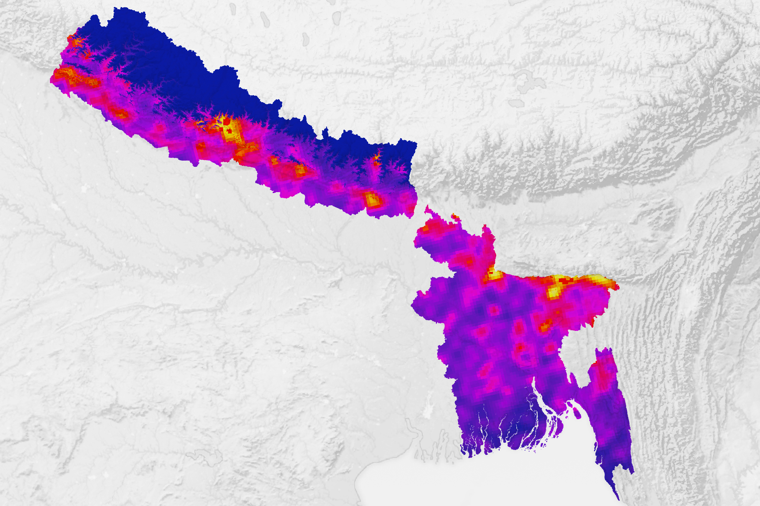
One team of researchers in the DEVELOP program at NASA’s Marshall Space Flight Center worked to turn LIS data into a product tailored to save lives. The team integrated maps of lightning flash density together with data on land elevation, population density, and socioeconomic vulnerability to lightning (including housing conditions and employment type). One of their lightning risk maps is shown at the top of the page; areas with the highest risk are depicted in yellow.
“Our goal was to map where lightning posed the highest risk to people—not just where the most lightning flashes occur,” explained Essence Raphael, a member of the DEVELOP team and a research associate at the University of Alabama in Huntsville. “That’s the kind of information people who develop safety interventions and educational campaigns can use to target their efforts most effectively.”
Flash density relative to population density was critical for defining the high-risk areas, explained Patrick Gatlin, a lightning researcher at NASA Marshall. Though the number of lightning strikes in both countries is similar, the risk is higher in Bangladesh due to its higher population density.
Terrain also plays an important role in defining high-risk areas. Dry air in the higher elevations of northern Nepal prevents storms from forming. However, in lower-elevation areas along the country's southern border, warm, moist winds from the Bay of Bengal collide with cool air from the north to produce towering cumulonimbus clouds and extreme lightning.
Likewise in Bangladesh, the northeastern part of the country has a higher risk because the area is buffeted by moisture-laden winds that run into hilly terrain, which promotes convection and storm development. It is also an area with large numbers of farm and other outdoor workers in harm’s way.
After creating the maps, the DEVELOP team shared them with meteorologists at the Bangladesh Meteorological Agency and Nepal’s Department of Hydrology and Meteorology. Targeted information about lightning risk could be used to help advance ongoing lightning safety initiatives, noted Raphael. Such efforts include building early warning systems, constructing lightning shelters, and conducting public education campaigns.
Given the increasing risks, Dewan has some practical advice for people in the two countries. “If you can, get inside a large building with grounded wiring and plumbing or a fully-enclosed, metal-topped vehicle during thunderstorms. Don’t shelter under isolated trees or on high ground if you are stuck outside,” he urged. “Stay away from water and open spaces.”
NASA Earth Observatory image by Lauren Dauphin using data from NASA DEVELOP (Raphael et al.) Astronaut photograph ISS065-E-386846 was acquired on September 14, 2021, with a Nikon D5 digital camera using a focal length of 24 millimeters. Story by Adam Voiland.