
Astronauts use the Sun’s reflection point to reveal features that are otherwise difficult or impossible to see.
Published Dec 1, 2014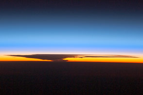
As moisture-filled thunderhead clouds expand upward through the atmosphere, they can hit a more stable layer and flatten into an anvil shape.
Published Nov 24, 2014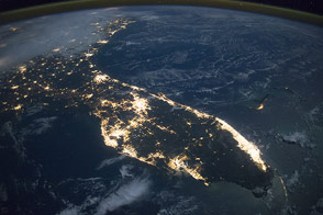
The peninsula is highly recognizable even at night, especially when looking north, as our map-trained brains expect.
Published Nov 17, 2014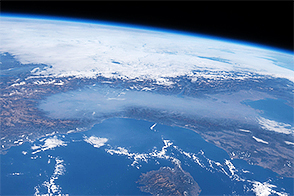
A photograph by an astronaut leads us to a teachable moment about what’s in our air.
Published Nov 11, 2014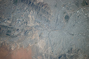
This astronaut photograph shows these sister cities on the Rio Grande, the second largest metropolitan area on the Mexico–U.S. border.
Published Nov 10, 2014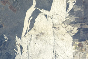
Recent fires burned away the vegetation cover of desert scrub to reveal a sheet of white sand and barchan dune patterns.
Published Nov 3, 2014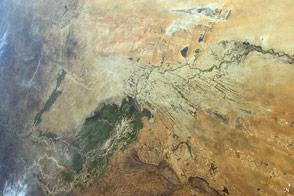
For millennia, the river has been the most important water supply in the western Sahara Desert.
Published Oct 27, 2014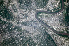
The hometown of a 2014 World Series contender is brimming with baseball history.
Published Oct 25, 2014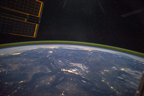
This wide-angle panorama shows a huge swath of the western United States from Portland to Phoenix.
Published Oct 20, 2014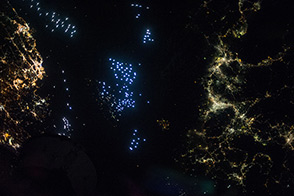
Distinct colors mark the communities and commerce along the Tsushima Strait, between Japan and South Korea.
Published Oct 19, 2014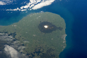
This protected area on North Island is centered around a volcano and sits on a promontory that juts out into the Tasman Sea.
Published Oct 13, 2014
Two images show the region before and during a vast a dust storm.
Published Oct 6, 2014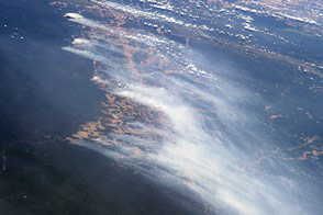
Astronauts caught a glimpse of rainforest being cleared for agriculture in Brazil.
Published Sep 22, 2014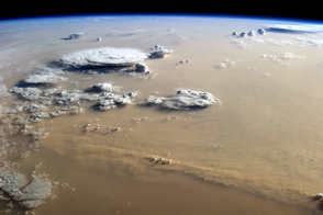
A massive dust storm filled the skies over Libya in early September 2014.
Published Sep 21, 2014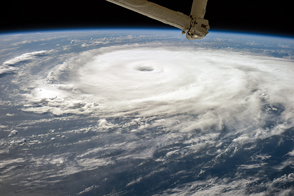
Researchers are deploying a mix of airborne and orbiting tools to unlock secrets of the most potent storms on Earth.
Published Sep 20, 2014
Changing conditions in the waters near Alaska promotes late summer phytoplankton growth.
Published Sep 19, 2014
PMCs have become brighter and thicker and have appeared farther south in recent years.
Published Sep 15, 2014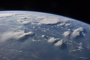
Different air flow patterns at low and high altitudes provoke compelling cloud features over Indonesia.
Published Sep 8, 2014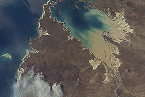
Off the northwestern coast of Australia, the sound has the second greatest daily tidal change in the world.
Published Sep 1, 2014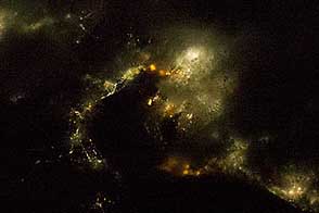
Astronauts collect a lot of photos of Earth at night, but they don't always know what they are looking at. You can help.
Published Aug 30, 2014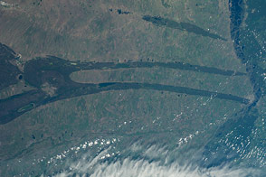
Strange spike patterns on the Siberian landscape caught the attention of astronauts on the ISS.
Published Aug 25, 2014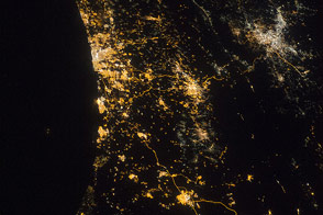
The bright lights of the cities are intersected and offset by the dark valley of the Jordan River and Dead Sea.
Published Aug 18, 2014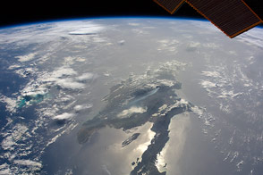
Astronauts captured an oblique view of the island that includes Haiti and the Dominican Republic as a wildfire raged in a national forest.
Published Aug 11, 2014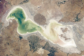
This shallow, saline lake in Iran is one of the largest in the Middle East. But drought and water withdrawals for farming are shrinking it.
Published Aug 4, 2014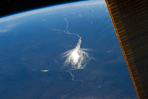
This wetland in the interior of Botswana is an oasis for biodiversity in the midst of the arid Kalahari Desert.
Published Jul 28, 2014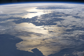
Sunglint provides compelling light for the coastlines of northern Europe.
Published Jul 22, 2014
Transcripts from the flight to the Moon capture some of the wonder and novelty of looking back at Earth.
Published Jul 21, 2014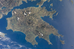
The great peninsula of Greece reaches into the Mediterranean and forms a crossroads with history.
Published Jul 14, 2014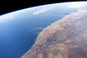
Strong, hot winds known as “berg winds” (mountain winds) are lofting plumes of dust directly out into the Atlantic Ocean in this panoramic image taken from the International Space Station.
Published Jul 7, 2014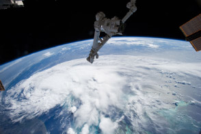
Hurricane Arthur is forecast to strengthen and graze or strike the Outer Banks of North Carolina tonight as a Category 2 hurricane.
Published Jul 4, 2014alert message
