The western half of the Arabian Peninsula contains not only large expanses of sand and gravel, but extensive lava fields known as haraat. One such field is the 14,000-square-kilometer Harrat Khaybar, located approximately 137 kilometers to the northeast of the city of Al Madinah (Medina). The volcanic field was formed by eruptions along a 100-kilometer, north-south vent system over the past 5 million years. The most recent recorded eruption took place between 600–700 AD.
Published Apr 14, 2008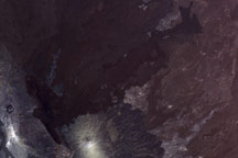
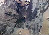
In early November 2008, a volcano erupted in the Erta Ale Range in northeastern Ethiopia, producing a fresh lava flow.
Published Nov 19, 2008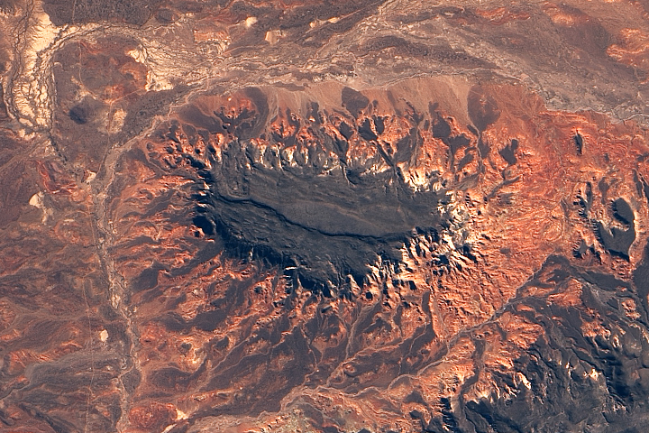
Erosion has produced a striking landscape east of the Andes Mountains in Chubut Province.
Published Nov 27, 2018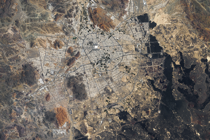
As Medina has grown during the past three decades, parts of the Saudi city are built atop relatively young lava flows.
Published Feb 25, 2019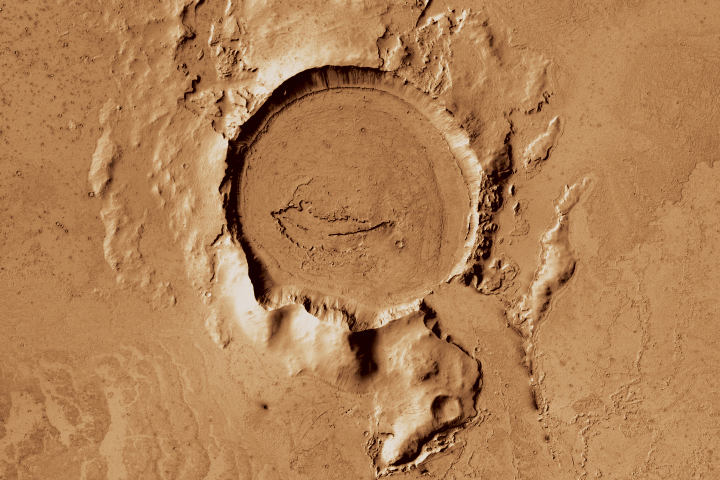
A team of NASA scientists headed to Holuhraun because the volcano has geologic cousins on Mars.
Published Oct 9, 2018
Volcan Parinacota is a potentially active stratovolcano located on the Altiplano, a high plateau in the Andes mountains.
Published Oct 17, 2011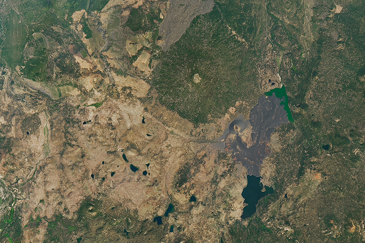
A 1666 eruption in what is now the northeast corner of Lassen Volcanic National Park flattened forests and created a new lake.
Published Mar 11, 2018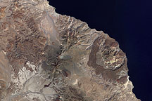
This natural-color image from the Landsat satellite on October 5, 2000, shows El Aguajito Caldera, Las Tres Vírgenes, and La Reforma Caldera on the Baja Peninsula.
Published Dec 23, 2008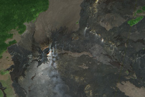
Fresh lava flows radiate from Kilauea’s Pu’su ’O’o, crater, as the Volcano’s longstanding eruption continues.
Published Nov 13, 2011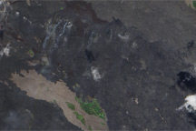
Fresh lava flows cover the slopes of Hawaii’s Kilauea Volcano.
Published Nov 4, 2010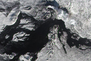
Acquired March 6, 2013, this image shows a fresh lava flow on the surface of Tolbachik Volcano on the Kamchatka Peninsula.
Published Mar 12, 2013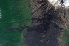
Fresh lava flows are difficult to distinguish from the barren rock of Tolbachinsky Dol, a volcanic plateau.
Published Jun 9, 2013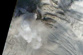
Fresh debris avalanches and a growing lava dome on Mount Shiveluch illustrate some of the processes that build stratovolcanoes.
Published Nov 8, 2011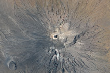
In September 2007, a series of explosive eruptions altered the summit of the volcano, the only one that erupts natrocarbonatite lava.
Published Sep 20, 2009alert message
