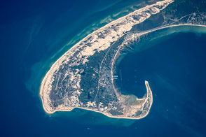
Winds and wave refraction give the area around Provincetown a distinctive hook shape.
Published Aug 31, 2015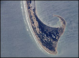
This astronaut photograph, taken from the International Space Station, shows the northernmost parts of the Cape Cod National Seashore, also known as Provincetown Spit.
Published Oct 19, 2005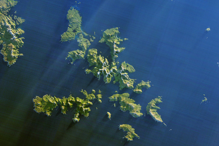
Ferocious winds and huge waves have long made it perilous to navigate around the southernmost tip of South America.
Published Dec 24, 2017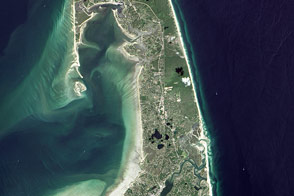
“A man may stand there and put all America behind him.”
Published Nov 25, 2016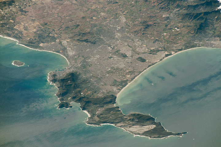
Originally named the Cape of Storms, it was later renamed to Good Hope in order to attract more people to the Cape Sea Route.
Published Aug 18, 2019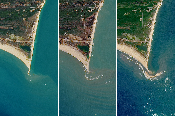
The natural movement of sediment has built up a shoal island off the Outer Banks in North Carolina.
Published Jul 12, 2017
Crews on the International Space Station seldom see the southern tip of Argentina and Chile in such clear weather.
Published May 26, 2014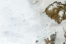
To understand ice sheets, glaciologists venture both below the surface with ice cores, and into the sky with satellites. Satellite imagery of the Greenland Ice Sheet reveals melt ponds that can affect glacier flow and sea level.
Published Oct 29, 2008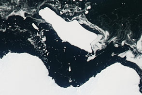
Sea ice in an East Antarctic bay broke up, providing access to Cape Denison for the first time in six years.
Published Mar 4, 2016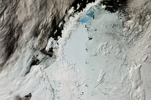
The northernmost arm of Antarctica is a hotspot of research because its retreating glaciers are a large contributor to sea level rise.
Published Feb 24, 2017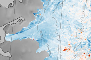
Sections of the Greenland Ice Sheet that end on land are slowing—a sliver of good news for sea level rise.
Published Oct 30, 2015
Researchers working in Antarctica have found evidence of large-scale ice making at the bottom of that continent's massive ice sheets.
Published Apr 21, 2011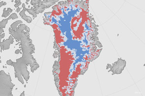
A new map shows where the bottom of the Greenland Ice Sheet is likely thawed.
Published Aug 4, 2016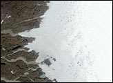

Nelson Mandela took the long view of his country and world, as does this photo from the space station.
Published Dec 15, 2013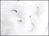
Thinner than the 2.3-kilometer-thick center, the outer edges of the Greenland ice sheet develop melt zones like the one shown here during the warm summer months.
Published Apr 7, 2007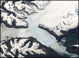
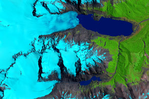
Brüggen Glacier in southern Chile is the largest western outflow from the Southern Patagonian Ice Field and, unlike most glaciers worldwide, advanced significantly since 1945. From 1945 to 1976, Brüggen surged 5 km across the Eyre Fjord, reaching the western shore by 1962 and cutting off Lake Greve from the sea.
Published Dec 9, 2001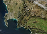
Ice loss in Patagonia has struck more than just the largest and most frequently studied ice fields.
Published Feb 23, 2016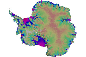
Scientists mapped the motion of Antarctica’s ice sheets and revealed unexpected patterns.
Published Aug 19, 2011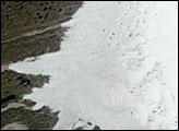
Although 2005 overall saw a new record, the extent of June melting in 2005 was unexceptional. The same held true for 2006, when this picture was taken.
Published Jun 30, 2006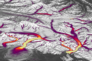
Better Landsat imaging and creative use of software is allowing scientists to map details of changing glaciers and ice sheets.
Published Dec 14, 2016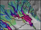
The image above depicts the region of West Antarctica where scientists measured ice speed. The fast-moving central ice streams are shown in red. Slower tributaries feeding the ice streams are shown in blue. Green areas depict slow-moving, stable areas. Thick black lines depict the areas that collect snowfall to feed their respective ice streams.
Published Jan 25, 2002alert message
