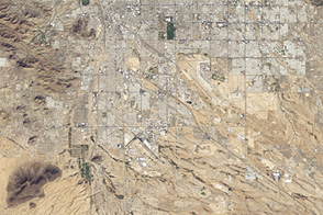
An astronaut photo from 1965 and a satellite image from 46 years later show cityscape engulfing green areas in the dry Southwest.
Published Jul 24, 2012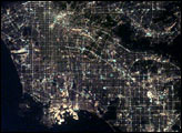
After sunset the borders of "The City of Angels" are defined as much by its dark terrain features as by its well-lit grid of streets and freeways.
Published Apr 6, 2003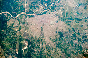
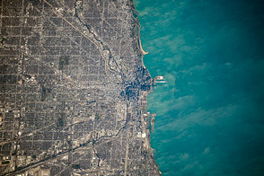
The metropolitan area is one of the fastest-growing cities in the world.
Published Apr 25, 2016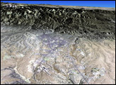
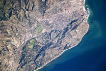
This detailed astronaut photograph highlights the Santa Barbara, California, metropolitan area, sometimes called the “American Riviera.”
Published Feb 9, 2009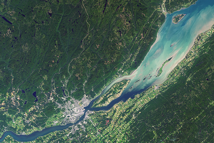
Québec City is one of the oldest continuously inhabited cities in the Americas, and the one that still feels closest to its roots.
Published Feb 12, 2018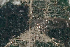
Acquired June 25, 2011, this image shows widespread flooding in the city of Minot, North Dakota, as the Souris River was reaching a historic crest.
Published Jun 30, 2011
Buenos Aires is one of the larger cities seen by orbiting crews. Twelve million people, almost one third of all Argentines, live in this city, often called the “Paris of the South”.
Published Mar 16, 2003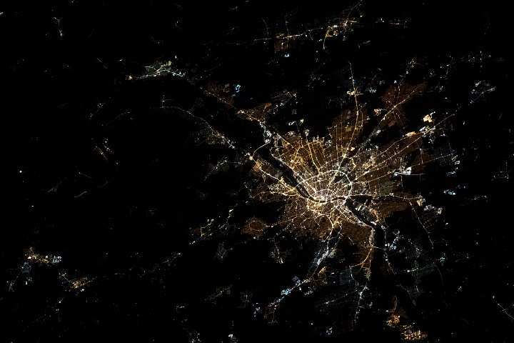
Divided by the Danube River, the city is actually a unification of three different older communities.
Published May 24, 2020
A photograph from the space station shows some of the natural features that have governed the growth of the city.
Published Dec 22, 2014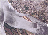
Corrientes, Argentina (sits on the east bank of the Paraná River, South America’s third largest river. Corrientes is located just inside Argentina, across the river from the southwestern tip of Paraguay.
Published Nov 8, 2004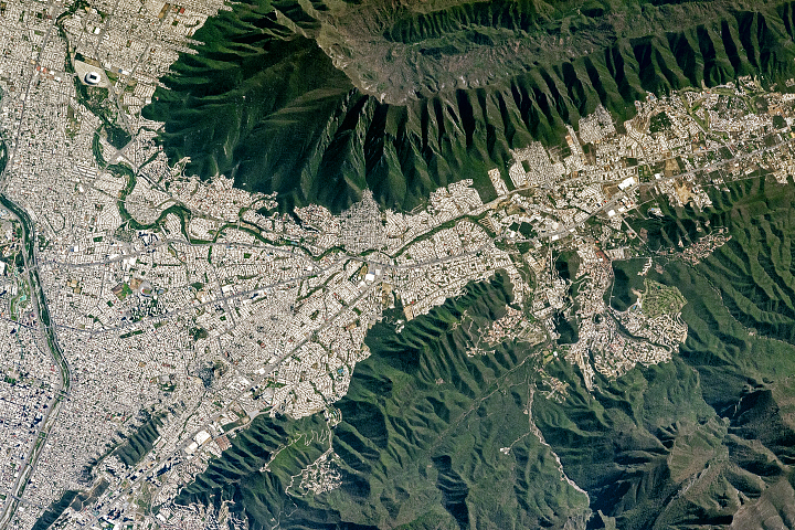
A saddle-shaped mountain distinguishes a region that carries a heavy economic load for Mexico.
Published May 10, 2017
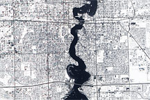
Held in place by reinforced levees, the swollen Red River snakes through Fargo, North Dakota, and Moorhead, Minnesota, in this image captured by the Advanced Land Imager on the EO-1 satellite on March 28, 2009.
Published Mar 31, 2009alert message
