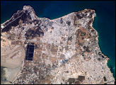
The city-state of Carthage in North Africa was founded by Phoenician settlers in 814 BC, and it subsequently became the seat of a trade empire that controlled much of the western Mediterranean region (including most of the former Phoenician lands). Carthage was completely destroyed by the Roman Republic during the Third (and final) Punic War (149-146 BC). The end of Carthage has been made notorious by the story that the Romans allegedly sowed the city with salt to ensure that no further rivals to their power would arise there. However, given the great value of salt at the time and the strategic importance of the city’s location, scholars dispute whether the event actually occurred. Following the destruction of Carthage, Roman dominance of the Mediterranean continued until the fall of the Western Empire in 476 AD.
Published Jun 26, 2006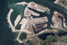
Acquired in 2006, 2009, and 2010, these natural-color images show the progress of land reclamation aimed at increasing the port capacity at Rotterdam.
Published Nov 28, 2010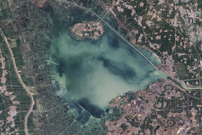
The fingerprints of human civilization are all over the lake in eastern China.
Published Jan 10, 2015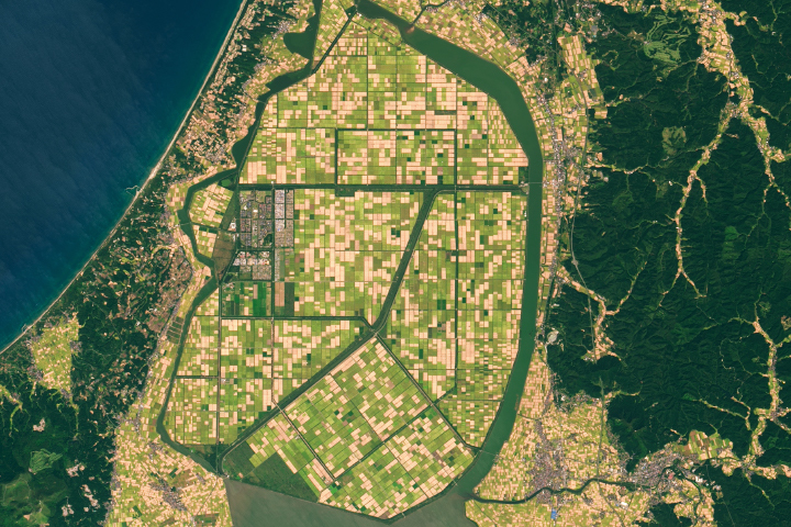
Lake Hachirō in northern Honshu was once Japan’s second largest lake.
Published Dec 1, 2019
One example of increasing aridity in Mali appears in Lake Faguibine. Starting in the late 1980s, a drop in precipitation steadily dried the lake. Even though normal rainfall resumed after the year 2000, the lake remained nearly dry.
Published Aug 10, 2008
Acquired on April 10, 2010, and and March 7, 2009, these natural-color images show changes in a central Australian saltpan, Lake Frome. In 2010, water has seeped into the salt lake, leaving standing water in some areas and muddying much of the ground surface.
Published Apr 14, 2010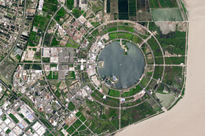
Seawalls and dredging have created new real estate along the city’s coastlines.
Published Mar 31, 2017
Water hyacinths may look beautiful, but communities along Lake Victoria are in a constant battle with the fast-spreading plant.
Published Oct 5, 2014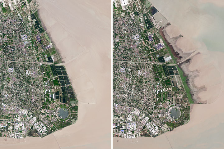
The Chinese city has reclaimed land from shallow coastal waters at a rapid rate.
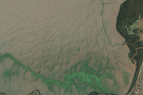
Published Dec 11, 2019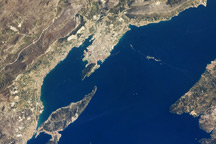
This astronaut photo from April 9, 2009, shows the Dalmatian coastline of the Adriatic Sea around Split, Croatia.
Published May 4, 2009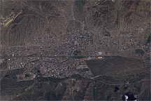
Mongolia’s capital city of Ulaanbaatar occupies a valley along the Tuul River. Roughly 1,350 meters above sea level, and over 47 degrees north of the Equator, the city rests atop a sporadic permafrost zone, and ranks among the world’s coldest national capitals.
Published Aug 18, 2009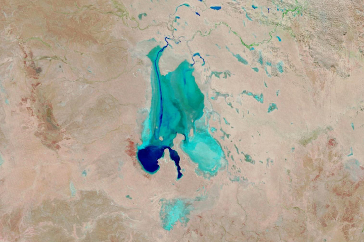
Floodwaters have worked their way through a series of parched channels, watering holes, and lagoons to start filling the iconic Australian lake.
Published May 28, 2019
Acquired in late October and mid-November 2011, these images document the slow withdrawal of flooding from the historic city of Ayutthaya, Thailand.
Published Nov 16, 2011
Acquired September 18, 2010, this natural-color image shows extensive flooding along the northeastern margin of Manchhar Lake in Pakistan.
Published Sep 23, 2010
alert message
