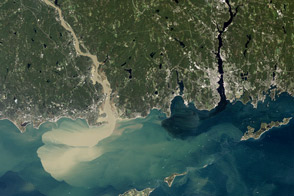
Nearly a week after Hurricane Irene drenched New England, the river was spewing large amounts of muddy sediment into Long Island Sound.
Published Sep 9, 2011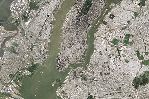
In the wake of Hurricane Irene’s heavy rains, sediment filled the Hudson River and New York Harbor.
Published Sep 2, 2011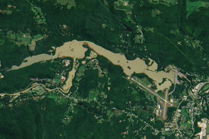
An aerial photo from July 6, 2009, and a satellite image from August 29, 2011, show the North Springfield Reservoir before and after Irene’s heavy rains.
Published Sep 1, 2011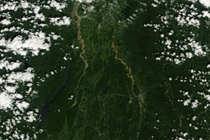
Swollen, muddy rivers run across Vermont in this image from August 30, 2011.
Published Aug 31, 2011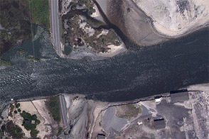
Acquired August 28, 2011, this aerial photo shows damage to Highway 12 on North Carolina’s Outer Banks. Highway breaches stranded at least 2,500 residents of Hatteras Island.
Published Aug 30, 2011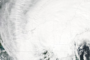
Acquired August 28, 2011, this natural-color image shows Irene over the U.S. Northeast.
Published Aug 30, 2011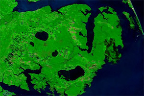
Acquired August 28, 2011, and August 16, 2011, these false-color images compare conditions in North Carolina before and after Hurricane Irene flooded parts of the state.
Published Aug 30, 2011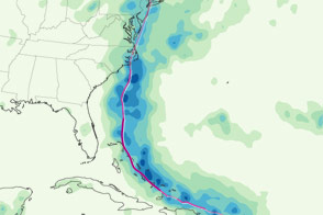
This color-coded map shows the storm track and rainfall totals associated with Hurricane Irene from August 22 to 28, 2011.
Published Aug 30, 2011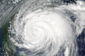
Hurricane Irene extends from central Florida to North Carolina in this image taken at 2:05 Eastern Daylight Time on August 26, 2011.
Published Aug 29, 2011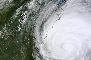
Hurricane Irene swirls off the East Coast of the United States in this image from August 26, 2011.
Published Aug 29, 2011
This series of images provide a 3D map of rainfall inside Hurricane Irene as the storm developed between August 21 and August 24, 2011.
Published Aug 29, 2011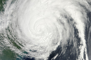
Acquired at 11:35 a.m. EDT on August 27, 2011, this natural-color image shows Hurricane Irene spanning hundreds of kilometers of the U.S. East Coast.
Published Aug 29, 2011
Irene, the first hurricane of the 2011 Atlantic season, was poised on August 26 to be the first to make land-fall in tU.S. since 2008. More than 50 million people were estimated to lie within the path of the storm.
Published Aug 27, 2011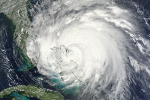
Large and dangerous, Hurricane Irene spans nearly 1,000 kilometers (600 miles) in this photo-like satellite image from August 25.
Published Aug 26, 2011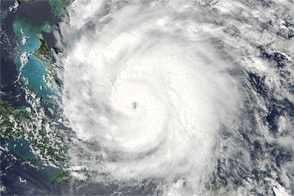
Acquired at 2:15 p.m. EDT on August 24, 2011, this natural-color image shows Hurricane Irene over the Caribbean, en route to the continental United States.
Published Aug 25, 2011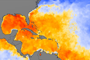
Plenty of warm-water fuel waits in the Atlantic Basin for Hurricane Irene and other tropical storms to build themselves up in August 2011.
Published Aug 25, 2011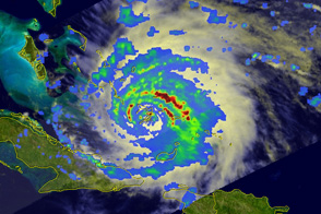
This view of rain inside Hurricane Irene reveals a strong, mature storm with circular bands of heavy rain on August 24, 2011.
Published Aug 24, 2011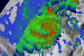
Though no eye was apparent in visible satellite images, patterns of rainfall reveal a fully developed eye at the center of Hurricane Irene on August 23.
Published Aug 24, 2011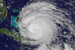
Category 3 Hurricane Irene has a distinct eye in this image taken just before 3 p.m. EDT on August 24, 2011.
Published Aug 24, 2011
Acquired August 22, 2011, this natural-color image shows Hurricane Irene over Puerto Rico and eastern Hispaniola, potentially en route to the continental United States.
Published Aug 23, 2011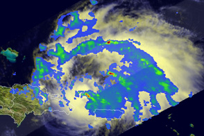
This view inside Hurricane Irene reveals a small area of heavy rain concentrated in a towering cloud, a sign that the storm is probably strengthening.
Published Aug 22, 2011alert message
