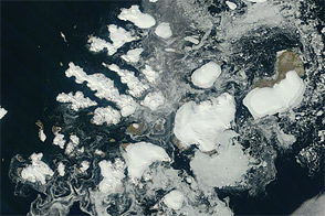
Acquired August 17, 2011, this natural-color image shows Franz Josef Land, a 191-island archipelago in the northeastern Barents Sea.
Published Aug 28, 2011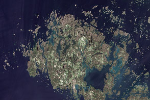
This summertime, natural-color image shows the Åland Islands between Sweden and Finland.
Published Sep 20, 2011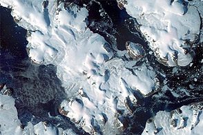
This late summertime shot captures sea ice and land ice in Russia’s northernmost territory.
Published Jan 7, 2012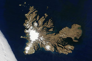
Penguins, seals, and scientists are among the residents of a remote archipelago in the southern Indian Ocean.
Published Dec 28, 2016
Unlike the vegetated tundra of its neighboring islands, Bunge Land is a barren sandy plain that also serves as a land bridge.
Published Oct 5, 2020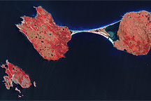
The last remnant of France’s once-vast holdings in North America, an island archipelago off the coast of Newfoundland bears the scars of a complicated geologic history. Altogether, the archipelago covers just 242 square kilometers (93 square miles), and the three biggest islands lend the entire island chain its name: Saint Pierre and Miquelon.
Published Oct 3, 2010
Myths about these Australian islands seem to provide an ancient explanation for sea level rise.
Published Dec 27, 2019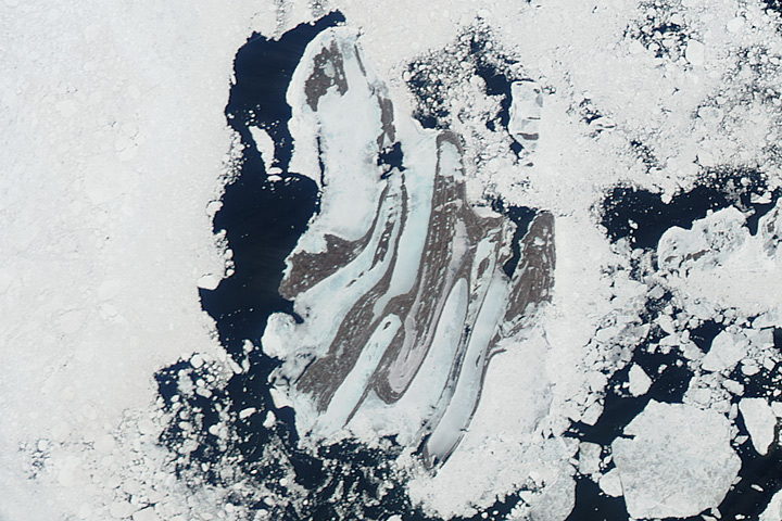
Hunters in the Belcher Islands keep a close eye on changing sea ice.
Published Jun 6, 2017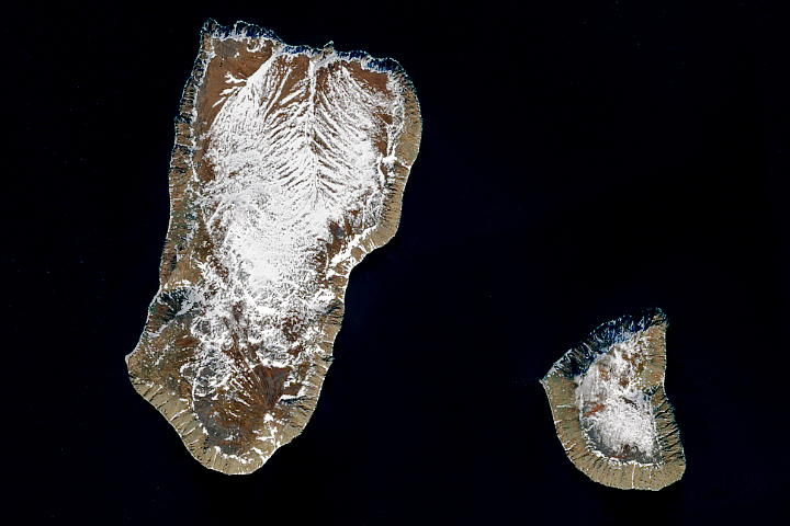
Which country is closest to the United States without sharing a land border?
Published Jan 27, 2018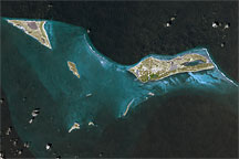
This approximately true-color image shows part of the Turks and Caicos Islands archipelago, observed September 18, 2001.
Published Apr 17, 2009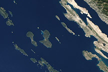
Acquired October 2, 2002, this natural-color image shows islands off the coast of Croatia, in the Adriatic Sea.
Published Apr 17, 2011
Bright white waves break along the fringing beaches of the Savage Islands in these astronaut photos from October 22, 2009.
Published Nov 23, 2009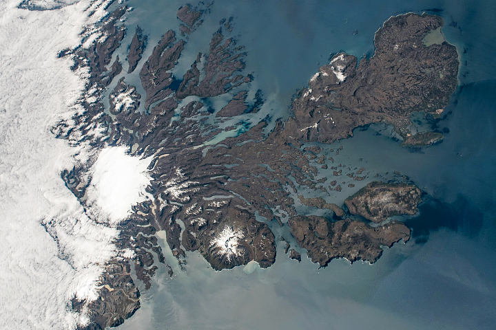
They are geographically isolated but scientifically and visually compelling.
Published Mar 22, 2020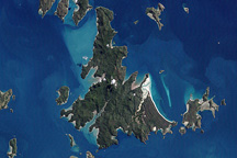
The Whitsunday Islands are a collection of some 74 islands sandwiched between the Australian mainland and the outer atolls of the Great Barrier Reef.
Published Jan 2, 2010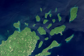
Lighthouses and sandstone formations draw visitors to the shores of Lake Superior.
Published Aug 28, 2016
Lakshadweep’s coral atolls glow iridescent blue-green in this natural-color scene from February 2012.
Published Apr 15, 2012