The MODIS instrument on NASA’s Aqua satellite captured this clear view of the Antarctic Peninsula, the Larsen Ice Shelf, and the sea ice covered waters around the region in October 2011.
Published Oct 15, 2011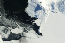
Spanning nearly a decade, this series of true-color images shows how sea ice has changed in Antarctica’s McMurdo Sound between 2002 and 2011.
Published Mar 10, 2011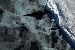
A spectacular view of sea ice was captured during an Operation IceBridge flight in 2014; the mission surveyed ice at both poles again in 2015, this time simultaneously.
Published Oct 4, 2015
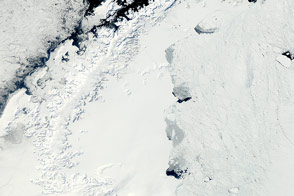
In some places where ice should cover the sea, open water appears instead.
Published Nov 22, 2011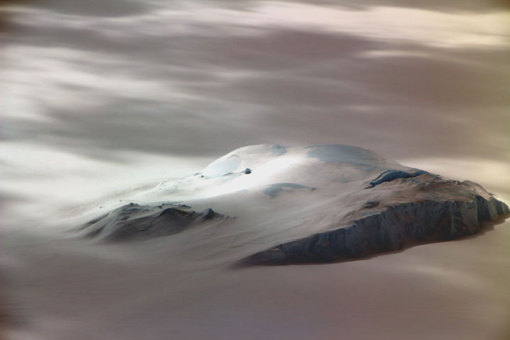
Hundreds of scientific papers have come out of NASA’s Operation IceBridge, which ended this week.
Published Nov 23, 2019
This map shows sea ice extent around Antarctica on September 22, 2013, when ice covered more of the Southern Ocean than at any other time in the satellite record.
Published Oct 1, 2013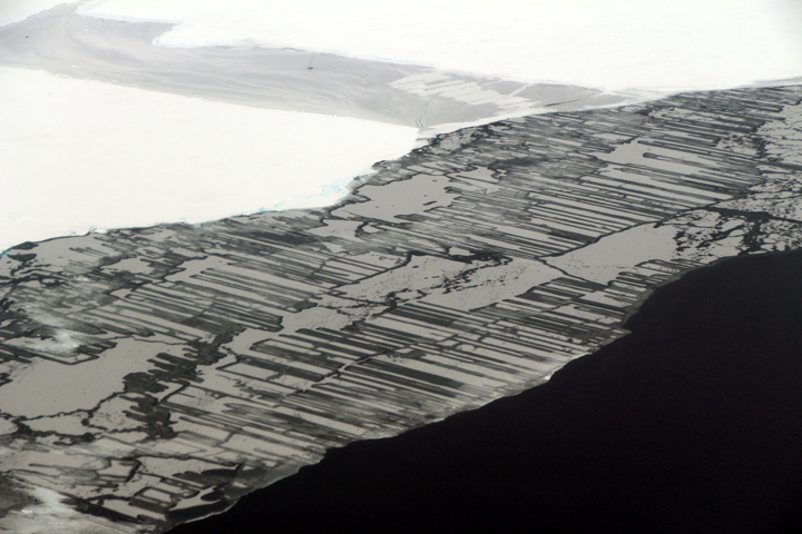
As a result of the collision, blocks of ice slide above and below each other in a pattern that resembles a zipper or interlocking fingers.
Published Nov 22, 2017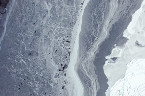
Sea ice in the Amundsen Sea was among the first images acquired by the airborne campaign designed to study Earth's polar ice.
Published Oct 16, 2014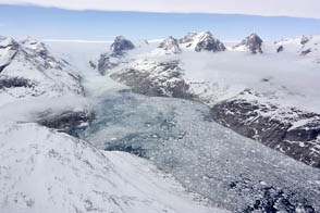
NASA aircraft return to the Arctic to assess the health of the region’s ice.
Published May 3, 2012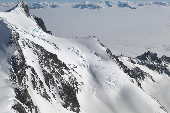
Approaching the icy continent by aircraft, the vast expanse of water and ice is suddenly broken by gray and brown rocky mountaintops
Published Dec 28, 2017
New elevation measurements will give researchers an unprecedented understanding of the thickness of sea ice, which will be used to help improve climate modeling and forecasts.
Published Dec 18, 2018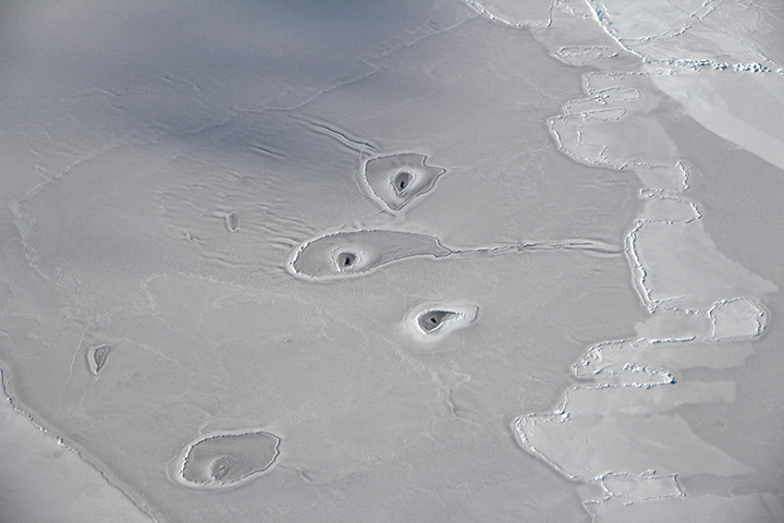
Scientists pose an array of explanations for the strange circular features visible on sea ice in the eastern Beaufort Sea.
Published Apr 21, 2018
Researchers working in Antarctica have found evidence of large-scale ice making at the bottom of that continent's massive ice sheets.
Published Apr 21, 2011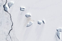
A guano stain betrays the location of an emperor penguin colony on Antarctic ice in this Landsat image from December 4, 2002.
Published Jun 5, 2009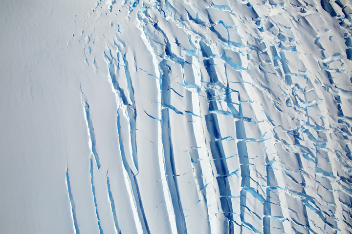
Ice moves slowly, and fractures are often the only perceptible indication of movement.
Published Jan 20, 2018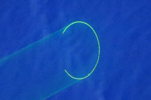
In twilight conditions, green lasers that measure polar ice are easily visible with the naked eye.
Published Apr 5, 2015
As the Arctic experienced a new record summer minimum for ice extent, the Antarctic set a new record for maximum winter sea ice.
Published Oct 11, 2012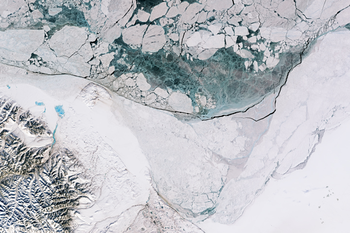
Springtime sunlight and warmth advanced the melting of sea ice to produce some beautiful patterns and textures in the Beaufort Sea.
Published Apr 30, 2018
On February 24, 2008—late summer in the Southern Hemisphere—the Moderate Resolution Imaging Spectroradiometer (MODIS) on NASA’s Aqua satellite captured this image of lingering sea ice in the Southern Ocean.
Published Feb 28, 2008
The 2014 arctic sea ice minimum is the sixth lowest on record, while antarctic sea ice continues to exceed the record maximum extent.
Published Sep 24, 2014
One of NASA’s workhorse planes, the DC-8, is being used this month to provide critical insight on the health of the ice sheets and shelves at the southern tip of the world.
Published Nov 16, 2010