On March 11, 2011, a magnitude 8.9 earthquake struck off the east coast of Honshu, Japan, about 130 kilometers (80 miles) east of Sendai. If the initial estimate is confirmed, it will be the fifth largest earthquake in recorded history.
Published Mar 12, 2011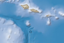
A large (magnitude 8.0) undersea earthquake near Samoa generated a destructive tsunami that killed over 100 people.
Published Oct 1, 2009
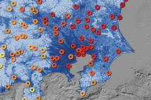
This map shows the ground motion and shaking intensity from the March 11, 2011, earthquake at dozens of locations across Japan.
Published Mar 19, 2011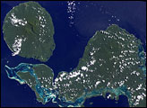
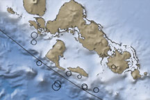
The contrast in ocean depths between the Australia Plate and the Pacific Plate near the Solomon islands reveals the subduction of the former beneath its northeastern neighbor. This subduction was responsible for the 7.2-magnitude quake on January 4, 2010.
Published Jan 5, 2010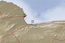
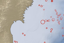
A strong earthquake struck off the Venezuelan coast on September 12, 2009.
Published Sep 15, 2009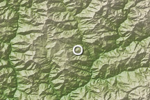
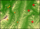
A deadly magnitude 6.1 earthquake struck Bhutan on September 21, 2009.
Published Sep 21, 2009