The Soberanes Fire has been burning for 11 days and may continue for weeks.
Published Aug 2, 2016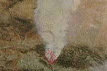
Acquired on the afternoon August 29, 2009, this image shows fires burning north of the city of Los Angeles. Hotspots associated with the fire correspond with the Station and Morris fires described by the California Department of Forestry and Fire Protection.
Published Aug 30, 2009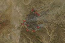
This image pair shows two large fires burning in the mountains of northern Mexico on April 3, 2011.
Published Apr 4, 2011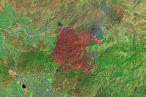
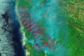
False-color images reveal the hot spots and charred land left behind by the fire.
Published Jul 25, 2016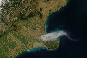
In mid-February 2017, wildfires near Christchurch, New Zealand, spurred the evacuation of more than 1,000 residents.
Published Feb 18, 2017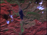
Satellite images show the extent of a destructive fire that burned thousands of homes in the picturesque seaside city.
Published May 7, 2014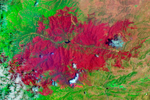
The EO-1 satellite observed the burn scar from the Little Bear Fire.
Published Jun 14, 2012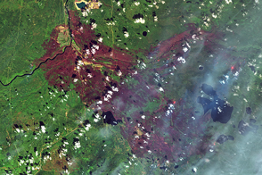
The fire in Alberta, Canada, had burned 2,410 square kilometers of land by May 12, 2016.
Published May 16, 2016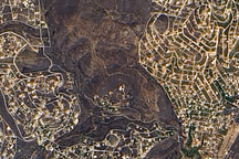
Charred plants color the hills northeast of Athens, Greece, chocolate brown in this photo-like image taken days after a large fire raced through the region.
Published Aug 29, 2009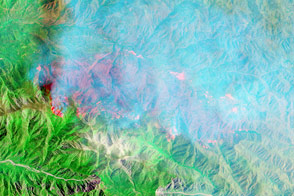
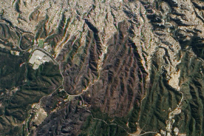
California’s Lake fire spread across a part of the national forest that rarely burns.
Published Jun 23, 2015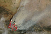
Acquired August 30, 2009, this true-color image shows hotspots and smoke associated with the Station Fire in Los Angeles County. The hotspots remain west of Mt. Wilson, the site of critical communication centers.
Published Sep 1, 2009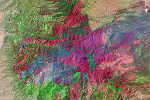
The Whitewater-Baldy Fire is the largest on record in New Mexico.
Published Jun 14, 2012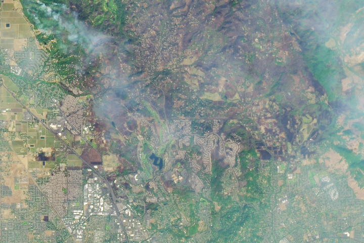
In the past week, 21 wildfires have ignited in communities north and east of San Francisco Bay, consuming at least 170,000 acres.
Published Oct 12, 2017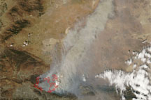
Acquired August 31, 2009, this true-color image shows the spreading Station Fire north of Los Angeles. Hotspots from the fire almost reach Mt. Wilson Observatory.
Published Aug 31, 2009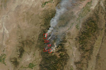
The false-color image in this true- and false-color image pair shows the extent of the large Twitchell Canyon Fire burning in the mountains of central Utah on September 21, 2010.
Published Sep 22, 2010