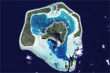
Low-profile fringing islands and coral reefs surround a relatively tall central island.
Published Nov 22, 2009

Named Isla de Aves in Spanish, (meaning “Island of the Birds”) Aves Island lies west of the Lesser Antilles in the Caribbean. It provides a nesting site to green sea turtles (Chelonia mydas) and, of course, birds. Because the abundant bird droppings, known as guano, could be used in fertilizer and gunpowder, guano miners worked on the island until they depleted the supply. Since its discovery by Europeans, likely in the late 16th century, Aves Island was subsequently claimed by several European nations. The island is currently claimed by Venezuela, although disputes about ownership of the island, and the surrounding exclusive economic zone in the Caribbean, continue today.
Published Jun 19, 2006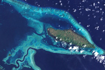
Scattered like turquoise and emeralds across the dark blue waters of the Coral and Solomon Seas, the coral reefs and forested islands of the Louisiade Archipelago stretch southeastward from the tip of Papua New Guinea for over 350 kilometers.
Published Jan 2, 2009

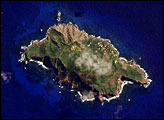
The most interesting geology lies just offshore and below the water line of this Northwest Australian island.
Published Aug 3, 2015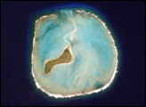

The ghostly white shapes northeast and immediately southwest of Wrangel Island are sea ice. Over the course of the satellite record, Arctic sea ice has advanced and retreated past Wrangel Island many times. From 1979 to 2000, the sea ice edge at the end of summer generally fell somewhere in the vicinity of Wrangel Island, but this is not the first summer when the sea ice edge has retreated well north of the island.
Published Aug 29, 2008
In the western Pacific Ocean, a new volcanic island that formed in the shadow of Nishino-shima has merged with it. The island has doubled in size as the eruption continues.
Published Apr 4, 2014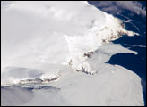
Bouvet Island is known as the most remote island in the world; Antarctica, over 1600 kilometers (994 miles) to the south, is the nearest land mass. Located near the junction between the South American, African, and Antarctic tectonic plates, the island is mostly formed from a shield volcano—a broad, gently sloping cone formed by thin, fluid lavas—that is almost entirely covered by glaciers.
Published Oct 6, 2008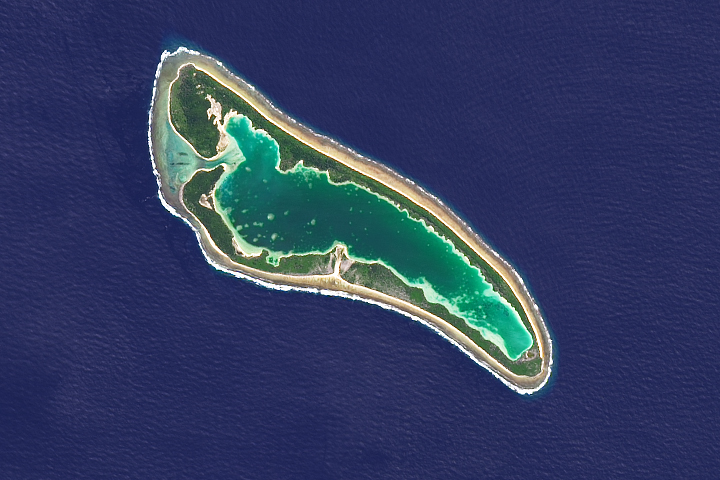
It is one of the most famous patches of coral outside of the Great Barrier Reef.
Published Mar 26, 2018
On September 25, 2002, astronauts aboard the International Space Station viewed Easter Island, one of the most remote locations on Earth. Easter Island is more than 2000 miles from the closest populations on Tahiti and Chile—even more remote than astronauts orbiting at 210 nautical miles above the Earth. Archaeologists believe the island was discovered and colonized by Polynesians at about 400 AD. Subsequently, a unique culture developed. The human population grew to levels that could not be sustained by the island. A civil war resulted, and the island’s deforestation and ecosystem collapse was nearly complete.
Published Oct 6, 2002