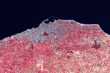
Deserts cover Libya’s interior, but cities such as Tripoli have expanded along the fertile lowlands of the country’s coast.
Published Nov 9, 2008
Although it is now the largest desert on Earth, during the last ice age the Sahara was a savannah with a climate similar to that of present-day Kenya and Tanzania. The annual rainfall was much greater than it is now, creating many rivers and lakes that are now hidden under shifting sands or exposed as barren salt flats. Over several hundred thousand years, the rains also filled a series of vast underground aquifers. Modern African nations are now mining this fossil water to support irrigated farming projects.
Published Mar 2, 2002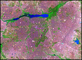
In western Africa, just south of the Sahara Desert, lies the landlocked nation of Burkina Faso. The nation experienced a 200 percent increase in urban population between 1975 and 2000. Much of that growth occurred in the capital city of Ouagadougou: Between 1960 and 1993, Ouagadougou experienced a 14-fold increase in area.
Published Jun 29, 2008
One example of increasing aridity in Mali appears in Lake Faguibine. Starting in the late 1980s, a drop in precipitation steadily dried the lake. Even though normal rainfall resumed after the year 2000, the lake remained nearly dry.
Published Aug 10, 2008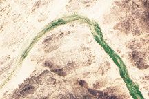
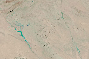
These true-color images show a wadi in northern Niger on September 19, 2007, and September 18, 2009. The 2007 shows the wadi populated by plants that have taken advantage of recent precipitation.
Published Nov 8, 2009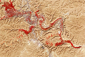
Rising out of parched surroundings, the M’zab Valley is filled with palm groves and dotted with centuries-old settlements.
Published Jul 10, 2011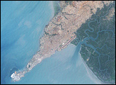
Acquired October 3, 2011, and September 19, 2011, these false-color images compare conditions in northern Algeria, which experienced severe flooding in early October.
Published Oct 6, 2011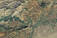
Acquired December 17, 2010, this natural-color image shows hills, rivers, and cultivated fields in northwestern Algeria.
Published Jan 16, 2011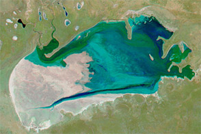
Acquired at the end of July in 2009, 2010, 2011, and 2012, these false-color images show changing conditions in Namibia’s Etosha Pan.
Published Sep 2, 2012