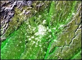
Located on the Meseta Central, a vast plateau covering about 40 percent of the country, this city of 3 million is very near the exact geographic center of the Iberian Peninsula.
Published Dec 17, 2002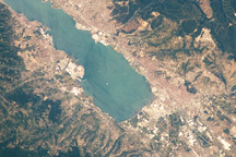
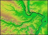
Taken on July 31, 2010, this astronaut photograph shows an industrialized area of Turkey at the eastern edge of the Sea of Marmara.
Published Aug 23, 2010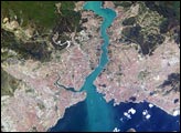
This metropolis of 15 million people occupies both sides of the entrance to the narrow, 20-mile long Bosporus Strait connecting the Mediterranean and Sea of Marmara (south) to the Black Sea (north). From its founding as Byzantium by the Greeks in 600 B.C., this strategically located city has been a focus of maritime trade and commerce as well as an outpost and threshold for cultural exchange and conflict between Europe and Asia. This digital camera image was taken by the crew of the International Space Station on April 16, 2004. When this image was taken, strong currents carried turbid coastal waters from the Black Sea through the Strait and into the Sea of Marmara.
Published May 10, 2004
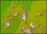
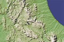
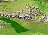
This image of central Italy shows the rugged topography in the vicinity of L’Aquila, where a magnitude 6.3 earthquake struck on April 6, 2009.
Published Apr 7, 2009