

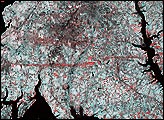
This pair of images from the Multi-angle Imaging Spectroradiometer (MISR) shows the strip of flattened and possibly denuded vegetation left by the F4 tornado (winds from 207 to 260 miles per hour, causing “devastating damage”) that struck La Plata, Maryland on April 28, 2002.
Published May 8, 2002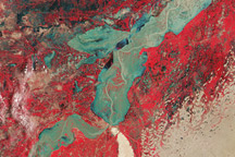
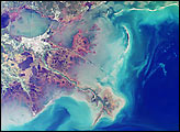
These false-color image show flooding in the Sindh Province of Pakistan on August 11, 2010.
Published Aug 18, 2010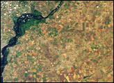
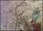
Southern Russia produces roughly 40 percent of the country’s total agricultural output, and Saratov Oblast is the largest producer of grain in the Volga region. Vegetation changes in the province’s agricultural lands between spring and summer are apparent in these images acquired on May 31 and July 18, 2002 (upper and lower image panels, respectively) by the Multi-angle Imaging SpectroRadiometer (MISR).
Published Aug 1, 2002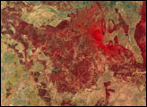
alert message
