This distant, lonely volcanic rock brings new meaning to the phrase “the middle of nowhere.”
Published Dec 19, 2015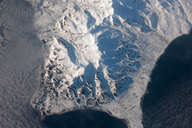
This astronaut photograph shows the southern end of Paramushir Island after a snowfall. Four volcanic centers are brightly lit on their western slopes and deeply shadowed to the east.
Published Jul 12, 2010
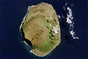
Bouvet Island is known as the most remote island in the world; Antarctica, over 1600 kilometers (994 miles) to the south, is the nearest land mass. Located near the junction between the South American, African, and Antarctic tectonic plates, the island is mostly formed from a shield volcano—a broad, gently sloping cone formed by thin, fluid lavas—that is almost entirely covered by glaciers.
Published Oct 6, 2008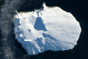
Bouvet Island, a territory of Norway, is one of the most remote islands in the world.
Published Feb 26, 2014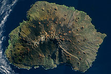
Acquired on on May 5, 2009, this true-color image shows Marion Island in the Indian Ocean. Sparsely vegetated, this volcanic island has remnants of snow near its summit.
Published Oct 18, 2009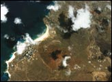

In the western Pacific Ocean, a new volcanic island that formed in the shadow of Nishino-shima has merged with it. The island has doubled in size as the eruption continues.
Published Apr 4, 2014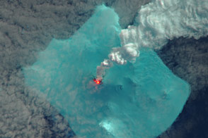
A volcano in the far South Atlantic appears to be erupting for the first time in 60 years.
Published May 10, 2016Image of the Day Heat Land Water Volcanoes Snow and Ice Remote Sensing
Nishinoshima has grown to twelve times its original size.
Published Nov 29, 2015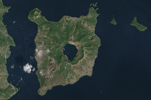
A long history of eruptions from Taal volcano has helped shape the southern end of the Philippine island of Luzon.
Published Apr 9, 2015
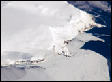
Deception Island is one of the only places in the world where ships can sail directly into the center of an active volcano.
Published Jan 18, 2020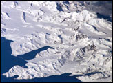
There is no permanent human base on South Georgia Island, a British territory in the South Atlantic Ocean that lies 1,300 kilometers east of the Falkland Islands. The crew of the International Space Station captured this image of the rugged and isolated landscape of the northern shore of the island. The first recorded explorer to land on the island was Captain James Cook aboard the HMS Resolution in 1775. He mapped part of the coastline, but was discouraged by the thick ice cover, lack of vegetation, and steep mountains. Mt. Paget, the highest peak, rises to 2,934 meters (9,625 feet) above sea level, and the island supports 161 glaciers. Cook named the southernmost point of the island “Cape Disappointment” when he realized he had not reached Antarctica.
Published Oct 17, 2005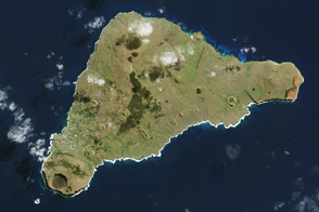
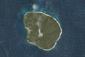
The island once looked very different from how it does today.
Published Apr 16, 2017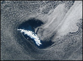

This natural-color image shows Henrietta Island, with a smooth, dome-capped surface and a rugged coastline, illuminated by low-angled sunlight.
Published May 3, 2009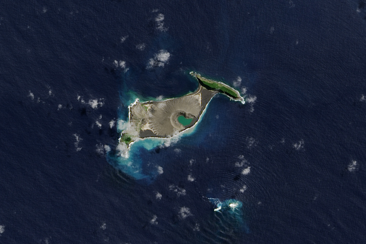
Hunga Tonga-Hunga Ha'apai is likely to persist for years, maybe decades.
Published Dec 11, 2017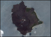

On September 25, 2002, astronauts aboard the International Space Station viewed Easter Island, one of the most remote locations on Earth. Easter Island is more than 2000 miles from the closest populations on Tahiti and Chile—even more remote than astronauts orbiting at 210 nautical miles above the Earth. Archaeologists believe the island was discovered and colonized by Polynesians at about 400 AD. Subsequently, a unique culture developed. The human population grew to levels that could not be sustained by the island. A civil war resulted, and the island’s deforestation and ecosystem collapse was nearly complete.
Published Oct 6, 2002alert message
