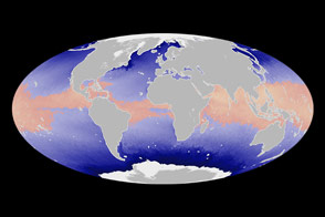
Satellite measurements of sea surface temperatures provide clues to the potential for tropical cyclone development.
Published Jun 4, 2014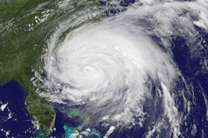
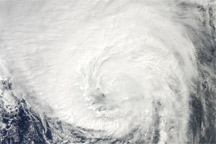
Irene, the first hurricane of the 2011 Atlantic season, was poised on August 26 to be the first to make land-fall in tU.S. since 2008. More than 50 million people were estimated to lie within the path of the storm.
Published Aug 27, 2011
Acquired August 29, 2010, this natural-color image shows Hurricane Danielle over the Atlantic Ocean.
Published Aug 30, 2010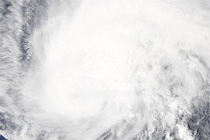
Acquired September 2, 2011, this natural-color image shows Hurricane Katia west of the Leeward Islands.
Published Sep 2, 2011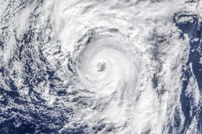
Alex is the earliest hurricane in the North Atlantic since 1938, and one of the farthest northeast on record.
Published Jan 15, 2016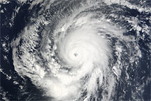
Acquired at 12:55 UTC on September 9, 2009, this true-color image shows Hurricane Fred, hundreds of kilometers across, hovering over the eastern Atlantic Ocean.
Published Sep 9, 2009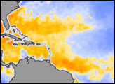
In early August, forecasters at the National Oceanic and Atmospheric Administration (NOAA) revised downward slightly their early-season predictions of the 2006 Atlantic hurricane season.
Published Aug 16, 2006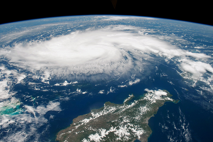
Heading into Labor Day weekend, citizens and government officials braced for a potent hurricane that has been intensifying in the tropical Atlantic Ocean.
Published Aug 30, 2019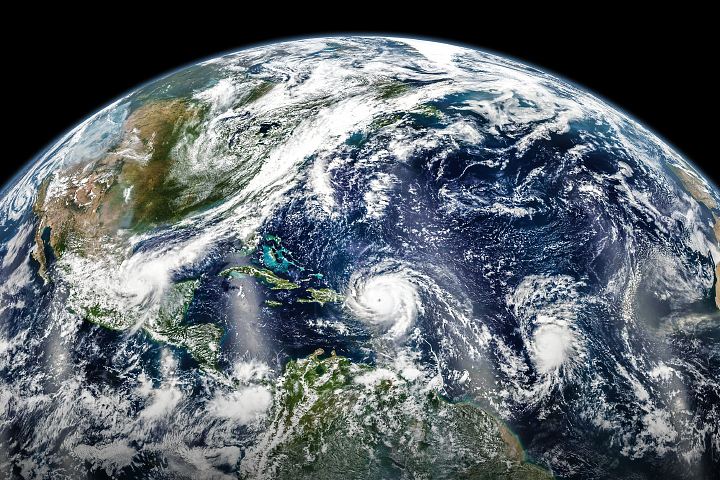
In early September 2017, hurricanes Katia, Irma, and Jose lined up across the Atlantic basin.
Published Sep 7, 2017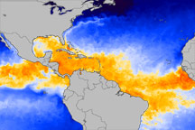
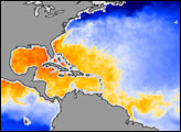
This color-coded image from June 1, 2010, shows which equatorial ocean waters are warm enough to promote hurricane formation.
Published Jun 3, 2010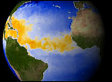

alert message
