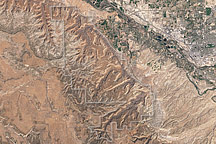
Acquired April 2, 2002, this natural-color image shows Colorado National Monument and nearby agricultural and residential areas.
Published Mar 6, 2011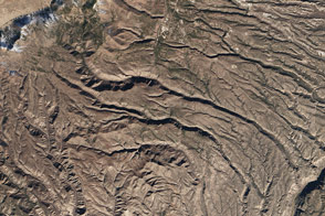
The rugged canyons slicing through plateaus in New Mexico’s Bandelier National Monument contain relics from human civilization that date back 11,000 years.
Published Feb 10, 2016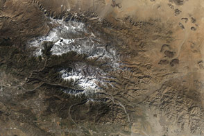
Three new national monuments in Southern California connect with existing protected areas to form the world’s second-largest desert preserve.
Published Mar 13, 2016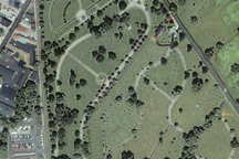
Soldiers’ National Cemetery, where U.S. President Abraham Lincoln delivered the “Gettysburg Address” in November 1863, appears in this Ikonos satellite image from June 25, 2003.
Published Feb 12, 2009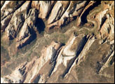
Located in southwestern Utah along the western margin of the Colorado Plateau, the park was established in 1919 after roadway improvements allowed access to the Mukuntuweap National Monument.
Published May 26, 2008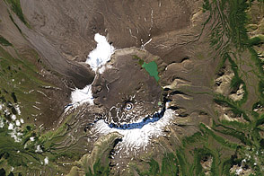
Acquired September 15, 2000, this natural-color image shows Aniakchak National Monument in Alaska, home to an old caldera, and even older fossils.
Published Oct 12, 2011
Acquired June 24, 2007, this natural-color image shows the eastern half of St. John Island in the U.S. Virgin Islands. The area pictured incorporates a national park and national monument.
Published Jan 20, 2011
Tall, branch-like cacti provide shelter for animals at the Organ Pipe Cactus National Monument.
Published Dec 4, 2016
The landscape is a recently formed set of basaltic lava flows that creates a foreboding landscape of sharp obsidian, cinder and spatter cones, twisted rivers of solidified rock, pit craters, and a network of caves from lava tubes.
Published Oct 16, 2005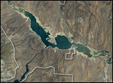
The most striking feature is Roosevelt Lake, an artificial lake created by the construction of Roosevelt Dam across the Salt River. The National Monument is surrounded by the Tonto National Forest, which includes low plains, desert scrubland, and alpine pine forests.
Published Sep 4, 2005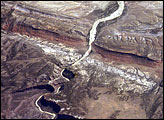
In the northwest corner of Colorado, the west-flowing Yampa River meets the south-flowing Green River, which runs into Utah. Stretches of both river canyons upstream and downstream from the junction make up Dinosaur National Monument. The monument takes its name, of course, from the abundant fossils found in exposed valleys and low ridges of the Morrison Formation, a series of rock layers that were formed late in the Jurassic Period, roughly 145 million years ago.
Published Oct 1, 2007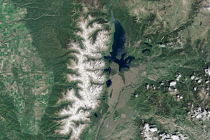
A long, active geologic history sculpted the surface features visible today in the Teton mountain range and Jackson Hole valley.
Published Apr 10, 2016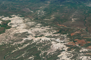
Over epochs, deposition and erosion have carved sharp spires and deep canyons out of this South Dakota landscape.
Published Aug 27, 2016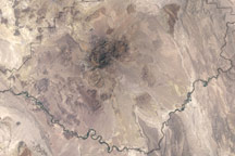
Acquired on May 10, 2002, this natural-color image shows the varied landscapes of Big Bend National Park in southwestern Texas.
Published Jul 18, 2010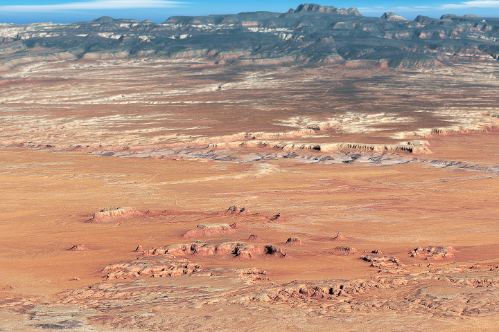
A satellite a view of Monument Valley Navajo Tribal Park, the quintessential picture of the American West.
Published Jun 7, 2018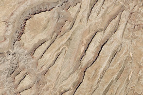
Sinking blocks of rock created this distinctive network of valleys.
Published Jun 6, 2014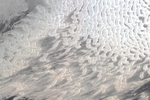
Captured on June 27, 2009, this true-color image shows part of the White Sands National Monument in New Mexico, where brilliant white gypsum dunes slowly migrate toward the northeast.
Published Jul 12, 2009alert message
