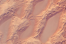
This astronaut photograph shows classic large and small sand masses of the central Sahara Desert, where wind is a more powerful land-shaping agent than water.
Published Jan 19, 2009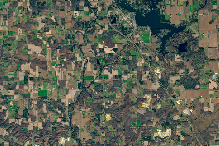
A fracking-fueled demand for round and durable sand has triggered a mining boom in the western part of the state.
Published Mar 14, 2018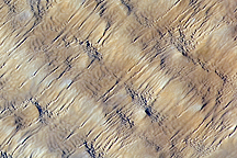
Layers of dunes march across a sand sea in the east-central Tenéré Desert of Niger in this astronaut photo from December 1, 2009.
Published Dec 28, 2009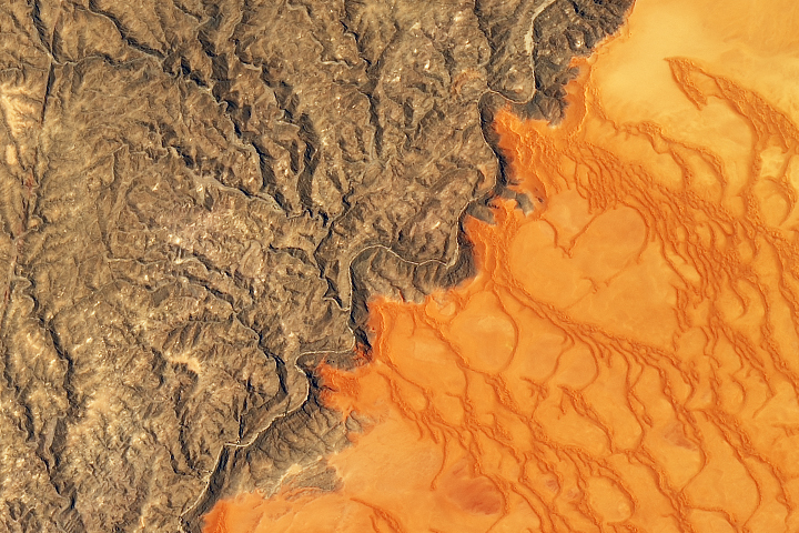
Namibia’s sea of sand is bounded on its northern side by the impermanent Kuiseb River.
Published Jan 2, 2020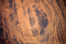
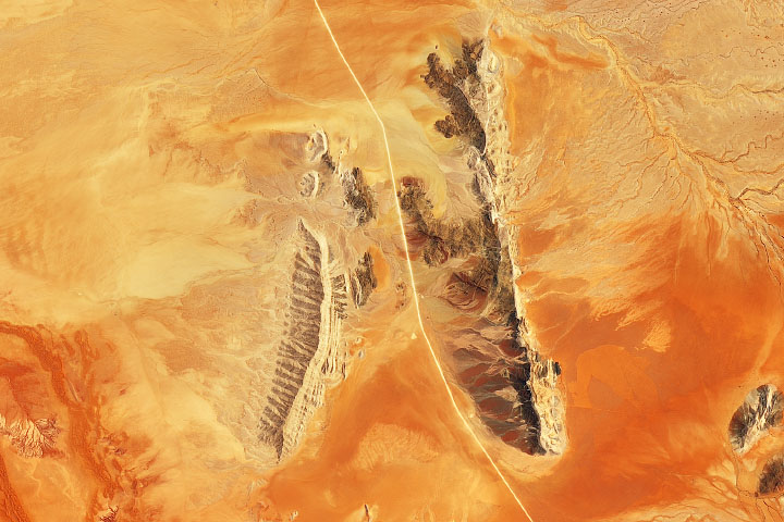
Taken July 25, 2009, this astronaut photograph shows the concentric rings of Aorounga Impact Crater in north-central Chad.
Published Aug 10, 2009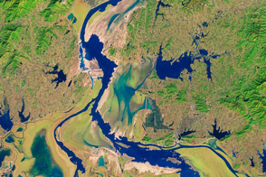
Intensive sand mining has dramatically changed the northern branch of China’s largest freshwater lake.
Published Mar 18, 2016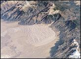
The Sangre de Cristo Mountains of south-central Colorado stretch dramatically from top left to lower right of this astronaut photograph. The mountains are outlined by dark green forests at lower elevations and white, snow-capped peaks at the highest elevations. Dun-colored dunes are banked up on the west side of the mountains. These dunes make up the Great Sand Dunes National Park and Preserve.
Published Jan 21, 2008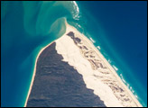
Fraser Island, the world’s largest sand island, is located along the coastline of Queensland, Australia, and it includes Great Sandy National Park. The island was designated a World Heritage site in 1992, in part due to its outstanding preservation of geological processes related to sand dune formation.
Published Oct 13, 2008
Sand dunes and outcrops add color and dimension across the Namib Sand Sea.
Published Jan 13, 2020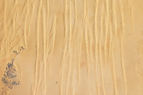
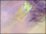
Winds shape the sands that were left behind by an ancient river.
Published Jun 4, 2012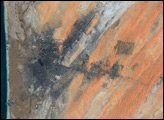
alert message
