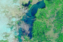
Acquired August 29, 2010, and July 31, 2010, these false-color images show changes in the Indus River Valley near the Pakistani coast during the 2010 monsoon season.
Published Aug 30, 2010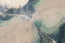
The muddy, swollen Indus River surges past an irrigation structure in southern Pakistan in this Landsat image from August 12, 2010.
Published Aug 19, 2010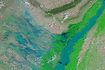
In August 2010, entire villages were washed away, more than 1,100 people died, and an estimated 2.5 million people were affected by dramatic monsoon rains.
Published Aug 3, 2010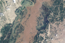
Acquired August 21, 2010, this natural-color image shows the Chenab River, near the city of Multan, Pakistan, in flood.
Published Aug 31, 2010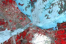
Floods surround the Pakistani city of Sukkur in this false-color image from August 18, 2010.
Published Aug 20, 2010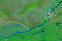
These false-color images show part of the Jhelum River, southwest of the city of Swabi, shortly before and after the floods that struck the region on August 16, 2009. The earlier image was acquired August 13, and the later image was acquired August 18. The later image shows a swollen river and conspicuous tributary not visible in the earlier shot.
Published Aug 19, 2009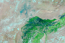
Acquired on July 30, 2010 (top), and June 5, 2010 (bottom), these images show flooding along the Indus River in Pakistan.
Published Jul 30, 2010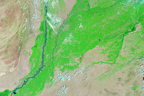
In the summer of 2013, monsoon-driven rains triggered flooding along the Indus River.
Published Sep 6, 2013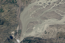
Acquired August 5, 2010, this natural-color image shows the area where the Kabul and Indus Rivers meet.
Published Aug 6, 2010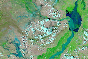
An intense monsoon storm brought widespread flooding to Pakistan.
Published Aug 6, 2013alert message
