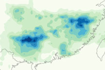
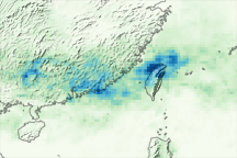
This color-coded image shows rainfall amounts from June 15–21, 2010. Pockets of very heavy rain occur roughly 250 kilometers inland, near Taiwan and the Vietnam border.
Published Jul 2, 2010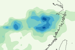
This color-coded image shows rainfall amounts over southern China from June 3 to 9, 2011, when heavy rain inundated multiple provinces.
Published Jun 13, 2011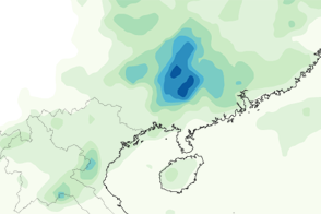
This color-coded map shows rainfall amounts in and around southern China May 10–16, 2012.
Published May 17, 2012
Patterns running from pale green to deep blue are draped over southern China, showing rainfall totals for the week of June 4 through June 11, 2007. Though seasonal rains are not unexpected in the area, the rain that fell during the week was torrential and relentless. As the image shows, a broad stretch of China received up to 200 millimeters of rain, and some areas were inundated with up to 500 millimeters.
Published Jun 14, 2007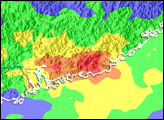
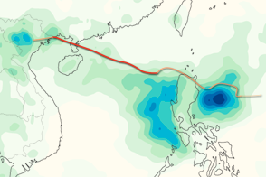
This color-coded image shows rainfall totals and the storm track for Typhoon Kai-tak in August 2012.
Published Aug 20, 2012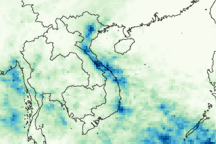
Torrential rains brought the worst floods in decades to northern and central Vietnam in early November 2008.
Published Nov 3, 2008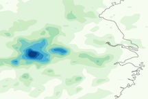
Heavy rain around Shanghai from July 15 to 21, 2010, exacerbated ongoing flooding and landslides.
Published Jul 22, 2010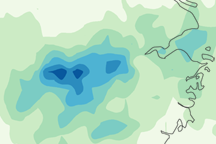
This color-coded image shows precipitation amounts in the vicinity of Shanghai, Taiwan, and the East China Sea from May 19 to 25, 2010. Heaviest rain is blue and lightest rain is pale green.
Published May 28, 2010alert message
