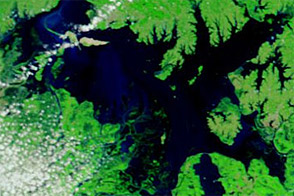

Days of torrential rain caused widespread flooding in southern China in May 2012. Heavy rain fell from May 8 to 16, 2012, the Flood Observatory reported. The International Business Times reported that more than 5 million people in more than 10 provinces had been affected by the downpours. As of May 14, authorities had evacuated nearly 200,000 residents.
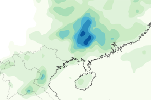
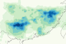
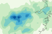
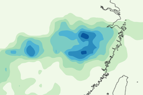
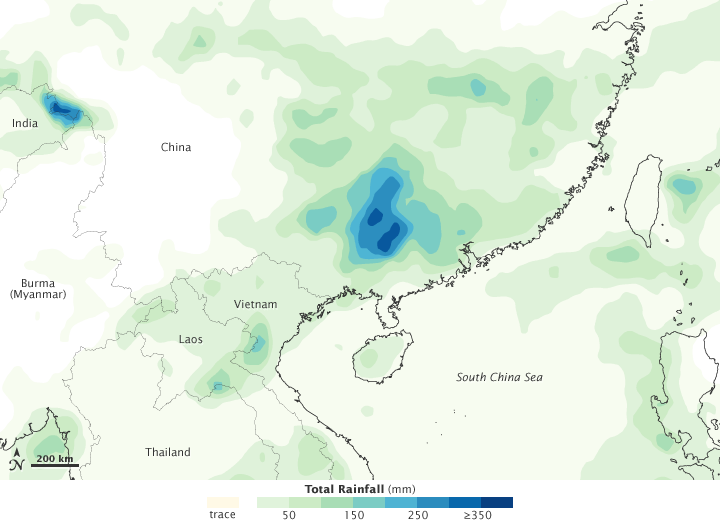
This image shows rainfall totals in the region from May 10 to 16, 2012. The heaviest rainfall—more than 350 millimeters, or 14 inches—appears in dark blue. The lightest rainfall—less than 50 millimeters or 2 inches—appears in light green. Trace amounts appear in pale yellow.
Particularly heavy rain fell in southern China, just inland from the South China Sea, and along the China-India-Burma (Myanmar) border. Lighter amounts of rain fell throughout parts of southern China, Vietnam, and Laos.
This map is based on data from the Multisatellite Precipitation Analysis produced at NASA’s Goddard Space Flight Center, which estimates rainfall by combining measurements from many satellites and calibrating them using rainfall measurements from the Tropical Rainfall Measuring Mission (TRMM) satellite.