This series of images shows morning and afternoon views of the ash clouds from Sarychev Volcano on June 14 and 15, 2009.
Published Jun 16, 2009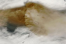
This true-color image of the plume from Sarychev Peak on June 14, 2009, shows intense volcanic ash concentrations west of the volcano, and ash spreading both east and west of the summit.
Published Jun 14, 2009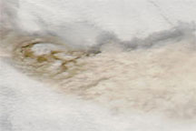
True-color images of the Central Kuril Islands show ash plumes from Sarychev Peak hovering over a blanket of clouds in early June 2009, and a clear-sky view of the same region acquired a month earlier.
Published Jun 12, 2009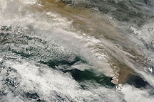
This true-color MODIS image shows ash plumes from Sarychev Peak blowing across the Sea of Okhotsk and the island of Sakhalin.
Published Jun 16, 2009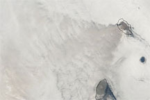
On June 18, 2009, Sarychev Peak produced a plume that was barely visible amid the cloud cover over the Sea of Okhotsk.
Published Jun 18, 2009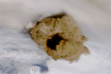
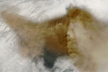
A true-color image of Sarychev Peak on June 15, 2009, shows remnants of older ash plumes and a new eruption from the volcano.
Published Jun 15, 2009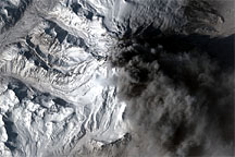
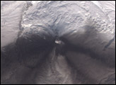
In contrast to the explosive eruptions of the previous week, ash emissions from Mount Redoubt became more frequent but confined to lower altitudes on March 30, 2009. The commercial satellite GeoEye-1 captured a high-resolution view of the volcano the same day.
Published Apr 1, 2009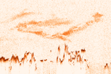
A satellite records a vertical profile of the atmosphere and reveals the altitude of ash clouds.
Published May 25, 2010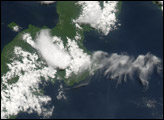
Volcanic ash from earlier eruptions has settled onto the snowy landscape, leaving dark gray swaths. The ash stains are confined to the south of the Karymsky’s summit, one large stain fanning out toward the southwest, and another toward the east.
Published Jun 17, 2007alert message
