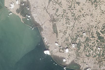
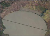
Acquired September 15, 2010, this natural-color image shows flooding along the northern and eastern margins of Pakistan’s Manchhar Lake.
Published Sep 17, 2010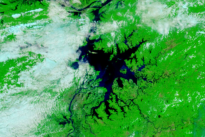
Between 2019 and 2020, water levels went from barely there to the highest on record.
Published Jul 16, 2020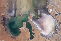
By mid-June 2009, the rare filling of this lake in Australia’s Simpson Desert appeared to have reached its peak.
Published Jun 21, 2009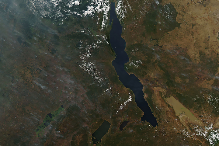
Long and short. Deep and shallow. Salty and fresh. Blue and brown. These are Africa’s Lake Tanganyika and Lake Rukwa.
Published Jun 20, 2019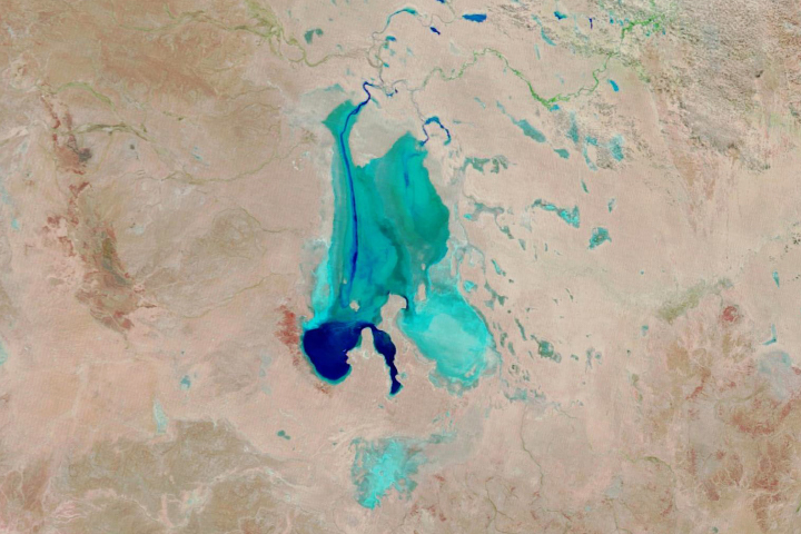
Floodwaters have worked their way through a series of parched channels, watering holes, and lagoons to start filling the iconic Australian lake.
Published May 28, 2019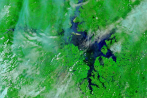
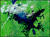
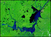
Acquired June 23, 2011, and May 26, 2011, these false-color images show changes in Dongting and Poyang Lakes, comparing drought to flood conditions.
Published Jun 23, 2011
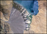
Meltwater from glaciers to the east and west drains into Lake Morari, a large lake that lies at an altitude of 4,521 meters (14,830 feet) on the Tibetan Plateau. A stream on the west side provides the lake’s main inflow. Mud from this river gives the light blue hues to the lake water. The well-formed alluvial fan (image center), built by sediment from the main inflow river, is the reason the lake has formed at this point in the valley.
Published Dec 18, 2006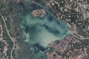
The fingerprints of human civilization are all over the lake in eastern China.
Published Jan 10, 2015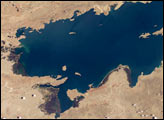
Lake Titicaca, at an elevation of 12,507 feet (3,812 meters) in the Andean Altiplano, is the highest large lake in the world. More than 120 miles long and 50 miles wide, it was the center of the Incan civilization, and today straddles the boundary between Peru and Bolivia.
Published Dec 22, 2003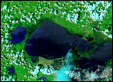
At the juncture of the border between China and Russia sits Lake Khanka, also known as Lake Xinghai. Due to their importance to plant and animal species, the lake and the surrounding wetlands are protected by the Ramsar Convention, an international treaty for the protection and sustainable use of wetlands. Migratory birds that frequent this lake include several endangered species, such as the Japanese crane.
Published Feb 18, 2007alert message
