The Earth Observatory has published its last Image of the Day on this website. Please join us on our new home at science.nasa.gov/earth/earth-observatory.

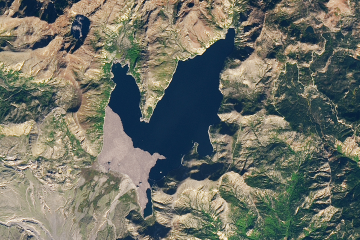
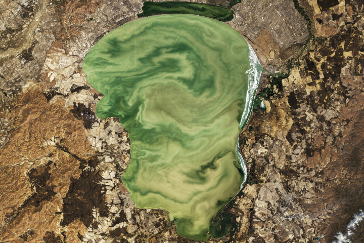
By the Sea of Japan, Russia curls around the tip of China, creating the rare situation where part of China actually lies north of Russia. At the juncture of these odd borders sits Lake Khanka, also known as Lake Xinghai. Due to their importance to plant and animal species, the lake and the surrounding wetlands are protected by the Ramsar Convention, an international treaty for the protection and sustainable use of wetlands. Migratory birds that frequent this lake include several endangered species, such as the Japanese crane.
The Enhanced Thematic Mapper on NASA’s Landsat 7 satellite took this picture of the northern part of Lake Khanka on September 25, 2001. The lake’s uniform, nondescript color may result from sediment. In contrast to the lake, the surrounding land surface shows a variety of colors and textures. Croplands surround the lake, most notably the semicircle of buff-colored crops in the east. Northwest of the lake, meandering patches of deep green indicate lush vegetation. Between that vegetation and the lake, rivulets carved into the land suggest drainage into the lake. Although only one river, the Song’acha, flows out of the lake, 23 rivers flow into it.
Because the Lake Khanka region provides habitat for migratory birds while simultaneously providing food for humans, it is an example of an effective use of land to meet human and wildlife needs. According to Lakenet, an international network to sustain and manage lakes, in 1998, Lake Khanka was listed as a demonstration engineering region for sustainable wetland use. The designation came from the Global Environment Facility, which helps developing countries protect their environments.
NASA image created by Jesse Allen, using data obtained from the University of Maryland’s Global Land Cover Facility.