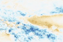
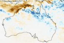
La Niña, the counterpart to El Niño, alters rainfall patterns over the Pacific and Indian Ocean basins. La Niña develops when stronger-than-average trade winds push the warm surface waters of the equatorial Pacific west. Since cold water rises to replace the warm water, La Niña leaves the eastern and central Pacific Ocean much cooler than normal, while the western Pacific is much warmer than normal. These anomalies in sea surface temperature are mirrored in rainfall patterns, with warmer-than-normal temperatures resulting in enhanced rainfall. In general, La Niña brings unusually heavy rain to the West Pacific, Indonesia, parts of Southeast Asia, and northern Australia.
Published Jan 23, 2008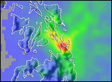
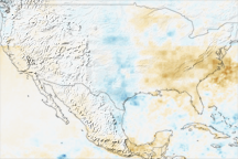
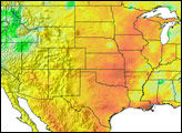
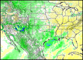
The rainfall pattern across the United States during the first eight months of 2007 is a study in contrasts. Drought dominated both coasts, while the Great Plains states saw far more rain than average.
Published Nov 24, 2007
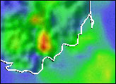
During the first two weeks of January 2009, torrential rains brought both drought relief and severe flooding to parts of Queensland and Northern Territory in northern Australia.
Published Jan 14, 2009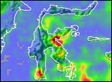
alert message
