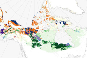
A holey, Swiss cheese-like landscape, thermokarst is distributed widely across the high latitudes of the northern hemisphere.
Published Jan 18, 2017
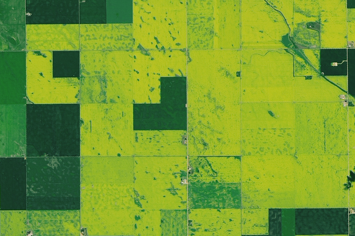
Vast tracts of the prairie turn yellow in the summer when this oil-rich crop blooms.
Published Aug 27, 2019
Unlike the vegetated tundra of its neighboring islands, Bunge Land is a barren sandy plain that also serves as a land bridge.
Published Oct 5, 2020
The landscape of the Kitikmeot region of Nunavut Territory was carved by ice and water.
Published Jul 13, 2012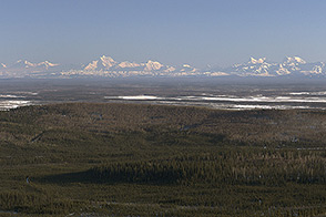
Operation IceBridge, an aerial ice surveying mission, has plenty of area to cover.
Published May 9, 2014
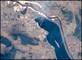
On April 26, 1986, the world’s worst nuclear power accident occurred at the Chernobyl Nuclear Power Plant near the Ukrainian-Belarus border. Toxic radionuclides like Cs137 and Sr90 contaminated an area of 155,000 square kilometers in what is today Belarus, Ukraine and Russia. Hundreds of thousands of people were killed, sickened from radiation-induced illnesses, or resettled to uncontaminated land. This image, taken from the Russian Mir spacecraft, shows Chernobyl and the surrounding countryside.
Published Apr 26, 2004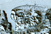
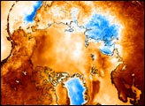
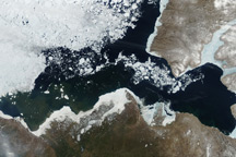
Taken on June 10, 2010, this true-color image captures the western Canadian Arctic in a moment of transformation. Signs of winter are still present, but summer is clearly on the horizon.
Published Jun 16, 2010alert message
