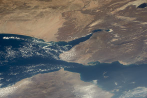
The nation is strategically positioned on one of the world's busiest shipping lanes, with access to the Red Sea and the Indian Ocean.
Published Mar 2, 2015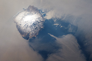
The highest volcano in the chain has a nearly perfect cone shape.
Published Jun 18, 2012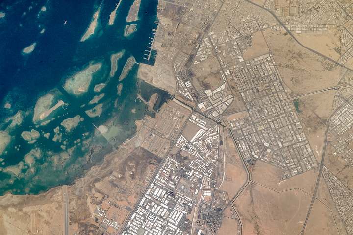
This “Gateway to Mecca” stands along the Red Sea coast of Saudi Arabia.
Published Nov 27, 2017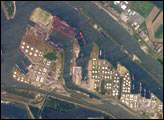
The Port of Rotterdam, also known as Europoort (Eurogate), has been an important trading center since approximately AD 1250. The history of the port reflects the evolution of the world’s economic base. Originally serving the North Sea herring fleets, it rapidly grew into a major mercantile port during the Dutch colonial period. The 19th century witnessed the Industrial Revolution, and steel and coal became major commodities passing through the port. Following the development of petroleum as a primary energy resource in the early 20th century, the port expanded westward to accommodate storage facilities and large oil tankers.
Published Jun 20, 2005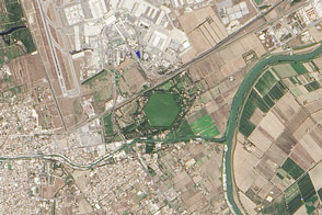
The distinctive, hexagon-shaped Trajanic Basin marks the spot of one of the Roman Empire’s great engineering achievement.
Published Mar 15, 2015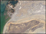
The arrow-shaped island in the Aral Sea used to be a 35-kilometer-long visual marker, indicating the Aral Sea to astronauts. An image from the present International Space Station increment shows how much the coastline has changed as the sea level has dropped during the last three decades.
Published Aug 15, 2005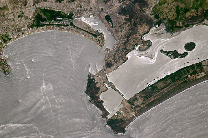
The port city handles cargo for Mexico City and the surrounding region.
Published Aug 14, 2017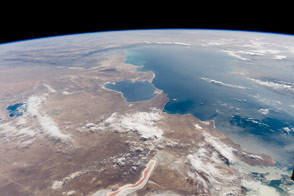
The inland sea in Central Asia has a host of distinctive features along its shores.
Published Oct 24, 2016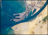
The Port of Suez is located in Egypt along the northern coastline of the Gulf of Suez. The port and city mark the southern terminus of the Suez Canal, which runs north-south through Egypt from the Mediterranean Sea to the Gulf of Suez.
Published Jan 28, 2008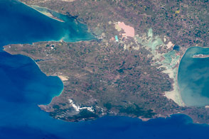
Crimea is a small piece of the world with a large role in modern history.
Published Feb 29, 2016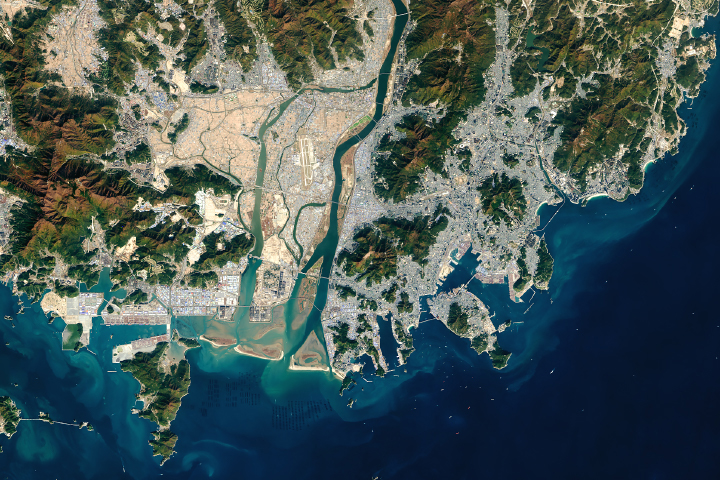
The South Korean port is among the busiest in the world.
Published Sep 5, 2018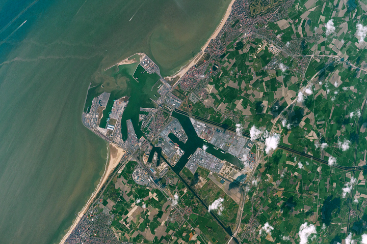
One of Europe’s most important modern ports is a city of commercial superlatives.
Published Aug 21, 2017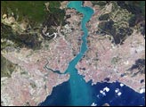
This metropolis of 15 million people occupies both sides of the entrance to the narrow, 20-mile long Bosporus Strait connecting the Mediterranean and Sea of Marmara (south) to the Black Sea (north). From its founding as Byzantium by the Greeks in 600 B.C., this strategically located city has been a focus of maritime trade and commerce as well as an outpost and threshold for cultural exchange and conflict between Europe and Asia. This digital camera image was taken by the crew of the International Space Station on April 16, 2004. When this image was taken, strong currents carried turbid coastal waters from the Black Sea through the Strait and into the Sea of Marmara.
Published May 10, 2004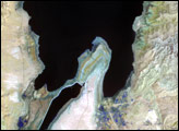
The lowest spot on dry land, the Dead Sea depression sinks 400 meters (1,300 feet) below sea level.
Published Nov 12, 2006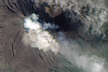
A NASA satellite captured this image of an eruption at Japan’s Sakurajima Volcano on February 15, 2010.
Published Feb 17, 2010