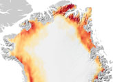
Thinner than the 2.3-kilometer-thick center, the outer edges of the Greenland ice sheet develop melt zones like the one shown here during the warm summer months.
Published Apr 7, 2007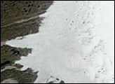
Although 2005 overall saw a new record, the extent of June melting in 2005 was unexceptional. The same held true for 2006, when this picture was taken.
Published Jun 30, 2006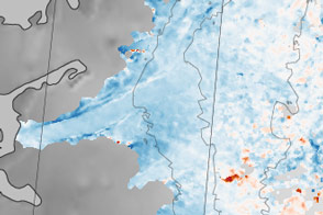
Sections of the Greenland Ice Sheet that end on land are slowing—a sliver of good news for sea level rise.
Published Oct 30, 2015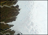
A new study of the mass of ice capping Greenland reveals that the giant ice sheet burying the island has rapidly lost mass in recent years due to melting and iceberg calving.
Published Oct 20, 2006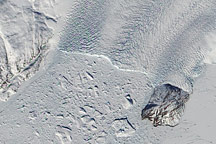
The heavily crevassed terminus of Kong Oscar Glacier in northwestern Greenland crumbles into a mélange of icebergs in the Davis Strait.
Published Aug 25, 2010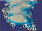
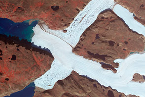
Crisscrossing glaciers in northwest Greenland flow along the path of least resistance.
Published Jan 22, 2015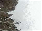
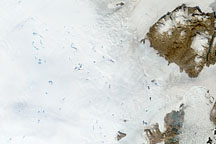
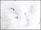
To understand ice sheets, glaciologists venture both below the surface with ice cores, and into the sky with satellites. Satellite imagery of the Greenland Ice Sheet reveals melt ponds that can affect glacier flow and sea level.
Published Oct 29, 2008