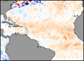
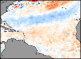
Tropical waters are warm, as usual, but not unusually so.
Published Jun 1, 2012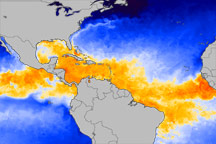
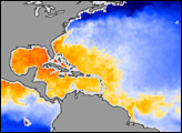
This color-coded image from June 1, 2010, shows which equatorial ocean waters are warm enough to promote hurricane formation.
Published Jun 3, 2010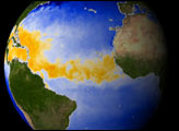
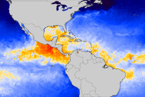
Warm sea surface temperatures help fuel hurricanes, and in 2006, those temperatures were cooler than expected. Why the difference between 2005 and 2006? William Lau of NASA Goddard Space Flight Center and Kyu-Myong Kim of University of Maryland-Baltimore County think the answer comes from the Sahara, namely dust.
Published Apr 18, 2007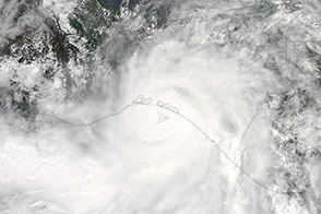
Forecasters are calling for an active storm season in the Atlantic Ocean. Meanwhile, in the eastern Pacific, Hurricane Barbara made an early-season landfall in southern Mexico.
Published Jun 1, 2013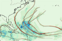
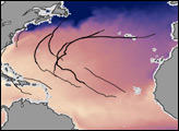
This map provides a summary of the very active 2010 Atlantic hurricane season, showing both the track each storm took and the rain it produced.
Published Dec 3, 2010
September 8, 2013, was an unusual day in an unusual season for tropical cyclones.
Published Sep 15, 2013