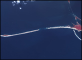
This photo-like image of Chincoteague Island and the southern section of Assateague was acquired by the IKONOS satellite on June 27, 2001.
Published Oct 28, 2008


Named Isla de Aves in Spanish, (meaning “Island of the Birds”) Aves Island lies west of the Lesser Antilles in the Caribbean. It provides a nesting site to green sea turtles (Chelonia mydas) and, of course, birds. Because the abundant bird droppings, known as guano, could be used in fertilizer and gunpowder, guano miners worked on the island until they depleted the supply. Since its discovery by Europeans, likely in the late 16th century, Aves Island was subsequently claimed by several European nations. The island is currently claimed by Venezuela, although disputes about ownership of the island, and the surrounding exclusive economic zone in the Caribbean, continue today.
Published Jun 19, 2006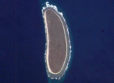
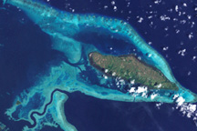
Howland Island is a United States possession located in the north Pacific between Australia and the Hawaiian Islands. Prior to 1890, organic nitrate (guano) was mined from the island by both the United States and the British. This tiny island (1.6 km²) is currently part of the U.S. National Wildlife Refuge system, and provides nesting areas and forage for a variety of birds and marine wildlife. The island is composed of coral fragments and is surrounded by an active fringing reef. White breakers encircling the island indicate the position of the reef. Astronauts aboard the International Space Station photograph numerous reefs around the world as part of a global mapping and monitoring program.
Published Jan 4, 2005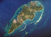
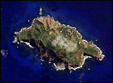
Guanaja Island is located in the western Caribbean, approximately 60 kilometers (about 37 miles) north of mainland Honduras. The island is near the western edge of the Cayman Ridge, a topographic feature made of rock types that indicate ancient volcanic islands, sedimentary layers, and ocean crust. The ridge resulted from tectonic interactions between the North American, South American, and Caribbean Plates. Guanaja and the nearby islands of Roatan and Utila (not shown) are the only portions of the western Cayman Ridge currently exposed above water.
Published Mar 26, 2007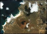
Scattered like turquoise and emeralds across the dark blue waters of the Coral and Solomon Seas, the coral reefs and forested islands of the Louisiade Archipelago stretch southeastward from the tip of Papua New Guinea for over 350 kilometers.
Published Jan 2, 2009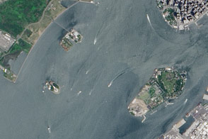
A pair of modest oyster flats turned into two of most important islands in the United States.
Published Mar 20, 2016