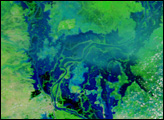
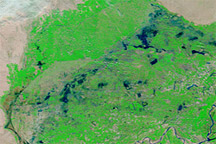
Acquired June 23, 2011, and May 26, 2011, these false-color images show changes in Dongting and Poyang Lakes, comparing drought to flood conditions.
Published Jun 23, 2011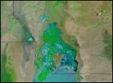
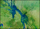
Acquired on February 21, 2011, and February 23, 2010, these false-color images show water levels along the Indus River before and after the monsoon floods that struck Pakistan in 2010.
Published Feb 25, 2011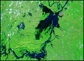
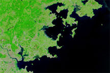
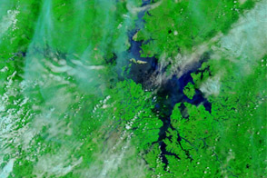
Acquired on May 25, 2010 (top), and May 2, 2010 (bottom), these false-color images show part of Fujian Province before and after heavy rains caused widespread flooding.
Published May 27, 2010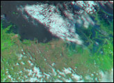
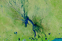
Channels of water flowed through normally dry northern Namibia on March 23, 2009, when this image was captured.
Published Mar 23, 2009
For more than 100 years, groups in the western United States have fought over water. During the 1880s, sheep ranchers and cattle ranchers argued over drinking water for their livestock on the high plains. In 1913, the city of Los Angeles began to draw water away from small agricultural communities in Owen Valley, leaving a dusty dry lake bed. In the late 1950s, construction of the Glen Canyon Dam catalyzed the American environmental movement. Today, farmers are fighting fishermen, environmentalists, and Native American tribes over the water in the Upper Klamath River Basin. The Landsat 7 satellite, launched by NASA and operated by the U.S. Geological Survey, documented an extreme drought in the area along the California/Oregon border in the spring of 2001.
Published Sep 8, 2001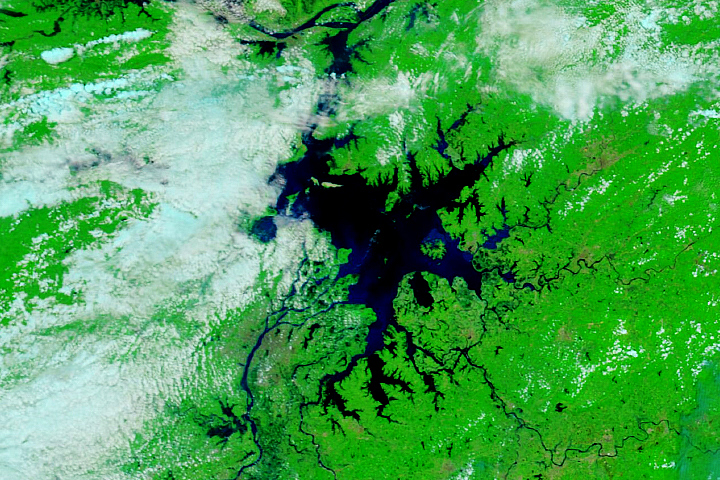
Between 2019 and 2020, water levels went from barely there to the highest on record.
Published Jul 16, 2020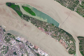
The fast-growing city has polluted waterways and a growing demand for clean tap water.
Published Apr 11, 2017