Acquired June 8, 2011, and June 9, 2010, these false-color images compare conditions along the Mississippi and Atchafalaya Rivers in Louisiana.
Published Jun 9, 2011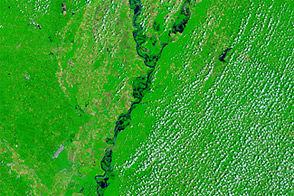
Acquired June 1, 2011, and May 28, 2010, these false-color images compare conditions along the Lower Mississippi River.
Published Jun 1, 2011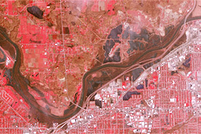
Acquired April 30, 2013, and April 30, 2007, these images compare conditions along the Grand River near Grand Rapids, Michigan.
Published May 3, 2013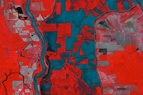
The ASTER instrument on NASA’s Terra satellite captured this false-color image of the Morganza Floodway on May 18, 2011.
Published May 20, 2011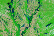
Acquired May 8, 2011, April 29, 2011, and May 3, 2010, these false-color images show water levels along the Mississippi River between Memphis and Vicksburg.
Published May 9, 2011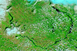
Acquired June 25, 2011, and June 22, 2010, these false-color images compare conditions along the Souris River, which reached a historic crest at Minot, North Dakota in June 2011.
Published Jun 27, 2011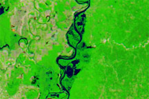
Acquired May 15, 2011, April 29, 2011, and May 4, 2010, these false-color images show conditions along the Lower Mississippi River.
Published May 16, 2011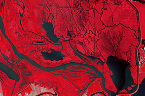
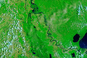
In this false-color image of the flood plains above Morgan City, Louisiana, there are tell-tale signs of floodwater from the Morganza Spillway.
Published Jun 5, 2011
These false-color images compare conditions along the Mississippi and Yazoo Rivers around Vicksburg in June 2011, during heavy flooding, and three years earlier.
Published Jun 14, 2011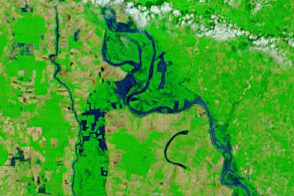
Acquired May 18, 2011, and May 4, 2011, these false-color images show flooded conditions along the Lower Mississippi River, including diverted water entering the Morganza Floodway on May 18.
Published May 18, 2011