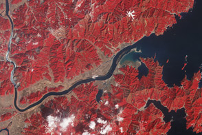
One year after the tsunami, the landscape near the mouth of the Kitakami river remains irrevocably altered.
Published Mar 11, 2012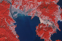
Acquired March 14, 2011, and March 1, 2007, these false-color images show the city of Rikuzentakata before and after a tsunami reshaped the local coastline.
Published Mar 18, 2011Image of the Day Land Water Floods Human Presence Earthquakes
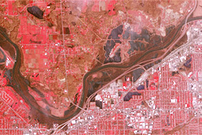
Acquired April 30, 2013, and April 30, 2007, these images compare conditions along the Grand River near Grand Rapids, Michigan.
Published May 3, 2013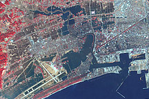
This false-color image acquired on March 14, 2011, shows widespread flooding in tsunami-hit Ishinomaki, Japan.
Published Mar 15, 2011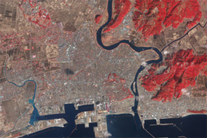
Acquired in March 2011 and February 2012, these images document the recession of flood waters after the Tohoku tsunami.
Published Mar 13, 2012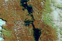
Acquired May 7, 2011, and May 14, 2010, these false-color images compare conditions along the Red River of the North.
Published May 10, 2011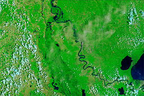
Acquired June 8, 2011, and June 9, 2010, these false-color images compare conditions along the Mississippi and Atchafalaya Rivers in Louisiana.
Published Jun 9, 2011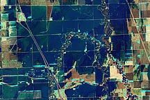
A pair of false-color and natural-color images acquired March 21, 2010, show flooding in agricultural areas north of Fargo, North Dakota.
Published Mar 24, 2010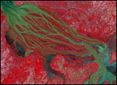

Acquired May 11, 2011, and April 21, 2007, these false-color images show the Mississippi River near Natchez, Mississippi. The image from May 2011 shows flooded conditions.
Published May 13, 2011