Acquired January 6, 2011, and December 12, 2010, these false-color images show the area around Goodooga, the first New South Wales community to be affected by Queensland flood waters moving south.
Published Jan 6, 2011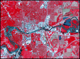
In June 2008, intense spring rains pushed the Iowa River over its banks in Iowa City. Though the flood had started to recede when the Advanced Spaceborne Thermal Emission and Reflection Radiometer (ASTER) on NASA’s Terra satellite captured the top image on June 22, the river was still swollen.
Published Jun 26, 2008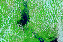
Acquired March 8, 2010 (top), and March 12, 2009 (bottom), these false-color images show part of Mozambique before and after flooding in the region.
Published Mar 10, 2010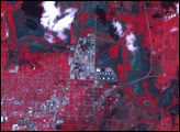
Rivers in Australia’s Fitzroy Basin are swollen in this false-color image acquired on January 4, 2011.
Published Jan 6, 2011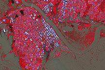
Though water levels had started to subside, the Australian city of Rockhampton was still inundated when this image was taken on January 7, 2011.
Published Jan 8, 2011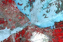
Floods surround the Pakistani city of Sukkur in this false-color image from August 18, 2010.
Published Aug 20, 2010
Acquired May 11, 2011, and April 21, 2007, these false-color images show the Mississippi River near Natchez, Mississippi. The image from May 2011 shows flooded conditions.
Published May 13, 2011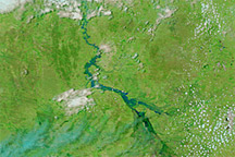
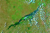
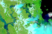
Acquired December 6 and November 6, 2010, these false-color images show conditions before and after heavy rains filled seasonal rivers in Queensland.
Published Dec 6, 2010