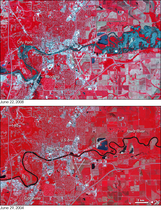


In June 2008, intense spring rains pushed the Iowa River over its banks in Iowa City. Though the flood had started to recede when the Advanced Spaceborne Thermal Emission and Reflection Radiometer (ASTER) on NASA’s Terra satellite captured the top image on June 22, the river was still swollen. These false-color images use infrared and visible light to highlight standing water on the ground: water is dark blue, and vegetated ground is red. Pools of blue line the river’s banks where water lingers in the wake of the floods. The worst of the flooding seems to be concentrated around bends in the river, particularly in the south on the right side of the image.
Floods cover a few sections of both Iowa City and Coralville, the concentrated silver grids in this image. The most obvious urban flooding is in Coralville near the banks of the Iowa river and along U.S. Highway 6 in Iowa City. Away from the city center, residential neighborhoods look like a maze of gray roads surrounded by red plant-covered land. Bare or sparsely vegetated earth, such as the farmland north of the cities (right) is gray-tan.
NASA image created by Jesse Allen, using data provided courtesy of NASA/GSFC/METI/ERSDAC/JAROS, and U.S./Japan ASTER Science Team. Caption by Holli Riebeek.